Property Record
2071 Albany Post Rd, Montrose, NY 10548
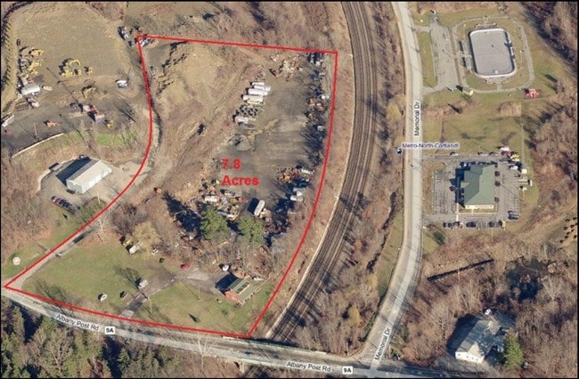
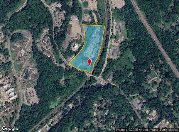
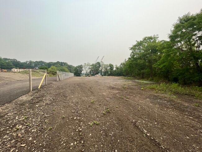
This Property Is For Sale
NEARBY LISTINGS FOR SALE OR LEASE
Property Detail
2071 Albany Post Rd
New York-Jersey City-White Plains, NY-NJ
Westchester
2289-055-013-00001-000-0006
New York
Sfr
8.30 AC
X
Northwest
36119C0106F
Westchester/So Connecticut
DEMOGRAPHICS near 2071 Albany Post Rd
1 Mile
3 Mile
5 Mile
2024 Total Population
4,961
22,513
95,427
2029 Population
4,832
21,916
93,385
Pop Growth 2024-2029
(2.60%)
(2.65%)
(2.14%)
Average Age
50
44
42
2024 Total Households
1,725
8,296
33,847
HH Growth 2024-2029
(3.25%)
(3.05%)
(2.33%)
Median Household Inc
$91,911
$114,318
$99,803
Avg Household Size
2.20
2.50
2.70
2024 Avg HH Vehicles
2.00
2.00
2.00
Median Home Value
$458,639
$499,999
$430,644
Median Year Built
1958
1963
1964
Nearby Places
- Restaurants
- Banks
- Shops
- Fitness
- Groceries
PUBLIC TRANSPORTATION
COMMUTER RAIL
Cortlandt Station (Hudson Line - Metro-North Commuter Railroad Company (Metro-North))
DRIVE
WALK
Distance
Cortlandt Station (Hudson Line - Metro-North Commuter Railroad Company (Metro-North))
2 min
11 min
0.6 mi
Peekskill Station (Hudson Line - Metro-North Commuter Railroad Company (Metro-North))
DRIVE
WALK
Distance
Peekskill Station (Hudson Line - Metro-North Commuter Railroad Company (Metro-North))
8 min
3.7 mi
AIRPORT
Westchester County
DRIVE
WALK
Distance
Westchester County
38 min
23.2 mi
New York Stewart International
DRIVE
WALK
Distance
New York Stewart International
49 min
27.6 mi
Freight Ports
NY - Red Hook Container Terminal
DRIVE
WALK
Distance
NY - Red Hook Container Terminal
75 min
50.1 mi
Nearby Properties
Address
Land Use
TOTAL SIZE
Lot Size
Zoning
Address
Land Use
TOTAL SIZE
Lot Size
Zoning
Address
Land Use
TOTAL SIZE
Lot Size
Zoning
188.01 AC
Address
Land Use
TOTAL SIZE
Lot Size
Zoning
Address
Land Use
TOTAL SIZE
Lot Size
Zoning
157 AC
Address
Land Use
TOTAL SIZE
Lot Size
Zoning
74.84 AC
Address
Land Use
TOTAL SIZE
Lot Size
Zoning
49.60 AC
963
Address
Land Use
TOTAL SIZE
Lot Size
Zoning
28,357 SF
0.01 AC
963
Address
Land Use
TOTAL SIZE
Lot Size
Zoning
4.50 AC
963
Address
Land Use
TOTAL SIZE
Lot Size
Zoning
4.80 AC
RW
Address
Land Use
TOTAL SIZE
Lot Size
Zoning
4.50 AC
963
Address
Land Use
TOTAL SIZE
Lot Size
Zoning
44.39 AC
963
Address
Land Use
TOTAL SIZE
Lot Size
Zoning
27.60 AC
965
Address
Land Use
TOTAL SIZE
Lot Size
Zoning
Address
Land Use
TOTAL SIZE
Lot Size
Zoning
Address
Land Use
TOTAL SIZE
Lot Size
Zoning
Address
Land Use
TOTAL SIZE
Lot Size
Zoning
2.10 AC
963
Address
Land Use
TOTAL SIZE
Lot Size
Zoning
Address
Land Use
TOTAL SIZE
Lot Size
Zoning
410,221 SF
33.49 AC
LI
Address
Land Use
TOTAL SIZE
Lot Size
Zoning
26.80 AC
Address
Land Use
TOTAL SIZE
Lot Size
Zoning
655.36 AC
Address
Land Use
TOTAL SIZE
Lot Size
Zoning
8.75 AC
Address
Land Use
TOTAL SIZE
Lot Size
Zoning
13.75 AC
Address
Land Use
TOTAL SIZE
Lot Size
Zoning
Address
Land Use
TOTAL SIZE
Lot Size
Zoning
143.43 AC
Address
Land Use
TOTAL SIZE
Lot Size
Zoning
39.18 AC
Address
Land Use
TOTAL SIZE
Lot Size
Zoning
Address
Land Use
TOTAL SIZE
Lot Size
Zoning
9.90 AC
963
Address
Land Use
TOTAL SIZE
Lot Size
Zoning
8.52 AC
Address
Land Use
TOTAL SIZE
Lot Size
Zoning
580 SF
23.20 AC
MHC
Address
Land Use
TOTAL SIZE
Lot Size
Zoning
16.91 AC
The World's #1 Commercial Real Estate Marketplace
Connect with us
© 2025 CoStar Group
The information above has been obtained from sources believed reliable. While we do not doubt its accuracy we have not verified it and make no guarantee, warranty or representation about it. It is your responsibility to independently confirm its accuracy and completeness. Any projections, opinions, assumptions, or estimates used are for example only and do not represent the current or future performance of the property. The value of this transaction to you depends on tax and other factors which should be evaluated by your tax, financial, and legal advisors. You and your advisors should conduct a careful, independent investigation of the property to determine to your satisfaction the suitability of the property for your needs.