Property Record
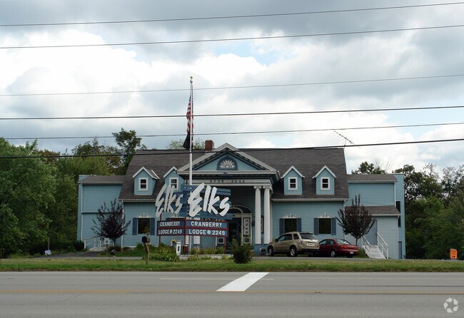
20720 Route 19, Cranberry Township, PA 16066


NEARBY LISTINGS FOR SALE OR LEASE
Property Detail
20720 Route 19
130-4F108-9D1-0000
1.476 ACS HALL 2 SHEDS
Clubslodgesprofessionalassociations
Butler
X
Pennsylvania
42019C0503D
1.48 AC
2025
Butler County
2025
Pittsburgh
912001
Pittsburgh, PA
DEMOGRAPHICS near 20720 Route 19
1 Mile
3 Mile
5 Mile
2024 Total Population
3,392
38,006
68,242
2029 Population
3,586
38,973
69,399
Pop Growth 2024-2029
+ 5.72%
+ 2.54%
+ 1.70%
Average Age
41
40
41
2024 Total Households
1,427
14,725
26,233
HH Growth 2024-2029
+ 6.45%
+ 2.85%
+ 1.88%
Median Household Inc
$98,430
$115,371
$116,691
Avg Household Size
2.30
2.50
2.50
2024 Avg HH Vehicles
2.00
2.00
2.00
Median Home Value
$404,082
$363,932
$368,780
Median Year Built
1993
1996
1996
Nearby Places
Map Layers
Map Styles
 Street
 Aerial
- Restaurants
- Banks
- Shops
- Fitness
- Groceries
PUBLIC TRANSPORTATION
AIRPORT
Pittsburgh International
DRIVE
WALK
Distance
Pittsburgh International
41 min
22.2 mi
Nearby Properties
Address
Land Use
TOTAL SIZE
Lot Size
Zoning
Address
Land Use
TOTAL SIZE
Lot Size
Zoning
Address
Land Use
TOTAL SIZE
Lot Size
Zoning
Address
Land Use
TOTAL SIZE
Lot Size
Zoning
12.44 AC
Address
Land Use
TOTAL SIZE
Lot Size
Zoning
11.95 AC
Address
Land Use
TOTAL SIZE
Lot Size
Zoning
13.59 AC
Address
Land Use
TOTAL SIZE
Lot Size
Zoning
32.41 AC
Address
Land Use
TOTAL SIZE
Lot Size
Zoning
Address
Land Use
TOTAL SIZE
Lot Size
Zoning
1,431 SF
40.30 AC
Address
Land Use
TOTAL SIZE
Lot Size
Zoning
8.26 AC
Address
Land Use
TOTAL SIZE
Lot Size
Zoning
Address
Land Use
TOTAL SIZE
Lot Size
Zoning
13.02 AC
Address
Land Use
TOTAL SIZE
Lot Size
Zoning
Address
Land Use
TOTAL SIZE
Lot Size
Zoning
Address
Land Use
TOTAL SIZE
Lot Size
Zoning
13.58 AC
Address
Land Use
TOTAL SIZE
Lot Size
Zoning
Address
Land Use
TOTAL SIZE
Lot Size
Zoning
9.32 AC
Address
Land Use
TOTAL SIZE
Lot Size
Zoning
Address
Land Use
TOTAL SIZE
Lot Size
Zoning
Address
Land Use
TOTAL SIZE
Lot Size
Zoning
Address
Land Use
TOTAL SIZE
Lot Size
Zoning
39.80 AC
Address
Land Use
TOTAL SIZE
Lot Size
Zoning
150.61 AC
Address
Land Use
TOTAL SIZE
Lot Size
Zoning
3.12 AC
Address
Land Use
TOTAL SIZE
Lot Size
Zoning
Address
Land Use
TOTAL SIZE
Lot Size
Zoning
1.48 AC
Address
Land Use
TOTAL SIZE
Lot Size
Zoning
Address
Land Use
TOTAL SIZE
Lot Size
Zoning
Address
Land Use
TOTAL SIZE
Lot Size
Zoning
Address
Land Use
TOTAL SIZE
Lot Size
Zoning
Address
Land Use
TOTAL SIZE
Lot Size
Zoning
Address
Land Use
TOTAL SIZE
Lot Size
Zoning
2.79 AC
The World's #1 Commercial Real Estate Marketplace
Connect with us
© 2026 CoStar Group
The information above has been obtained from sources believed reliable. While we do not doubt its accuracy we have not verified it and make no guarantee, warranty or representation about it. It is your responsibility to independently confirm its accuracy and completeness. Any projections, opinions, assumptions, or estimates used are for example only and do not represent the current or future performance of the property. The value of this transaction to you depends on tax and other factors which should be evaluated by your tax, financial, and legal advisors. You and your advisors should conduct a careful, independent investigation of the property to determine to your satisfaction the suitability of the property for your needs.