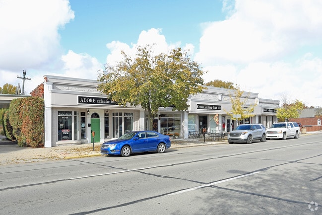
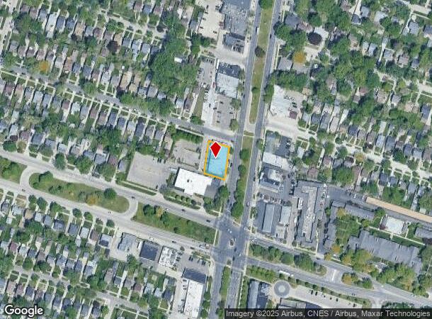
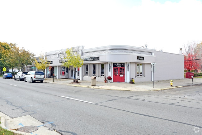
Property Record
20725 Mack Ave, Grosse Pointe Woods, MI 48236
NEARBY LISTINGS FOR SALE OR LEASE
Property Detail
20725 Mack Ave
Detroit-Warren-Dearborn, MI
Beaufait Koch Tessmar
40-003-04-0301-001
WDE301A TO 306A LOTS 301 TO 306 INCL EXC THE ELY PART THEREOF MEAS 41.75 FT ON THE NLY LINE OF LOT 301 AND 42.22 FT ON THE
Stripcommercialcenter
Wayne
X
Michigan
26163C0135F
0301
2024
0.26 AC
2025
The Pointes/Harper Woods
551800
Detroit
8,771 SF
DEMOGRAPHICS near 20725 Mack Ave
1 Mile
3 Mile
5 Mile
2024 Total Population
16,075
122,553
277,686
2029 Population
15,456
119,800
275,127
Pop Growth 2024-2029
(3.85%)
(2.25%)
(0.92%)
Average Age
42
40
39
2024 Total Households
6,667
48,440
108,187
HH Growth 2024-2029
(3.90%)
(2.34%)
(1.08%)
Median Household Inc
$84,725
$62,324
$55,375
Avg Household Size
2.30
2.50
2.50
2024 Avg HH Vehicles
2.00
2.00
2.00
Median Home Value
$199,551
$160,331
$142,484
Median Year Built
1953
1953
1953
Nearby Places
Map Layers
Map Styles
 Street
 Aerial
- Restaurants
- Banks
- Shops
- Fitness
- Groceries
PUBLIC TRANSPORTATION
AIRPORT
Windsor International
DRIVE
WALK
Distance
Windsor International
43 min
22.6 mi
Detroit Metro Wayne County
DRIVE
WALK
Distance
Detroit Metro Wayne County
46 min
32.1 mi
SALE & LEASE HISTORY
LISTING DATE
SALE/LEASE

Nov 07, 2016
For Lease
Nearby Properties
Address
Land Use
TOTAL SIZE
Lot Size
Zoning
Address
Land Use
TOTAL SIZE
Lot Size
Zoning
1,034,990 SF
28.60 AC
Address
Land Use
TOTAL SIZE
Lot Size
Zoning
9,937 SF
35.42 AC
CLD
Address
Land Use
TOTAL SIZE
Lot Size
Zoning
211,065 SF
8.84 AC
C.F
Address
Land Use
TOTAL SIZE
Lot Size
Zoning
575,081 SF
8.53 AC
R6
Address
Land Use
TOTAL SIZE
Lot Size
Zoning
89,970 SF
2.86 AC
RM-1
Address
Land Use
TOTAL SIZE
Lot Size
Zoning
192,387 SF
11.26 AC
CLD
Address
Land Use
TOTAL SIZE
Lot Size
Zoning
101,733 SF
1.10 AC
C-2
Address
Land Use
TOTAL SIZE
Lot Size
Zoning
129,502 SF
3.17 AC
RM-1
Address
Land Use
TOTAL SIZE
Lot Size
Zoning
103,069 SF
11.41 AC
B-3
Address
Land Use
TOTAL SIZE
Lot Size
Zoning
105,354 SF
2.33 AC
B-3
Address
Land Use
TOTAL SIZE
Lot Size
Zoning
115,307 SF
7.01 AC
RM-1
Address
Land Use
TOTAL SIZE
Lot Size
Zoning
75,284 SF
0.87 AC
C
Address
Land Use
TOTAL SIZE
Lot Size
Zoning
202,788 SF
27.98 AC
CLD
Address
Land Use
TOTAL SIZE
Lot Size
Zoning
5,511 SF
1.52 AC
Address
Land Use
TOTAL SIZE
Lot Size
Zoning
41,235 SF
8.81 AC
Address
Land Use
TOTAL SIZE
Lot Size
Zoning
136,270 SF
3.42 AC
LI
Address
Land Use
TOTAL SIZE
Lot Size
Zoning
30,244 SF
2.06 AC
B-1
Address
Land Use
TOTAL SIZE
Lot Size
Zoning
28,300 SF
11.49 AC
I-1
Address
Land Use
TOTAL SIZE
Lot Size
Zoning
11,315 SF
41.52 AC
RA
Address
Land Use
TOTAL SIZE
Lot Size
Zoning
7,797 SF
24.23 AC
CLD
Address
Land Use
TOTAL SIZE
Lot Size
Zoning
26,068 SF
5.57 AC
B-2
Address
Land Use
TOTAL SIZE
Lot Size
Zoning
46,246 SF
3.19 AC
B-3
Address
Land Use
TOTAL SIZE
Lot Size
Zoning
71,025 SF
4.03 AC
RM-1
Address
Land Use
TOTAL SIZE
Lot Size
Zoning
30,919 SF
0.86 AC
C
Address
Land Use
TOTAL SIZE
Lot Size
Zoning
92,903 SF
1.70 AC
LI
Address
Land Use
TOTAL SIZE
Lot Size
Zoning
80,320 SF
4.73 AC
RM-1
Address
Land Use
TOTAL SIZE
Lot Size
Zoning
102,205 SF
214.30 AC
Address
Land Use
TOTAL SIZE
Lot Size
Zoning
36,191 SF
3.87 AC
B-2
Address
Land Use
TOTAL SIZE
Lot Size
Zoning
60,694 SF
3.05 AC
B-2
Address
Land Use
TOTAL SIZE
Lot Size
Zoning
56,170 SF
3.19 AC
RM-1
The World's #1 Commercial Real Estate Marketplace
Connect with us
© 2025 CoStar Group
The information above has been obtained from sources believed reliable. While we do not doubt its accuracy we have not verified it and make no guarantee, warranty or representation about it. It is your responsibility to independently confirm its accuracy and completeness. Any projections, opinions, assumptions, or estimates used are for example only and do not represent the current or future performance of the property. The value of this transaction to you depends on tax and other factors which should be evaluated by your tax, financial, and legal advisors. You and your advisors should conduct a careful, independent investigation of the property to determine to your satisfaction the suitability of the property for your needs.