Property Record
2074 E 10 Mile Rd, Warren, MI 48091
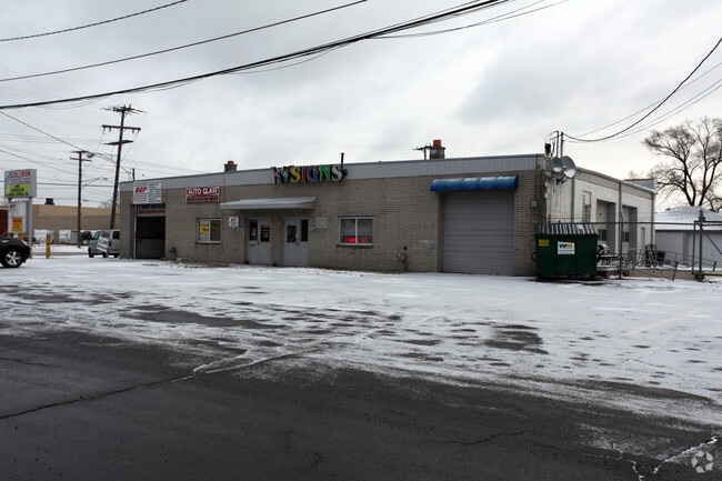


Property Detail
2074 E 10 Mile Rd
12-13-30-101-003
T1N,R12E SEC 30 BEG AT A PT 718.92 FT N89*29'20"E OF NW COR SEC 30; TH N89*29'20"E 100 FT; TH S1*02'E665.5 FT; TH S89*45'W
Industrialgeneral
Macomb
MZ
Michigan
B and X Area of moderate flood hazard, usually the area between the limits of the 100-year and 500-year floods.
1.47 AC
2025
W of Van Dyke/Macomb
2025
Detroit
263500
Detroit-Warren-Dearborn, MI
19,200 SF
NEARBY LISTINGS FOR SALE OR LEASE
DEMOGRAPHICS near 2074 E 10 Mile Rd
1 mile
3 mile
5 mile
2025 Total Population
13,508
127,932
342,447
2030 Population
13,760
129,979
347,693
Pop Growth 2025-2030
+ 1.87%
+ 1.60%
+ 1.53%
Average Age
41
40
40
2025 Total Households
5,841
55,030
144,786
HH Growth 2025-2030
+ 2.02%
+ 1.68%
+ 1.66%
Median Household Inc
$60,463
$64,708
$64,983
Avg Household Size
2.30
2.30
2.30
2025 Avg HH Vehicles
2.00
2.00
2.00
Median Home Value
$156,457
$175,199
$198,006
Median Year Built
1965
1957
1956
Nearby Places
Map Layers
Map Styles
 Street
 Aerial
Transit
 Traffic
 Biking
Places
Listings with unknown addresses are not visible on the map
- Restaurants
- Banks
- Shops
- Fitness
- Groceries
PUBLIC TRANSPORTATION
COMMUTER RAIL
Drive
Walk
Distance
9 min
4.3 mi
Drive
Walk
Distance
18 min
9.2 mi
AIRPORT
Windsor International
Drive
Walk
Distance
Windsor International
41 min
21.1 mi
Detroit Metro Wayne County
Drive
Walk
Distance
Detroit Metro Wayne County
45 min
30.7 mi
SALE & LEASE HISTORY
LISTING DATE
SALE/LEASE

Oct 23, 2023
For Sale
The World's #1 Commercial Real Estate Marketplace
Connect with us
© 2026 CoStar Group
The information above has been obtained from sources believed reliable. While we do not doubt its accuracy we have not verified it and make no guarantee, warranty or representation about it. It is your responsibility to independently confirm its accuracy and completeness. Any projections, opinions, assumptions, or estimates used are for example only and do not represent the current or future performance of the property. The value of this transaction to you depends on tax and other factors which should be evaluated by your tax, financial, and legal advisors. You and your advisors should conduct a careful, independent investigation of the property to determine to your satisfaction the suitability of the property for your needs.