Property Record
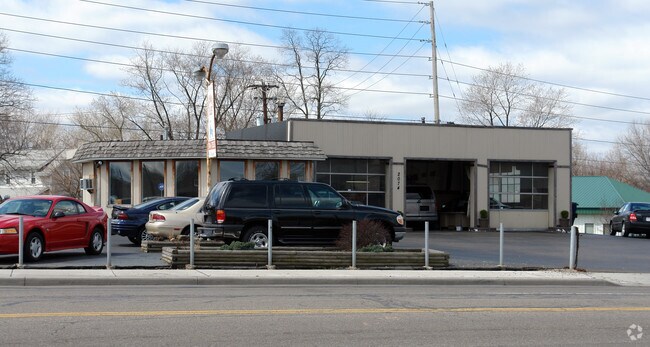
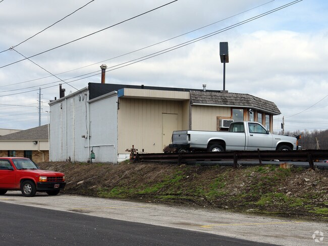
2074 E Market St, Akron, OH 44312
NEARBY LISTINGS FOR SALE OR LEASE
Property Detail
2074 E Market St
Cleveland
Akers Dell
Akron, OH
AKERS DELL LOT 24 E OF W 75.36 FT ENGLEWOOD AVE E MARKET
67-02740
Summit
Vehiclerentalsvehiclesales
Ohio
2023
24
2025
0.15 AC
503600
Akron
1,539 SF
DEMOGRAPHICS near 2074 E Market St
1 Mile
3 Mile
5 Mile
2024 Total Population
12,261
75,467
170,056
2029 Population
12,111
75,010
168,889
Pop Growth 2024-2029
(1.22%)
(0.61%)
(0.69%)
Average Age
41
39
39
2024 Total Households
5,524
32,480
71,715
HH Growth 2024-2029
(1.29%)
(0.68%)
(0.74%)
Median Household Inc
$55,016
$45,743
$45,034
Avg Household Size
2.20
2.20
2.20
2024 Avg HH Vehicles
2.00
2.00
2.00
Median Home Value
$102,123
$103,044
$118,192
Median Year Built
1954
1956
1956
Nearby Places
Map Layers
Map Styles
 Street
 Aerial
- Restaurants
- Banks
- Shops
- Fitness
- Groceries
PUBLIC TRANSPORTATION
COMMUTER RAIL
Akron Northside (National Park Scenic Railway - Cuyahoga Valley Scenic Railroad)
DRIVE
WALK
Distance
Akron Northside (National Park Scenic Railway - Cuyahoga Valley Scenic Railroad)
10 min
5.3 mi
Big Bend (National Park Scenic Railway - Cuyahoga Valley Scenic Railroad)
DRIVE
WALK
Distance
Big Bend (National Park Scenic Railway - Cuyahoga Valley Scenic Railroad)
19 min
8.6 mi
AIRPORT
Akron-Canton Regional
DRIVE
WALK
Distance
Akron-Canton Regional
21 min
15.0 mi
Freight Ports
Port of Toledo
DRIVE
WALK
Distance
Port of Toledo
165 min
139.5 mi
Nearby Properties
Address
Land Use
TOTAL SIZE
Lot Size
Zoning
Address
Land Use
TOTAL SIZE
Lot Size
Zoning
1,811,279 SF
38.71 AC
Address
Land Use
TOTAL SIZE
Lot Size
Zoning
Address
Land Use
TOTAL SIZE
Lot Size
Zoning
225,751 SF
0.16 AC
Address
Land Use
TOTAL SIZE
Lot Size
Zoning
404,207 SF
2.19 AC
Address
Land Use
TOTAL SIZE
Lot Size
Zoning
264,753 SF
22.87 AC
Address
Land Use
TOTAL SIZE
Lot Size
Zoning
Address
Land Use
TOTAL SIZE
Lot Size
Zoning
Address
Land Use
TOTAL SIZE
Lot Size
Zoning
145,684 SF
27.98 AC
Address
Land Use
TOTAL SIZE
Lot Size
Zoning
245,911 SF
14.48 AC
Address
Land Use
TOTAL SIZE
Lot Size
Zoning
Address
Land Use
TOTAL SIZE
Lot Size
Zoning
52,949 SF
2.35 AC
Address
Land Use
TOTAL SIZE
Lot Size
Zoning
226,050 SF
24.49 AC
Address
Land Use
TOTAL SIZE
Lot Size
Zoning
196,767 SF
37.16 AC
Address
Land Use
TOTAL SIZE
Lot Size
Zoning
99,003 SF
20.10 AC
Address
Land Use
TOTAL SIZE
Lot Size
Zoning
639,478 SF
29.51 AC
Address
Land Use
TOTAL SIZE
Lot Size
Zoning
95,696 SF
8.29 AC
Address
Land Use
TOTAL SIZE
Lot Size
Zoning
Address
Land Use
TOTAL SIZE
Lot Size
Zoning
270,860 SF
131.89 AC
Address
Land Use
TOTAL SIZE
Lot Size
Zoning
374,370 SF
27.79 AC
Address
Land Use
TOTAL SIZE
Lot Size
Zoning
56,529 SF
3.67 AC
Address
Land Use
TOTAL SIZE
Lot Size
Zoning
64,071 SF
2.65 AC
Address
Land Use
TOTAL SIZE
Lot Size
Zoning
203,059 SF
55.62 AC
Address
Land Use
TOTAL SIZE
Lot Size
Zoning
72,162 SF
4.76 AC
Address
Land Use
TOTAL SIZE
Lot Size
Zoning
49,712 SF
0.11 AC
Address
Land Use
TOTAL SIZE
Lot Size
Zoning
185,241 SF
12.62 AC
Address
Land Use
TOTAL SIZE
Lot Size
Zoning
6.06 AC
Address
Land Use
TOTAL SIZE
Lot Size
Zoning
489,909 SF
23.77 AC
Address
Land Use
TOTAL SIZE
Lot Size
Zoning
258,686 SF
19.52 AC
Address
Land Use
TOTAL SIZE
Lot Size
Zoning
141,288 SF
20.75 AC
Address
Land Use
TOTAL SIZE
Lot Size
Zoning
5,863 SF
343.43 AC
The World's #1 Commercial Real Estate Marketplace
Connect with us
© 2026 CoStar Group
The information above has been obtained from sources believed reliable. While we do not doubt its accuracy we have not verified it and make no guarantee, warranty or representation about it. It is your responsibility to independently confirm its accuracy and completeness. Any projections, opinions, assumptions, or estimates used are for example only and do not represent the current or future performance of the property. The value of this transaction to you depends on tax and other factors which should be evaluated by your tax, financial, and legal advisors. You and your advisors should conduct a careful, independent investigation of the property to determine to your satisfaction the suitability of the property for your needs.