Property Record
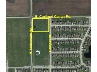
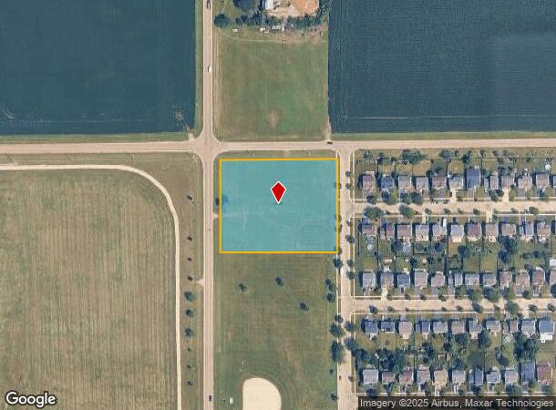
E Somonauk Rd, Cortland, IL 60112
NEARBY LISTINGS FOR SALE OR LEASE
Property Detail
E Somonauk Rd
09-20-200-003
PART OF THE S 1/2 OF THE NE 1/4, SECTION 20 TOWNSHIP 40 N, RANGE 5 E
Taxexempt
DeKalb
X
Illinois
17037C0275E
3.11 AC
2021
Western East/West Corr
2024
Chicago
001600
Chicago-Naperville-Elgin, IL-IN-WI
DEMOGRAPHICS near E Somonauk Rd
1 Mile
3 Mile
5 Mile
2024 Total Population
3,424
14,043
62,933
2029 Population
3,451
14,030
62,826
Pop Growth 2024-2029
+ 0.79%
(0.09%)
(0.17%)
Average Age
38
39
36
2024 Total Households
1,304
5,424
24,598
HH Growth 2024-2029
+ 0.46%
(0.37%)
(0.17%)
Median Household Inc
$77,610
$69,217
$56,271
Avg Household Size
2.60
2.50
2.30
2024 Avg HH Vehicles
2.00
2.00
2.00
Median Home Value
$166,092
$169,659
$184,923
Median Year Built
1993
1973
1978
Nearby Places
Map Layers
Map Styles
 Street
 Aerial
- Restaurants
- Banks
- Shops
- Fitness
- Groceries
PUBLIC TRANSPORTATION
AIRPORT
Chicago/Rockford International
DRIVE
WALK
Distance
Chicago/Rockford International
59 min
38.5 mi
SALE & LEASE HISTORY
LISTING DATE
SALE/LEASE

Sep 24, 2016
For Sale
Nearby Properties
Address
Land Use
TOTAL SIZE
Lot Size
Zoning
Address
Land Use
TOTAL SIZE
Lot Size
Zoning
49.71 AC
Address
Land Use
TOTAL SIZE
Lot Size
Zoning
26.65 AC
Address
Land Use
TOTAL SIZE
Lot Size
Zoning
49.73 AC
Address
Land Use
TOTAL SIZE
Lot Size
Zoning
98.56 AC
Address
Land Use
TOTAL SIZE
Lot Size
Zoning
204,828 SF
27.88 AC
Address
Land Use
TOTAL SIZE
Lot Size
Zoning
25.70 AC
Address
Land Use
TOTAL SIZE
Lot Size
Zoning
42,453 SF
13.08 AC
RC2
Address
Land Use
TOTAL SIZE
Lot Size
Zoning
13.48 AC
BC
Address
Land Use
TOTAL SIZE
Lot Size
Zoning
Address
Land Use
TOTAL SIZE
Lot Size
Zoning
Address
Land Use
TOTAL SIZE
Lot Size
Zoning
29,732 SF
3.66 AC
Address
Land Use
TOTAL SIZE
Lot Size
Zoning
20.83 AC
Address
Land Use
TOTAL SIZE
Lot Size
Zoning
70,481 SF
7.93 AC
Address
Land Use
TOTAL SIZE
Lot Size
Zoning
143,935 SF
14.20 AC
Address
Land Use
TOTAL SIZE
Lot Size
Zoning
8.14 AC
Address
Land Use
TOTAL SIZE
Lot Size
Zoning
128,192 SF
18.02 AC
Address
Land Use
TOTAL SIZE
Lot Size
Zoning
21.35 AC
Address
Land Use
TOTAL SIZE
Lot Size
Zoning
23.25 AC
Address
Land Use
TOTAL SIZE
Lot Size
Zoning
188,034 SF
33.22 AC
Address
Land Use
TOTAL SIZE
Lot Size
Zoning
16.85 AC
Address
Land Use
TOTAL SIZE
Lot Size
Zoning
202,500 SF
15.65 AC
Address
Land Use
TOTAL SIZE
Lot Size
Zoning
2.86 AC
Address
Land Use
TOTAL SIZE
Lot Size
Zoning
28,011 SF
3.33 AC
Address
Land Use
TOTAL SIZE
Lot Size
Zoning
240 SF
7.46 AC
Address
Land Use
TOTAL SIZE
Lot Size
Zoning
8.46 AC
Address
Land Use
TOTAL SIZE
Lot Size
Zoning
4.33 AC
Address
Land Use
TOTAL SIZE
Lot Size
Zoning
1.46 AC
Address
Land Use
TOTAL SIZE
Lot Size
Zoning
3.63 AC
Address
Land Use
TOTAL SIZE
Lot Size
Zoning
3.84 AC
Address
Land Use
TOTAL SIZE
Lot Size
Zoning
4.06 AC
The World's #1 Commercial Real Estate Marketplace
Connect with us
© 2025 CoStar Group
The information above has been obtained from sources believed reliable. While we do not doubt its accuracy we have not verified it and make no guarantee, warranty or representation about it. It is your responsibility to independently confirm its accuracy and completeness. Any projections, opinions, assumptions, or estimates used are for example only and do not represent the current or future performance of the property. The value of this transaction to you depends on tax and other factors which should be evaluated by your tax, financial, and legal advisors. You and your advisors should conduct a careful, independent investigation of the property to determine to your satisfaction the suitability of the property for your needs.