Property Record
2075 E Algonquin Rd, Algonquin, IL 60102


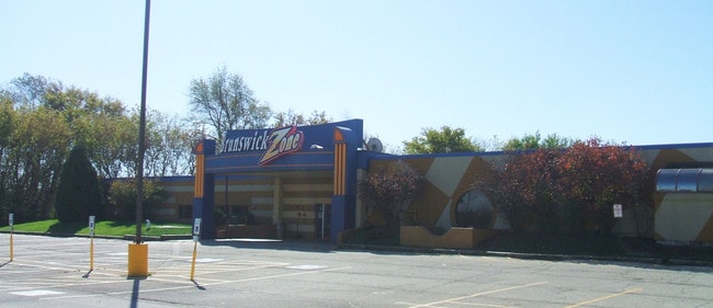
Property Detail
2075 E Algonquin Rd
Chicago-Naperville-Elgin, IL-IN
DOC 2021R0048723 (PLAT) LT 1 2075 REDEVELOPMENT SUB
19-35-452-008
MCHENRY
Commercialnec
Illinois
2024
1
2024
5.31 AC
871404
Far Northwest
34,624 SF
Chicago
NEARBY LISTINGS FOR SALE OR LEASE
DEMOGRAPHICS near 2075 E Algonquin Rd
1 mile
3 mile
5 mile
2024 Total Population
8,212
50,985
125,065
2029 Population
8,259
51,320
126,511
Pop Growth 2024-2029
+ 0.57%
+ 0.66%
+ 1.16%
Average Age
41
39
40
2024 Total Households
3,222
16,970
43,993
HH Growth 2024-2029
+ 0.56%
+ 0.70%
+ 1.20%
Median Household Inc
$105,991
$98,924
$102,566
Avg Household Size
2.50
2.90
2.80
2024 Avg HH Vehicles
2.00
2.00
2.00
Median Home Value
$273,587
$275,371
$295,746
Median Year Built
1995
1981
1987
Nearby Places
Map Layers
Map Styles
 Street
 Aerial
Transit
 Traffic
 Biking
Places
Listings with unknown addresses are not visible on the map
- Restaurants
- Banks
- Shops
- Fitness
- Groceries
SALE & LEASE HISTORY
LISTING DATE
SALE/LEASE

May 19, 2017
For Lease
May 19, 2017
For Sale
Nearby Properties
Address
Land Use
TOTAL SIZE
Lot Size
Zoning
Address
Land Use
TOTAL SIZE
Lot Size
Zoning
183,924 SF
0.80 AC
Address
Land Use
TOTAL SIZE
Lot Size
Zoning
211,680 SF
11.60 AC
Address
Land Use
TOTAL SIZE
Lot Size
Zoning
211,680 SF
11.34 AC
Address
Land Use
TOTAL SIZE
Lot Size
Zoning
23.38 AC
Address
Land Use
TOTAL SIZE
Lot Size
Zoning
9,614 SF
1.42 AC
Address
Land Use
TOTAL SIZE
Lot Size
Zoning
56,900 SF
5.93 AC
Address
Land Use
TOTAL SIZE
Lot Size
Zoning
106,488 SF
5.60 AC
Address
Land Use
TOTAL SIZE
Lot Size
Zoning
35.28 AC
Address
Land Use
TOTAL SIZE
Lot Size
Zoning
Address
Land Use
TOTAL SIZE
Lot Size
Zoning
35,452 SF
105.76 AC
Address
Land Use
TOTAL SIZE
Lot Size
Zoning
106,488 SF
6.64 AC
Address
Land Use
TOTAL SIZE
Lot Size
Zoning
85,364 SF
5.57 AC
Address
Land Use
TOTAL SIZE
Lot Size
Zoning
229.01 AC
Address
Land Use
TOTAL SIZE
Lot Size
Zoning
61,955 SF
7.48 AC
Address
Land Use
TOTAL SIZE
Lot Size
Zoning
103,155 SF
10.72 AC
Address
Land Use
TOTAL SIZE
Lot Size
Zoning
64,728 SF
5.16 AC
Address
Land Use
TOTAL SIZE
Lot Size
Zoning
75,399 SF
4.82 AC
Address
Land Use
TOTAL SIZE
Lot Size
Zoning
64,728 SF
2 AC
Address
Land Use
TOTAL SIZE
Lot Size
Zoning
Address
Land Use
TOTAL SIZE
Lot Size
Zoning
63,216 SF
2.98 AC
Address
Land Use
TOTAL SIZE
Lot Size
Zoning
39,271 SF
4.07 AC
Address
Land Use
TOTAL SIZE
Lot Size
Zoning
49,992 SF
2 AC
Address
Land Use
TOTAL SIZE
Lot Size
Zoning
49,828 SF
1.37 AC
Address
Land Use
TOTAL SIZE
Lot Size
Zoning
72,994 SF
4.58 AC
Address
Land Use
TOTAL SIZE
Lot Size
Zoning
30.05 AC
Address
Land Use
TOTAL SIZE
Lot Size
Zoning
30,454 SF
2.79 AC
Address
Land Use
TOTAL SIZE
Lot Size
Zoning
12,082 SF
1.69 AC
Address
Land Use
TOTAL SIZE
Lot Size
Zoning
Address
Land Use
TOTAL SIZE
Lot Size
Zoning
44,832 SF
1 AC
Address
Land Use
TOTAL SIZE
Lot Size
Zoning
42,880 SF
4.37 AC
The World's #1 Commercial Real Estate Marketplace
Connect with us
© 2026 CoStar Group
The information above has been obtained from sources believed reliable. While we do not doubt its accuracy we have not verified it and make no guarantee, warranty or representation about it. It is your responsibility to independently confirm its accuracy and completeness. Any projections, opinions, assumptions, or estimates used are for example only and do not represent the current or future performance of the property. The value of this transaction to you depends on tax and other factors which should be evaluated by your tax, financial, and legal advisors. You and your advisors should conduct a careful, independent investigation of the property to determine to your satisfaction the suitability of the property for your needs.