Property Record
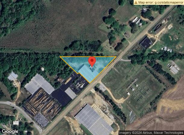
2075 Highway 43 N, Canton, MS 39046
NEARBY LISTINGS FOR SALE OR LEASE
Property Detail
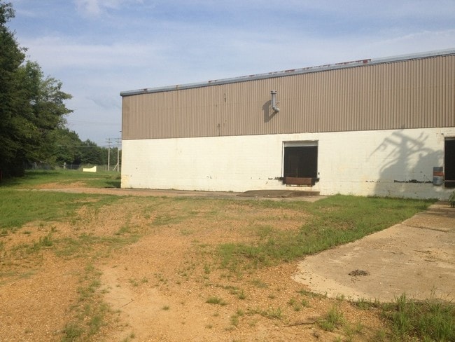
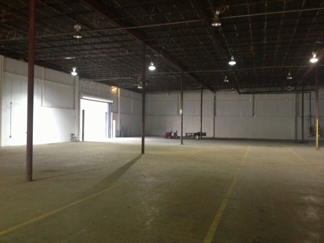
2075 Highway 43 N
093E-21B-004-00-00
1A IN NE COR NW1/4 NW1/4 N & W OF H W
Warehouse
Madison
X
Mississippi
28089C0410G
1 AC
2025
Outlying Madison County
2025
Jackson
030600
Jackson, MS
21,050 SF
DEMOGRAPHICS near 2075 Highway 43 N
1 Mile
3 Mile
5 Mile
2024 Total Population
1,301
12,437
17,146
2029 Population
1,362
13,016
17,980
Pop Growth 2024-2029
+ 4.69%
+ 4.66%
+ 4.86%
Average Age
39
37
37
2024 Total Households
453
4,460
6,357
HH Growth 2024-2029
+ 4.64%
+ 4.69%
+ 5.02%
Median Household Inc
$42,868
$37,668
$37,218
Avg Household Size
2.60
2.60
2.50
2024 Avg HH Vehicles
2.00
2.00
2.00
Median Home Value
$151,249
$131,706
$145,552
Median Year Built
1973
1973
1979
Nearby Places
Map Layers
Map Styles
 Street
 Aerial
- Restaurants
- Banks
- Shops
- Fitness
- Groceries
PUBLIC TRANSPORTATION
AIRPORT
Jackson-Medgar Wiley Evers International
DRIVE
WALK
Distance
Jackson-Medgar Wiley Evers International
48 min
34.7 mi
Freight Ports
Port of Gulf Port
DRIVE
WALK
Distance
Port of Gulf Port
227 min
186.4 mi
Nearby Properties
Address
Land Use
TOTAL SIZE
Lot Size
Zoning
Address
Land Use
TOTAL SIZE
Lot Size
Zoning
56,033 SF
6.90 AC
SU1
Address
Land Use
TOTAL SIZE
Lot Size
Zoning
56,033 SF
1 AC
Address
Land Use
TOTAL SIZE
Lot Size
Zoning
1,697 SF
9.25 AC
R3
Address
Land Use
TOTAL SIZE
Lot Size
Zoning
69,000 SF
15 AC
Address
Land Use
TOTAL SIZE
Lot Size
Zoning
59.86 AC
Address
Land Use
TOTAL SIZE
Lot Size
Zoning
1,027 SF
7.40 AC
R3
Address
Land Use
TOTAL SIZE
Lot Size
Zoning
62,594 SF
9.80 AC
Address
Land Use
TOTAL SIZE
Lot Size
Zoning
2,854 SF
7.90 AC
R3
Address
Land Use
TOTAL SIZE
Lot Size
Zoning
59,180 SF
2.85 AC
Address
Land Use
TOTAL SIZE
Lot Size
Zoning
1,752 SF
Address
Land Use
TOTAL SIZE
Lot Size
Zoning
29,489 SF
4.30 AC
Address
Land Use
TOTAL SIZE
Lot Size
Zoning
2,454 SF
7.30 AC
R3
Address
Land Use
TOTAL SIZE
Lot Size
Zoning
23,217 SF
4.64 AC
Address
Land Use
TOTAL SIZE
Lot Size
Zoning
6,147 SF
2.55 AC
Address
Land Use
TOTAL SIZE
Lot Size
Zoning
38,363 SF
7.90 AC
Address
Land Use
TOTAL SIZE
Lot Size
Zoning
19,311 SF
0.82 AC
Address
Land Use
TOTAL SIZE
Lot Size
Zoning
4,934 SF
9.70 AC
R3
Address
Land Use
TOTAL SIZE
Lot Size
Zoning
3,514 SF
4.80 AC
R3
Address
Land Use
TOTAL SIZE
Lot Size
Zoning
6,256 SF
3 AC
R2
Address
Land Use
TOTAL SIZE
Lot Size
Zoning
7,416 SF
2.60 AC
Address
Land Use
TOTAL SIZE
Lot Size
Zoning
6,501 SF
2.83 AC
R3
Address
Land Use
TOTAL SIZE
Lot Size
Zoning
3,525 SF
2.71 AC
Address
Land Use
TOTAL SIZE
Lot Size
Zoning
884 SF
149 AC
Address
Land Use
TOTAL SIZE
Lot Size
Zoning
8,035 SF
0.25 AC
Address
Land Use
TOTAL SIZE
Lot Size
Zoning
14,031 SF
1.23 AC
Address
Land Use
TOTAL SIZE
Lot Size
Zoning
33,688 SF
5.24 AC
Address
Land Use
TOTAL SIZE
Lot Size
Zoning
4,887 SF
2.30 AC
Address
Land Use
TOTAL SIZE
Lot Size
Zoning
6,262 SF
1.32 AC
Address
Land Use
TOTAL SIZE
Lot Size
Zoning
8,021 SF
4.70 AC
Address
Land Use
TOTAL SIZE
Lot Size
Zoning
43,502 SF
3.87 AC
The World's #1 Commercial Real Estate Marketplace
Connect with us
© 2025 CoStar Group
The information above has been obtained from sources believed reliable. While we do not doubt its accuracy we have not verified it and make no guarantee, warranty or representation about it. It is your responsibility to independently confirm its accuracy and completeness. Any projections, opinions, assumptions, or estimates used are for example only and do not represent the current or future performance of the property. The value of this transaction to you depends on tax and other factors which should be evaluated by your tax, financial, and legal advisors. You and your advisors should conduct a careful, independent investigation of the property to determine to your satisfaction the suitability of the property for your needs.