Property Record
2075 Us Highway 59 S, Livingston, TX 77351
NEARBY LISTINGS FOR SALE OR LEASE
Property Detail
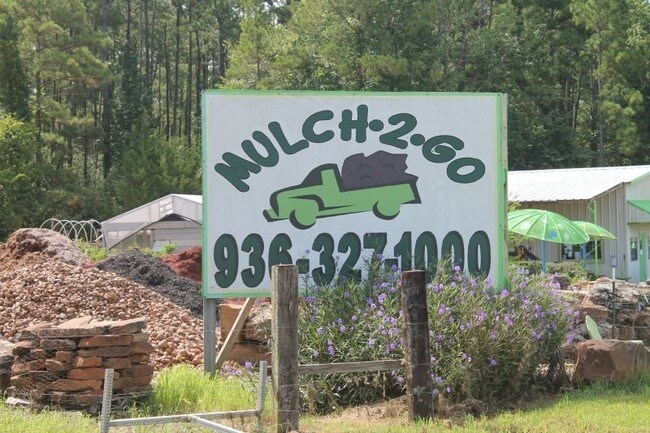
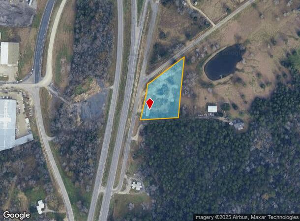
2075 Us Highway 59 S
10056-0050-50
Abst 56 Joseph Morgan Survey
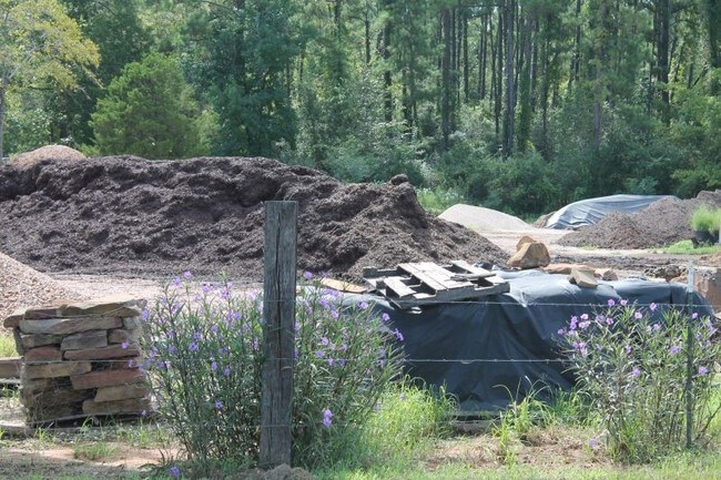
Commercialnec
ABST 56 JOSEPH MORGAN SURVEY TRACT 49-A
X
Polk
48373C0475C
Texas
2025
49-a
2025
2 AC
210105
Texas East Area
360 SF
Other Market Areas
DEMOGRAPHICS near 2075 Us Highway 59 S
1 Mile
3 Mile
5 Mile
2024 Total Population
564
8,220
18,084
2029 Population
652
9,711
21,050
Pop Growth 2024-2029
+ 15.60%
+ 18.14%
+ 16.40%
Average Age
41
40
42
2024 Total Households
195
3,036
6,008
HH Growth 2024-2029
+ 15.90%
+ 17.42%
+ 16.93%
Median Household Inc
$46,538
$45,970
$47,776
Avg Household Size
2.50
2.50
2.50
2024 Avg HH Vehicles
2.00
2.00
2.00
Median Home Value
$133,750
$126,336
$140,414
Median Year Built
1982
1984
1987
Nearby Places
Map Layers
Map Styles
 Street
 Aerial
- Restaurants
- Banks
- Shops
- Fitness
- Groceries
SALE & LEASE HISTORY
LISTING DATE
SALE/LEASE

Sep 23, 2016
For Sale
Nearby Properties
Address
Land Use
TOTAL SIZE
Lot Size
Zoning
Address
Land Use
TOTAL SIZE
Lot Size
Zoning
Address
Land Use
TOTAL SIZE
Lot Size
Zoning
70,339 SF
15.26 AC
Address
Land Use
TOTAL SIZE
Lot Size
Zoning
183,134 SF
18.41 AC
Address
Land Use
TOTAL SIZE
Lot Size
Zoning
Address
Land Use
TOTAL SIZE
Lot Size
Zoning
22,864 SF
5.11 AC
Address
Land Use
TOTAL SIZE
Lot Size
Zoning
111,072 SF
11.14 AC
Address
Land Use
TOTAL SIZE
Lot Size
Zoning
51,080 SF
16.41 AC
Address
Land Use
TOTAL SIZE
Lot Size
Zoning
6,006 SF
1.18 AC
Address
Land Use
TOTAL SIZE
Lot Size
Zoning
13.92 AC
Address
Land Use
TOTAL SIZE
Lot Size
Zoning
17,565 SF
8 AC
Address
Land Use
TOTAL SIZE
Lot Size
Zoning
32,901 SF
1.31 AC
Address
Land Use
TOTAL SIZE
Lot Size
Zoning
41,424 SF
10.55 AC
Address
Land Use
TOTAL SIZE
Lot Size
Zoning
7,552 SF
4 AC
Address
Land Use
TOTAL SIZE
Lot Size
Zoning
10,514 SF
3.50 AC
Address
Land Use
TOTAL SIZE
Lot Size
Zoning
35,292 SF
1.69 AC
Address
Land Use
TOTAL SIZE
Lot Size
Zoning
24,360 SF
3.79 AC
Address
Land Use
TOTAL SIZE
Lot Size
Zoning
10,187 SF
6.06 AC
Address
Land Use
TOTAL SIZE
Lot Size
Zoning
20,340 SF
1.96 AC
Address
Land Use
TOTAL SIZE
Lot Size
Zoning
7.12 AC
Address
Land Use
TOTAL SIZE
Lot Size
Zoning
28,896 SF
4.86 AC
Address
Land Use
TOTAL SIZE
Lot Size
Zoning
28,980 SF
4.47 AC
Address
Land Use
TOTAL SIZE
Lot Size
Zoning
12,606 SF
1.95 AC
Address
Land Use
TOTAL SIZE
Lot Size
Zoning
14,848 SF
2.39 AC
Address
Land Use
TOTAL SIZE
Lot Size
Zoning
27,360 SF
2.03 AC
Address
Land Use
TOTAL SIZE
Lot Size
Zoning
16,032 SF
2.54 AC
Address
Land Use
TOTAL SIZE
Lot Size
Zoning
21,109 SF
11.83 AC
Address
Land Use
TOTAL SIZE
Lot Size
Zoning
266.03 AC
Address
Land Use
TOTAL SIZE
Lot Size
Zoning
27,536 SF
0.66 AC
Address
Land Use
TOTAL SIZE
Lot Size
Zoning
32,720 SF
2.52 AC
Address
Land Use
TOTAL SIZE
Lot Size
Zoning
35,024 SF
1.01 AC
The World's #1 Commercial Real Estate Marketplace
Connect with us
© 2025 CoStar Group
The information above has been obtained from sources believed reliable. While we do not doubt its accuracy we have not verified it and make no guarantee, warranty or representation about it. It is your responsibility to independently confirm its accuracy and completeness. Any projections, opinions, assumptions, or estimates used are for example only and do not represent the current or future performance of the property. The value of this transaction to you depends on tax and other factors which should be evaluated by your tax, financial, and legal advisors. You and your advisors should conduct a careful, independent investigation of the property to determine to your satisfaction the suitability of the property for your needs.