Property Record
20751 State Route 410 E, Bonney Lake, WA 98391
NEARBY LISTINGS FOR SALE OR LEASE
-
-
View all Bonney Lake listings for sale on LoopNet.com
Property Detail
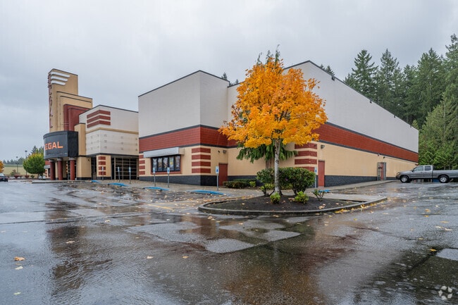
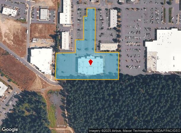
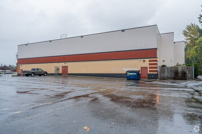
20751 State Route 410 E
Seattle-Tacoma-Bellevue, WA
Fred Meyer Bonney Lake
700034-0014
SECTION 03 TOWNSHIP 19 RANGE 05 QUARTER 11 FRED MEYER BONNEY LAKE L 4 SP 97-01-31-0389 EASE OF REC OUT OF 001-0 SEG I0718 MD 3/31/97MD
Theater
Pierce
X
Washington
53053C0367E
4
2024
4.36 AC
2025
E Pierce County
070310
Seattle/Puget Sound
33,245 SF
DEMOGRAPHICS near 20751 State Route 410 E
1 Mile
3 Mile
5 Mile
2024 Total Population
6,967
49,215
87,340
2029 Population
7,277
50,922
89,936
Pop Growth 2024-2029
+ 4.45%
+ 3.47%
+ 2.97%
Average Age
37
38
39
2024 Total Households
2,320
16,497
30,235
HH Growth 2024-2029
+ 4.57%
+ 3.55%
+ 2.99%
Median Household Inc
$110,158
$111,134
$110,724
Avg Household Size
3.00
2.90
2.80
2024 Avg HH Vehicles
2.00
3.00
2.00
Median Home Value
$451,366
$491,906
$525,980
Median Year Built
1996
1996
1994
Nearby Places
Map Layers
Map Styles
 Street
 Aerial
- Restaurants
- Banks
- Shops
- Fitness
- Groceries
PUBLIC TRANSPORTATION
COMMUTER RAIL
DRIVE
WALK
Distance
12 min
6.5 mi
Sumner Station (Sounder South Line - Central Puget Sound Regional Transit Authority Rail (Link Light Rail/Sounder))
DRIVE
WALK
Distance
Sumner Station (Sounder South Line - Central Puget Sound Regional Transit Authority Rail (Link Light Rail/Sounder))
13 min
6.7 mi
AIRPORT
Seattle-Tacoma International
DRIVE
WALK
Distance
Seattle-Tacoma International
45 min
27.2 mi
Freight Ports
Port of Tacoma
DRIVE
WALK
Distance
Port of Tacoma
30 min
16.4 mi
Nearby Properties
Address
Land Use
TOTAL SIZE
Lot Size
Zoning
Address
Land Use
TOTAL SIZE
Lot Size
Zoning
331,876 SF
14.41 AC
Address
Land Use
TOTAL SIZE
Lot Size
Zoning
253,600 SF
37.20 AC
PF
Address
Land Use
TOTAL SIZE
Lot Size
Zoning
182,022 SF
10.85 AC
Address
Land Use
TOTAL SIZE
Lot Size
Zoning
184,250 SF
10.33 AC
Address
Land Use
TOTAL SIZE
Lot Size
Zoning
214,284 SF
26.09 AC
MC
Address
Land Use
TOTAL SIZE
Lot Size
Zoning
83,521 SF
7.09 AC
MC
Address
Land Use
TOTAL SIZE
Lot Size
Zoning
94,997 SF
36.24 AC
PF
Address
Land Use
TOTAL SIZE
Lot Size
Zoning
96,208 SF
7.93 AC
MC
Address
Land Use
TOTAL SIZE
Lot Size
Zoning
170,717 SF
16.97 AC
MC
Address
Land Use
TOTAL SIZE
Lot Size
Zoning
151,333 SF
13.70 AC
Address
Land Use
TOTAL SIZE
Lot Size
Zoning
115,554 SF
5.80 AC
C2
Address
Land Use
TOTAL SIZE
Lot Size
Zoning
121,842 SF
10.46 AC
MC
Address
Land Use
TOTAL SIZE
Lot Size
Zoning
54,892 SF
14.05 AC
EBPC
Address
Land Use
TOTAL SIZE
Lot Size
Zoning
130,452 SF
12.56 AC
MC
Address
Land Use
TOTAL SIZE
Lot Size
Zoning
59,578 SF
3.19 AC
DM
Address
Land Use
TOTAL SIZE
Lot Size
Zoning
132,260 SF
2.09 AC
Address
Land Use
TOTAL SIZE
Lot Size
Zoning
59,753 SF
4.75 AC
MC
Address
Land Use
TOTAL SIZE
Lot Size
Zoning
87,458 SF
5.10 AC
Address
Land Use
TOTAL SIZE
Lot Size
Zoning
30,973 SF
3.12 AC
DM
Address
Land Use
TOTAL SIZE
Lot Size
Zoning
55,311 SF
17.29 AC
PF
Address
Land Use
TOTAL SIZE
Lot Size
Zoning
108,840 SF
15.92 AC
MC
Address
Land Use
TOTAL SIZE
Lot Size
Zoning
47,848 SF
9.30 AC
PF
Address
Land Use
TOTAL SIZE
Lot Size
Zoning
54,809 SF
13.67 AC
PF
Address
Land Use
TOTAL SIZE
Lot Size
Zoning
97,968 SF
1.50 AC
MC
Address
Land Use
TOTAL SIZE
Lot Size
Zoning
54,700 SF
10.25 AC
MSF
Address
Land Use
TOTAL SIZE
Lot Size
Zoning
55,347 SF
5.01 AC
MC
Address
Land Use
TOTAL SIZE
Lot Size
Zoning
55,635 SF
1.96 AC
E
Address
Land Use
TOTAL SIZE
Lot Size
Zoning
46,446 SF
4.73 AC
C2
Address
Land Use
TOTAL SIZE
Lot Size
Zoning
96,780 SF
7.86 AC
E
Address
Land Use
TOTAL SIZE
Lot Size
Zoning
64,530 SF
19.91 AC
R10
The World's #1 Commercial Real Estate Marketplace
Connect with us
© 2025 CoStar Group
The information above has been obtained from sources believed reliable. While we do not doubt its accuracy we have not verified it and make no guarantee, warranty or representation about it. It is your responsibility to independently confirm its accuracy and completeness. Any projections, opinions, assumptions, or estimates used are for example only and do not represent the current or future performance of the property. The value of this transaction to you depends on tax and other factors which should be evaluated by your tax, financial, and legal advisors. You and your advisors should conduct a careful, independent investigation of the property to determine to your satisfaction the suitability of the property for your needs.