Property Record
2078 Nickerson Blvd, Hampton, VA 23663
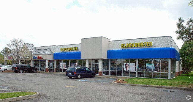

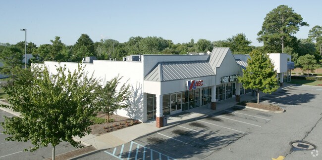
Property Detail
2078 Nickerson Blvd
11003251
NACHMAN TRACT 7.27AC & 15FT R/W.
Stripcommercialcenter
Hampton City
13 C-1 NEI
Virginia
C and X Area of minimal flood hazard, usually depicted on FIRMs as above the 500-year flood level.
7.27 AC
2025
Fox Hill
2025
Hampton Roads
010104
Virginia Beach-Chesapeake-Norfolk, VA-NC
64,474 SF
NEARBY LISTINGS FOR SALE OR LEASE
DEMOGRAPHICS near 2078 Nickerson Blvd
1 mile
3 mile
5 mile
2025 Total Population
13,799
55,061
93,121
2030 Population
13,625
54,750
93,417
Pop Growth 2025-2030
(1.26%)
(0.56%)
+ 0.32%
Average Age
39
39
39
2025 Total Households
5,439
22,153
38,912
HH Growth 2025-2030
(1.31%)
(0.48%)
+ 0.36%
Median Household Inc
$70,867
$73,710
$72,115
Avg Household Size
2.50
2.30
2.30
2025 Avg HH Vehicles
2.00
2.00
2.00
Median Home Value
$241,660
$251,644
$249,240
Median Year Built
1969
1971
1973
Nearby Places
Map Layers
Map Styles
 Street
 Aerial
Layers
 Traffic
 Biking
Places
Listings with unknown addresses are not visible on the map
- Restaurants
- Banks
- Shops
- Fitness
- Groceries
PUBLIC TRANSPORTATION
AIRPORT
Newport News/Williamsburg International
Drive
Walk
Distance
Newport News/Williamsburg International
28 min
15.6 mi
Norfolk International
Drive
Walk
Distance
Norfolk International
31 min
17.1 mi
Freight Ports
Virginia Port Authority - Newport News
Drive
Walk
Distance
Virginia Port Authority - Newport News
20 min
10.7 mi
Nearby Properties
Address
Land Use
TOTAL SIZE
Lot Size
Zoning
Address
Land Use
TOTAL SIZE
Lot Size
Zoning
2,500 SF
2,882 AC
5 R-13 ONE
Address
Land Use
TOTAL SIZE
Lot Size
Zoning
1 SF
92.67 AC
5 R-13 ONE
Address
Land Use
TOTAL SIZE
Lot Size
Zoning
83.50 AC
5 R-13 ONE
Address
Land Use
TOTAL SIZE
Lot Size
Zoning
7,644 SF
322.21 AC
19 PO-1 GE
Address
Land Use
TOTAL SIZE
Lot Size
Zoning
112,089 SF
11.95 AC
30 DT-3 DO
Address
Land Use
TOTAL SIZE
Lot Size
Zoning
204,584 SF
34.79 AC
6 R-11 ONE
Address
Land Use
TOTAL SIZE
Lot Size
Zoning
240,000 SF
30.38 AC
7 R-9 ONE
Address
Land Use
TOTAL SIZE
Lot Size
Zoning
73,668 SF
3.24 AC
30 DT-3 DO
Address
Land Use
TOTAL SIZE
Lot Size
Zoning
110,080 SF
2.21 AC
29 DT-2 DO
Address
Land Use
TOTAL SIZE
Lot Size
Zoning
4.99 AC
47 PH-2 PH
Address
Land Use
TOTAL SIZE
Lot Size
Zoning
114,040 SF
1.46 AC
28 DT-1 DO
Address
Land Use
TOTAL SIZE
Lot Size
Zoning
140,649 SF
25.29 AC
7 R-9 ONE
Address
Land Use
TOTAL SIZE
Lot Size
Zoning
253,896 SF
13.32 AC
9 R-M MULT
Address
Land Use
TOTAL SIZE
Lot Size
Zoning
2,106 SF
191.59 AC
42 FM-1 FO
Address
Land Use
TOTAL SIZE
Lot Size
Zoning
123,151 SF
21.81 AC
5 R-13 ONE
Address
Land Use
TOTAL SIZE
Lot Size
Zoning
127,600 SF
27.95 AC
5 R-13 ONE
Address
Land Use
TOTAL SIZE
Lot Size
Zoning
27,710 SF
14.38 AC
0 MD-2 MUL
Address
Land Use
TOTAL SIZE
Lot Size
Zoning
31,748 SF
5.30 AC
5 R-13 ONE
Address
Land Use
TOTAL SIZE
Lot Size
Zoning
11,772 SF
10.86 AC
0 MD-2 MUL
Address
Land Use
TOTAL SIZE
Lot Size
Zoning
122,256 SF
4.80 AC
11 MD-4 MU
Address
Land Use
TOTAL SIZE
Lot Size
Zoning
808 SF
112.03 AC
19 PO-1 GE
Address
Land Use
TOTAL SIZE
Lot Size
Zoning
92,102 SF
19.27 AC
7 R-9 ONE
Address
Land Use
TOTAL SIZE
Lot Size
Zoning
2,204 SF
90.11 AC
19 PO-1 GE
Address
Land Use
TOTAL SIZE
Lot Size
Zoning
149,244 SF
5.47 AC
11 MD-4 MU
Address
Land Use
TOTAL SIZE
Lot Size
Zoning
115,889 SF
0.92 AC
28 DT-1 DO
Address
Land Use
TOTAL SIZE
Lot Size
Zoning
6,150 SF
9.71 AC
7 R-9 ONE
Address
Land Use
TOTAL SIZE
Lot Size
Zoning
8,040 SF
9.79 AC
9 R-M MULT
Address
Land Use
TOTAL SIZE
Lot Size
Zoning
8,040 SF
9.79 AC
9 R-M MULT
Address
Land Use
TOTAL SIZE
Lot Size
Zoning
77,023 SF
1.13 AC
28 DT-1 DO
Address
Land Use
TOTAL SIZE
Lot Size
Zoning
94,710 SF
19.38 AC
14 C-2 LIM
The World's #1 Commercial Real Estate Marketplace
Connect with us
© 2026 CoStar Group
The information above has been obtained from sources believed reliable. While we do not doubt its accuracy we have not verified it and make no guarantee, warranty or representation about it. It is your responsibility to independently confirm its accuracy and completeness. Any projections, opinions, assumptions, or estimates used are for example only and do not represent the current or future performance of the property. The value of this transaction to you depends on tax and other factors which should be evaluated by your tax, financial, and legal advisors. You and your advisors should conduct a careful, independent investigation of the property to determine to your satisfaction the suitability of the property for your needs.