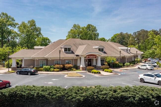
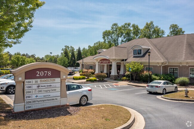
Property Record
2078 Teron Trce, Dacula, GA 30019

Property Detail
2078 Teron Trce
3-002B-518
L5 BA HAMILTON MILL STATION
Medicalbuilding
Gwinnett
C1
Georgia
B and X Area of moderate flood hazard, usually the area between the limits of the 100-year and 500-year floods.
5
2025
2.59 AC
2025
Lawrenceville/Lilburn
050618
Atlanta
27,606 SF
Atlanta-Sandy Springs-Roswell, GA
NEARBY LISTINGS FOR SALE OR LEASE
DEMOGRAPHICS near 2078 Teron Trce
1 mile
3 mile
5 mile
2025 Total Population
6,047
53,990
128,752
2030 Population
6,306
56,810
136,781
Pop Growth 2025-2030
+ 4.28%
+ 5.22%
+ 6.24%
Average Age
40
39
39
2025 Total Households
1,883
16,421
40,609
HH Growth 2025-2030
+ 4.46%
+ 5.38%
+ 6.46%
Median Household Inc
$136,137
$113,012
$109,275
Avg Household Size
3.20
3.20
3.10
2025 Avg HH Vehicles
3.00
2.00
2.00
Median Home Value
$619,711
$445,051
$449,280
Median Year Built
2001
2003
2004
Nearby Places
Map Layers
Map Styles
 Street
 Aerial
Transit
 Traffic
 Biking
Places
Listings with unknown addresses are not visible on the map
- Restaurants
- Banks
- Shops
- Fitness
- Groceries
PUBLIC TRANSPORTATION
AIRPORT
Hartsfield - Jackson Atlanta International
Drive
Walk
Distance
Hartsfield - Jackson Atlanta International
63 min
49.0 mi
SALE & LEASE HISTORY
LISTING DATE
SALE/LEASE

Sep 25, 2016
For Lease
Sep 18, 2019
For Lease
Sep 09, 2020
For Lease
Jul 24, 2018
For Lease
Jul 13, 2017
For Lease
Jan 14, 2021
For Sale
Jan 04, 2017
For Lease
Feb 13, 2017
For Sale
Dec 15, 2020
For Sale
Dec 07, 2021
For Lease
Nearby Properties
Address
Land Use
TOTAL SIZE
Lot Size
Zoning
Address
Land Use
TOTAL SIZE
Lot Size
Zoning
473,883 SF
85.71 AC
RA200
Address
Land Use
TOTAL SIZE
Lot Size
Zoning
891.66 AC
R100
Address
Land Use
TOTAL SIZE
Lot Size
Zoning
1,113,809 SF
57.50 AC
M1
Address
Land Use
TOTAL SIZE
Lot Size
Zoning
403,129 SF
126.91 AC
RA200
Address
Land Use
TOTAL SIZE
Lot Size
Zoning
379,680 SF
76.71 AC
R100
Address
Land Use
TOTAL SIZE
Lot Size
Zoning
372,813 SF
172.70 AC
RA200
Address
Land Use
TOTAL SIZE
Lot Size
Zoning
404,091 SF
58.20 AC
RA200
Address
Land Use
TOTAL SIZE
Lot Size
Zoning
348,358 SF
7.80 AC
H7
Address
Land Use
TOTAL SIZE
Lot Size
Zoning
233,266 SF
17.39 AC
RA200
Address
Land Use
TOTAL SIZE
Lot Size
Zoning
158,307 SF
26.77 AC
R75
Address
Land Use
TOTAL SIZE
Lot Size
Zoning
162,013 SF
20.23 AC
RA200
Address
Land Use
TOTAL SIZE
Lot Size
Zoning
138,229 SF
7.97 AC
OI
Address
Land Use
TOTAL SIZE
Lot Size
Zoning
23,126 SF
88.56 AC
RA200
Address
Land Use
TOTAL SIZE
Lot Size
Zoning
124,425 SF
20.73 AC
RA200
Address
Land Use
TOTAL SIZE
Lot Size
Zoning
97,824 SF
13.71 AC
M1
Address
Land Use
TOTAL SIZE
Lot Size
Zoning
93,702 SF
5.66 AC
C2
Address
Land Use
TOTAL SIZE
Lot Size
Zoning
116,332 SF
4.83 AC
OI
Address
Land Use
TOTAL SIZE
Lot Size
Zoning
84,890 SF
20.02 AC
RA200
Address
Land Use
TOTAL SIZE
Lot Size
Zoning
41,757 SF
19.66 AC
RA200
Address
Land Use
TOTAL SIZE
Lot Size
Zoning
206,107 SF
24.93 AC
C2
Address
Land Use
TOTAL SIZE
Lot Size
Zoning
117,207 SF
12.97 AC
C2
Address
Land Use
TOTAL SIZE
Lot Size
Zoning
31,094 SF
126.02 AC
RA200
Address
Land Use
TOTAL SIZE
Lot Size
Zoning
89,487 SF
11.15 AC
C2
Address
Land Use
TOTAL SIZE
Lot Size
Zoning
91,115 SF
5.20 AC
C2
Address
Land Use
TOTAL SIZE
Lot Size
Zoning
93,841 SF
9.07 AC
C2
Address
Land Use
TOTAL SIZE
Lot Size
Zoning
80,429 SF
9.67 AC
C2
Address
Land Use
TOTAL SIZE
Lot Size
Zoning
32,982 SF
25.46 AC
RA200
Address
Land Use
TOTAL SIZE
Lot Size
Zoning
71,854 SF
9.01 AC
OI
Address
Land Use
TOTAL SIZE
Lot Size
Zoning
78,086 SF
7.17 AC
C2
Address
Land Use
TOTAL SIZE
Lot Size
Zoning
52,024 SF
8.04 AC
C2
The World's #1 Commercial Real Estate Marketplace
Connect with us
© 2026 CoStar Group
The information above has been obtained from sources believed reliable. While we do not doubt its accuracy we have not verified it and make no guarantee, warranty or representation about it. It is your responsibility to independently confirm its accuracy and completeness. Any projections, opinions, assumptions, or estimates used are for example only and do not represent the current or future performance of the property. The value of this transaction to you depends on tax and other factors which should be evaluated by your tax, financial, and legal advisors. You and your advisors should conduct a careful, independent investigation of the property to determine to your satisfaction the suitability of the property for your needs.