Property Record
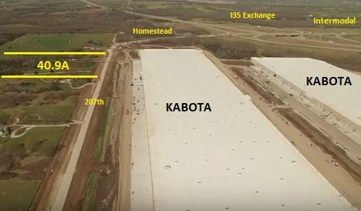
32185 W 207Th St, Edgerton, KS 66021


NEARBY LISTINGS FOR SALE OR LEASE
Property Detail
32185 W 207Th St
Kansas City, MO-KS
Johnson
2F221515-1011
Kansas
Sfr
9.04 AC
X
South Johnson County
20091C0134G
Kansas City
3,070 SF
DEMOGRAPHICS near 32185 W 207Th St
1 Mile
3 Mile
5 Mile
2024 Total Population
105
2,026
20,623
2029 Population
111
2,139
21,499
Pop Growth 2024-2029
+ 5.71%
+ 5.58%
+ 4.25%
Average Age
39
38
36
2024 Total Households
39
737
7,301
HH Growth 2024-2029
+ 7.69%
+ 5.43%
+ 4.37%
Median Household Inc
$85,714
$88,384
$80,717
Avg Household Size
2.60
2.80
2.80
2024 Avg HH Vehicles
3.00
3.00
2.00
Median Home Value
$499,999
$328,906
$246,622
Median Year Built
2002
1995
1999
Nearby Places
Map Layers
Map Styles
 Street
 Aerial
- Restaurants
- Banks
- Shops
- Fitness
- Groceries
SALE & LEASE HISTORY
LISTING DATE
SALE/LEASE

Dec 06, 2017
For Sale
Nearby Properties
Address
Land Use
TOTAL SIZE
Lot Size
Zoning
Address
Land Use
TOTAL SIZE
Lot Size
Zoning
1,952,263 SF
191.05 AC
RUR
Address
Land Use
TOTAL SIZE
Lot Size
Zoning
1,007,020 SF
57.84 AC
RUR
Address
Land Use
TOTAL SIZE
Lot Size
Zoning
951,860 SF
55.73 AC
RUR
Address
Land Use
TOTAL SIZE
Lot Size
Zoning
921,308 SF
46.62 AC
RUR
Address
Land Use
TOTAL SIZE
Lot Size
Zoning
822,082 SF
42.61 AC
RUR
Address
Land Use
TOTAL SIZE
Lot Size
Zoning
748,227 SF
38.70 AC
RUR
Address
Land Use
TOTAL SIZE
Lot Size
Zoning
764,500 SF
62.27 AC
RUR
Address
Land Use
TOTAL SIZE
Lot Size
Zoning
760,255 SF
36.45 AC
RUR
Address
Land Use
TOTAL SIZE
Lot Size
Zoning
650,915 SF
30.96 AC
RUR
Address
Land Use
TOTAL SIZE
Lot Size
Zoning
655,128 SF
36.79 AC
A-G
Address
Land Use
TOTAL SIZE
Lot Size
Zoning
573,983 SF
29.43 AC
A-G
Address
Land Use
TOTAL SIZE
Lot Size
Zoning
548,880 SF
33.62 AC
RUR
Address
Land Use
TOTAL SIZE
Lot Size
Zoning
511,945 SF
30.34 AC
RUR
Address
Land Use
TOTAL SIZE
Lot Size
Zoning
500,770 SF
26.61 AC
L-P
Address
Land Use
TOTAL SIZE
Lot Size
Zoning
379,400 SF
22.06 AC
RUR
Address
Land Use
TOTAL SIZE
Lot Size
Zoning
301,675 SF
15.57 AC
I-H, L-P
Address
Land Use
TOTAL SIZE
Lot Size
Zoning
186,110 SF
11.06 AC
I-H, L-P
Address
Land Use
TOTAL SIZE
Lot Size
Zoning
71,146 SF
16.20 AC
A
Address
Land Use
TOTAL SIZE
Lot Size
Zoning
25,407 SF
4.24 AC
RUR
Address
Land Use
TOTAL SIZE
Lot Size
Zoning
9,604 SF
88.55 AC
AG
Address
Land Use
TOTAL SIZE
Lot Size
Zoning
327,218 SF
18.66 AC
L-P
Address
Land Use
TOTAL SIZE
Lot Size
Zoning
10,615 SF
30.48 AC
L-P
Address
Land Use
TOTAL SIZE
Lot Size
Zoning
337.91 AC
AG
Address
Land Use
TOTAL SIZE
Lot Size
Zoning
333.54 AC
AG
Address
Land Use
TOTAL SIZE
Lot Size
Zoning
5,046 SF
218.55 AC
RUR
Address
Land Use
TOTAL SIZE
Lot Size
Zoning
28,122 SF
60.50 AC
A-G
Address
Land Use
TOTAL SIZE
Lot Size
Zoning
21,735 SF
8.69 AC
A
Address
Land Use
TOTAL SIZE
Lot Size
Zoning
0.60 AC
RUR
Address
Land Use
TOTAL SIZE
Lot Size
Zoning
16,527 SF
86.19 AC
RUR
Address
Land Use
TOTAL SIZE
Lot Size
Zoning
29,228 SF
9.56 AC
RP-5
The World's #1 Commercial Real Estate Marketplace
Connect with us
© 2026 CoStar Group
The information above has been obtained from sources believed reliable. While we do not doubt its accuracy we have not verified it and make no guarantee, warranty or representation about it. It is your responsibility to independently confirm its accuracy and completeness. Any projections, opinions, assumptions, or estimates used are for example only and do not represent the current or future performance of the property. The value of this transaction to you depends on tax and other factors which should be evaluated by your tax, financial, and legal advisors. You and your advisors should conduct a careful, independent investigation of the property to determine to your satisfaction the suitability of the property for your needs.