Property Record
208 E Main St, Nyssa, OR 97913
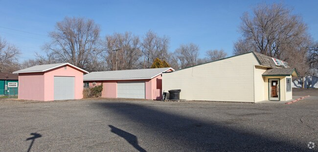


Property Detail
208 E Main St
Commercialnec
Malheur
N-C
Oregon
2025
0.55 AC
2025
Other Market Areas
970500
Ontario, OR-ID
3,821 SF
3892
NEARBY LISTINGS FOR SALE OR LEASE
-
-
View all Nyssa listings for sale on LoopNet.com
DEMOGRAPHICS near 208 E Main St
1 mile
3 mile
5 mile
2025 Total Population
3,011
5,220
6,834
2030 Population
3,041
5,376
7,100
Pop Growth 2025-2030
+ 1.00%
+ 2.99%
+ 3.89%
Average Age
35
37
38
2025 Total Households
986
1,715
2,252
HH Growth 2025-2030
+ 1.32%
+ 3.27%
+ 4.22%
Median Household Inc
$54,444
$58,499
$61,558
Avg Household Size
2.90
3.00
3.00
2025 Avg HH Vehicles
2.00
2.00
2.00
Median Home Value
$183,490
$229,838
$300,220
Median Year Built
1958
1968
1971
Nearby Places
Map Layers
Map Styles
 Street
 Aerial
Transit
 Traffic
 Biking
Places
Listings with unknown addresses are not visible on the map
- Restaurants
- Banks
- Shops
- Fitness
- Groceries
Nearby Properties
Address
Land Use
TOTAL SIZE
Lot Size
Zoning
Address
Land Use
TOTAL SIZE
Lot Size
Zoning
215,398 SF
24.89 AC
N-R3
Address
Land Use
TOTAL SIZE
Lot Size
Zoning
Address
Land Use
TOTAL SIZE
Lot Size
Zoning
19.24 AC
INDUSTRIAL
Address
Land Use
TOTAL SIZE
Lot Size
Zoning
70.54 AC
Address
Land Use
TOTAL SIZE
Lot Size
Zoning
26.82 AC
INDUSTRIAL
Address
Land Use
TOTAL SIZE
Lot Size
Zoning
4.79 AC
N-I
Address
Land Use
TOTAL SIZE
Lot Size
Zoning
5.99 AC
N-C
Address
Land Use
TOTAL SIZE
Lot Size
Zoning
13.88 AC
Address
Land Use
TOTAL SIZE
Lot Size
Zoning
772 SF
15,160.55 AC
C-A2
Address
Land Use
TOTAL SIZE
Lot Size
Zoning
51,310 SF
7.84 AC
N-R3
Address
Land Use
TOTAL SIZE
Lot Size
Zoning
7.08 AC
Address
Land Use
TOTAL SIZE
Lot Size
Zoning
39.52 AC
Address
Land Use
TOTAL SIZE
Lot Size
Zoning
145,710 SF
15.15 AC
Address
Land Use
TOTAL SIZE
Lot Size
Zoning
206.07 AC
N-I
Address
Land Use
TOTAL SIZE
Lot Size
Zoning
49,126 SF
8.29 AC
N-R3
Address
Land Use
TOTAL SIZE
Lot Size
Zoning
29.60 AC
N-I+
Address
Land Use
TOTAL SIZE
Lot Size
Zoning
29,164 SF
8 AC
N-R3
Address
Land Use
TOTAL SIZE
Lot Size
Zoning
21,826 SF
2.36 AC
N-R1
Address
Land Use
TOTAL SIZE
Lot Size
Zoning
25,812 SF
6 AC
N-R1
Address
Land Use
TOTAL SIZE
Lot Size
Zoning
Address
Land Use
TOTAL SIZE
Lot Size
Zoning
1,160 SF
96.31 AC
N-R1+
Address
Land Use
TOTAL SIZE
Lot Size
Zoning
1.35 AC
N-I
Address
Land Use
TOTAL SIZE
Lot Size
Zoning
Address
Land Use
TOTAL SIZE
Lot Size
Zoning
1.12 AC
N-I
Address
Land Use
TOTAL SIZE
Lot Size
Zoning
14.38 AC
C-A1
Address
Land Use
TOTAL SIZE
Lot Size
Zoning
0.51 AC
Address
Land Use
TOTAL SIZE
Lot Size
Zoning
1.35 AC
N-I
Address
Land Use
TOTAL SIZE
Lot Size
Zoning
4 AC
N-I+
Address
Land Use
TOTAL SIZE
Lot Size
Zoning
6,600 SF
15.30 AC
Address
Land Use
TOTAL SIZE
Lot Size
Zoning
8,988 SF
4.31 AC
N-R3
The World's #1 Commercial Real Estate Marketplace
Connect with us
© 2026 CoStar Group
The information above has been obtained from sources believed reliable. While we do not doubt its accuracy we have not verified it and make no guarantee, warranty or representation about it. It is your responsibility to independently confirm its accuracy and completeness. Any projections, opinions, assumptions, or estimates used are for example only and do not represent the current or future performance of the property. The value of this transaction to you depends on tax and other factors which should be evaluated by your tax, financial, and legal advisors. You and your advisors should conduct a careful, independent investigation of the property to determine to your satisfaction the suitability of the property for your needs.