Property Record
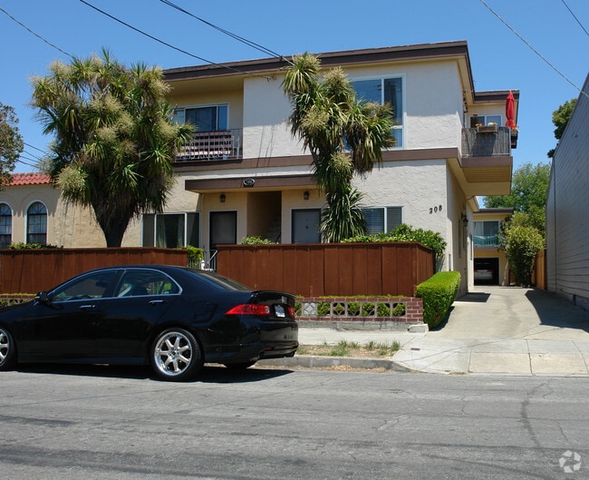
208 Myrtle Rd, Burlingame, CA 94010


NEARBY LISTINGS FOR SALE OR LEASE
Property Detail
208 Myrtle Rd
San Francisco-Redwood City-South San Francisco, CA
Burlingame Map No 1
029-215-160
LOT 20 BLOCK 21 SUPP TO TOWN OF BURLINGAME MAP NO 1 RSM B/28CITY OF BURLINGAME
Multifamilydwelling
San Mateo
X
California
06081C0154G
20
2024
0.17 AC
2025
Lyon Hoag
605400
San Francisco
7,201 SF
DEMOGRAPHICS near 208 Myrtle Rd
1 Mile
3 Mile
5 Mile
2024 Total Population
27,350
103,404
214,543
2029 Population
26,328
98,917
205,033
Pop Growth 2024-2029
(3.74%)
(4.34%)
(4.43%)
Average Age
41
42
42
2024 Total Households
11,420
38,792
80,159
HH Growth 2024-2029
(3.97%)
(4.54%)
(4.62%)
Median Household Inc
$130,777
$140,235
$146,827
Avg Household Size
2.30
2.60
2.60
2024 Avg HH Vehicles
2.00
2.00
2.00
Median Home Value
$1,086,003
$1,121,055
$1,124,706
Median Year Built
1964
1960
1965
Nearby Places
Map Layers
Map Styles
 Street
 Aerial
- Restaurants
- Banks
- Shops
- Fitness
- Groceries
PUBLIC TRANSPORTATION
COMMUTER RAIL
Burlingame (Caltrain - Caltrain (Caltrain))
DRIVE
WALK
Distance
Burlingame (Caltrain - Caltrain (Caltrain))
0 min
2 min
0.1 mi
Burlingame Caltrain Station Southbound (Local Weekday - Caltrain (Caltrain), Local Weekend - Caltrain (Caltrain))
DRIVE
WALK
Distance
Burlingame Caltrain Station Southbound (Local Weekday - Caltrain (Caltrain), Local Weekend - Caltrain (Caltrain))
0 min
4 min
0.2 mi
AIRPORT
San Francisco International
DRIVE
WALK
Distance
San Francisco International
10 min
4.9 mi
Metro Oakland International
DRIVE
WALK
Distance
Metro Oakland International
36 min
27.7 mi
Norman Y Mineta San Jose International
DRIVE
WALK
Distance
Norman Y Mineta San Jose International
37 min
29.1 mi
Freight Ports
Port of Redwood City
DRIVE
WALK
Distance
Port of Redwood City
18 min
11.9 mi
SALE & LEASE HISTORY
LISTING DATE
SALE/LEASE

Jul 12, 2024
For Sale
Nearby Properties
Address
Land Use
TOTAL SIZE
Lot Size
Zoning
Address
Land Use
TOTAL SIZE
Lot Size
Zoning
8.65 AC
Address
Land Use
TOTAL SIZE
Lot Size
Zoning
5.73 AC
Address
Land Use
TOTAL SIZE
Lot Size
Zoning
10,000 SF
0.48 AC
ML00M1
Address
Land Use
TOTAL SIZE
Lot Size
Zoning
277,784 SF
10.85 AC
Address
Land Use
TOTAL SIZE
Lot Size
Zoning
260,547 SF
2.23 AC
Address
Land Use
TOTAL SIZE
Lot Size
Zoning
634,000 SF
8.62 AC
M10000
Address
Land Use
TOTAL SIZE
Lot Size
Zoning
397,793 SF
10.48 AC
CL00C1
Address
Land Use
TOTAL SIZE
Lot Size
Zoning
5.02 AC
Address
Land Use
TOTAL SIZE
Lot Size
Zoning
19,657 SF
0.69 AC
Address
Land Use
TOTAL SIZE
Lot Size
Zoning
219,318 SF
4.77 AC
Address
Land Use
TOTAL SIZE
Lot Size
Zoning
2.83 AC
Address
Land Use
TOTAL SIZE
Lot Size
Zoning
547,306 SF
3.93 AC
Address
Land Use
TOTAL SIZE
Lot Size
Zoning
326,432 SF
10.27 AC
CL0C21
Address
Land Use
TOTAL SIZE
Lot Size
Zoning
55,000 SF
1.64 AC
ML00M1
Address
Land Use
TOTAL SIZE
Lot Size
Zoning
85,500 SF
2.20 AC
Address
Land Use
TOTAL SIZE
Lot Size
Zoning
2.57 AC
Address
Land Use
TOTAL SIZE
Lot Size
Zoning
0.93 AC
CL00C2
Address
Land Use
TOTAL SIZE
Lot Size
Zoning
589,128 SF
11.23 AC
Address
Land Use
TOTAL SIZE
Lot Size
Zoning
233,788 SF
3.35 AC
Address
Land Use
TOTAL SIZE
Lot Size
Zoning
5.47 AC
CBD000
Address
Land Use
TOTAL SIZE
Lot Size
Zoning
204,729 SF
2.70 AC
Address
Land Use
TOTAL SIZE
Lot Size
Zoning
319,696 SF
3.12 AC
Address
Land Use
TOTAL SIZE
Lot Size
Zoning
1.27 AC
Address
Land Use
TOTAL SIZE
Lot Size
Zoning
426,540 SF
9.36 AC
C40000
Address
Land Use
TOTAL SIZE
Lot Size
Zoning
661,318 SF
2.08 AC
E10000
Address
Land Use
TOTAL SIZE
Lot Size
Zoning
294,000 SF
6.34 AC
PD0000
Address
Land Use
TOTAL SIZE
Lot Size
Zoning
Address
Land Use
TOTAL SIZE
Lot Size
Zoning
97,762 SF
1.04 AC
MH00M2
Address
Land Use
TOTAL SIZE
Lot Size
Zoning
20.86 AC
Address
Land Use
TOTAL SIZE
Lot Size
Zoning
32,625 SF
1.70 AC
CL00C1
The World's #1 Commercial Real Estate Marketplace
Connect with us
© 2025 CoStar Group
The information above has been obtained from sources believed reliable. While we do not doubt its accuracy we have not verified it and make no guarantee, warranty or representation about it. It is your responsibility to independently confirm its accuracy and completeness. Any projections, opinions, assumptions, or estimates used are for example only and do not represent the current or future performance of the property. The value of this transaction to you depends on tax and other factors which should be evaluated by your tax, financial, and legal advisors. You and your advisors should conduct a careful, independent investigation of the property to determine to your satisfaction the suitability of the property for your needs.