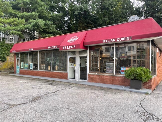
Property Record
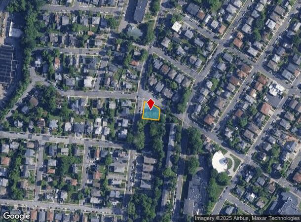
208 Underhill Ave, West Harrison, NY 10604

NEARBY LISTINGS FOR SALE OR LEASE
Property Detail
208 Underhill Ave
2801-000-806-00000-000-0029
Westchester
Restaurantbuilding
New York
X
29
36119C0286F
0.20 AC
2025
East I-287 Corridor
2024
Westchester/So Connecticut
008700
New York-Jersey City-White Plains, NY-NJ
2,002 SF
DEMOGRAPHICS near 208 Underhill Ave
1 Mile
3 Mile
5 Mile
2024 Total Population
20,686
98,384
197,235
2029 Population
20,241
97,258
193,954
Pop Growth 2024-2029
(2.15%)
(1.14%)
(1.66%)
Average Age
42
42
42
2024 Total Households
9,093
38,578
71,920
HH Growth 2024-2029
(2.02%)
(1.13%)
(1.67%)
Median Household Inc
$99,890
$119,927
$139,466
Avg Household Size
2.20
2.40
2.60
2024 Avg HH Vehicles
1.00
2.00
2.00
Median Home Value
$510,972
$630,715
$741,870
Median Year Built
1959
1961
1960
Nearby Places
- Restaurants
- Banks
- Shops
- Fitness
- Groceries
PUBLIC TRANSPORTATION
COMMUTER RAIL
White Plains Station (Harlem Line - Metro-North Commuter Railroad Company (Metro-North))
DRIVE
WALK
Distance
White Plains Station (Harlem Line - Metro-North Commuter Railroad Company (Metro-North))
4 min
1.9 mi
North White Plains Station (Harlem Line - Metro-North Commuter Railroad Company (Metro-North))
DRIVE
WALK
Distance
North White Plains Station (Harlem Line - Metro-North Commuter Railroad Company (Metro-North))
4 min
2.3 mi
AIRPORT
Westchester County
DRIVE
WALK
Distance
Westchester County
9 min
4.9 mi
LaGuardia
DRIVE
WALK
Distance
LaGuardia
42 min
25.6 mi
John F Kennedy International
DRIVE
WALK
Distance
John F Kennedy International
49 min
33.2 mi
Freight Ports
NY - Red Hook Container Terminal
DRIVE
WALK
Distance
NY - Red Hook Container Terminal
57 min
38.3 mi
SALE & LEASE HISTORY
LISTING DATE
SALE/LEASE

Oct 19, 2021
For Lease
Jun 07, 2023
For Sale
Jan 17, 2018
For Sale
Nearby Properties
Address
Land Use
TOTAL SIZE
Lot Size
Zoning
Address
Land Use
TOTAL SIZE
Lot Size
Zoning
358.83 AC
Address
Land Use
TOTAL SIZE
Lot Size
Zoning
75.87 AC
R-20
Address
Land Use
TOTAL SIZE
Lot Size
Zoning
16.22 AC
UR
Address
Land Use
TOTAL SIZE
Lot Size
Zoning
7.98 AC
CA
Address
Land Use
TOTAL SIZE
Lot Size
Zoning
1,975 SF
13.80 AC
CA
Address
Land Use
TOTAL SIZE
Lot Size
Zoning
29.42 AC
PUD
Address
Land Use
TOTAL SIZE
Lot Size
Zoning
10.90 AC
UR
Address
Land Use
TOTAL SIZE
Lot Size
Zoning
477.23 AC
Address
Land Use
TOTAL SIZE
Lot Size
Zoning
7.98 AC
M-14
Address
Land Use
TOTAL SIZE
Lot Size
Zoning
5.43 AC
R-40
Address
Land Use
TOTAL SIZE
Lot Size
Zoning
320 SF
5.38 AC
LI
Address
Land Use
TOTAL SIZE
Lot Size
Zoning
1,348 SF
5.67 AC
CA
Address
Land Use
TOTAL SIZE
Lot Size
Zoning
6.09 AC
DS
Address
Land Use
TOTAL SIZE
Lot Size
Zoning
1,630 SF
2.64 AC
LOB
Address
Land Use
TOTAL SIZE
Lot Size
Zoning
68,616 SF
3.11 AC
Address
Land Use
TOTAL SIZE
Lot Size
Zoning
5.37 AC
R-20
Address
Land Use
TOTAL SIZE
Lot Size
Zoning
9.73 AC
OB-1
Address
Land Use
TOTAL SIZE
Lot Size
Zoning
1.21 AC
B
Address
Land Use
TOTAL SIZE
Lot Size
Zoning
8.36 AC
Address
Land Use
TOTAL SIZE
Lot Size
Zoning
3.12 AC
LI
Address
Land Use
TOTAL SIZE
Lot Size
Zoning
3.96 AC
LI
Address
Land Use
TOTAL SIZE
Lot Size
Zoning
11.13 AC
DS
Address
Land Use
TOTAL SIZE
Lot Size
Zoning
49,865 SF
3 AC
A3
Address
Land Use
TOTAL SIZE
Lot Size
Zoning
1,338 SF
51.60 AC
R-20
Address
Land Use
TOTAL SIZE
Lot Size
Zoning
8 AC
M-10
Address
Land Use
TOTAL SIZE
Lot Size
Zoning
19,923 SF
2.16 AC
B
Address
Land Use
TOTAL SIZE
Lot Size
Zoning
2,365 SF
3.02 AC
CA
Address
Land Use
TOTAL SIZE
Lot Size
Zoning
1,836 SF
4.39 AC
Address
Land Use
TOTAL SIZE
Lot Size
Zoning
0.91 AC
CA
Address
Land Use
TOTAL SIZE
Lot Size
Zoning
2.60 AC
LOB
The World's #1 Commercial Real Estate Marketplace
Connect with us
© 2025 CoStar Group
The information above has been obtained from sources believed reliable. While we do not doubt its accuracy we have not verified it and make no guarantee, warranty or representation about it. It is your responsibility to independently confirm its accuracy and completeness. Any projections, opinions, assumptions, or estimates used are for example only and do not represent the current or future performance of the property. The value of this transaction to you depends on tax and other factors which should be evaluated by your tax, financial, and legal advisors. You and your advisors should conduct a careful, independent investigation of the property to determine to your satisfaction the suitability of the property for your needs.