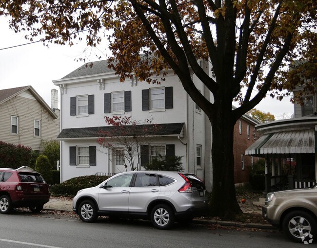
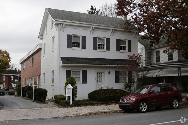
Property Record
208 W Main St, Ephrata, PA 17522
NEARBY LISTINGS FOR SALE OR LEASE
Property Detail
208 W Main St
260-16232-0-0000
208 W MAIN ST
Commercialnec
Lancaster
X
Pennsylvania
42071C0191F
12
2024
0.21 AC
2025
Lancaster County
012302
Philadelphia
4,920 SF
Lancaster, PA
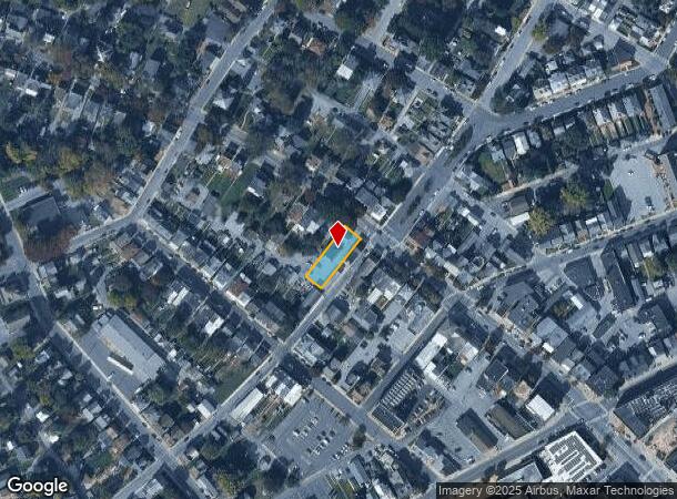
DEMOGRAPHICS near 208 W Main St
1 Mile
3 Mile
5 Mile
2024 Total Population
13,654
33,474
56,363
2029 Population
13,800
33,739
56,599
Pop Growth 2024-2029
+ 1.07%
+ 0.79%
+ 0.42%
Average Age
40
41
40
2024 Total Households
5,566
13,185
21,308
HH Growth 2024-2029
+ 1.13%
+ 0.86%
+ 0.49%
Median Household Inc
$57,750
$66,550
$71,482
Avg Household Size
2.40
2.50
2.60
2024 Avg HH Vehicles
2.00
2.00
2.00
Median Home Value
$195,131
$224,214
$233,255
Median Year Built
1973
1977
1978
Nearby Places
Map Layers
Map Styles
 Street
 Aerial
- Restaurants
- Banks
- Shops
- Fitness
- Groceries
PUBLIC TRANSPORTATION
AIRPORT
Harrisburg International
DRIVE
WALK
Distance
Harrisburg International
56 min
42.0 mi
Freight Ports
Port Newark Container Terminal
DRIVE
WALK
Distance
Port Newark Container Terminal
93 min
52.5 mi
Nearby Properties
Address
Land Use
TOTAL SIZE
Lot Size
Zoning
Address
Land Use
TOTAL SIZE
Lot Size
Zoning
251,634 SF
16.28 AC
Address
Land Use
TOTAL SIZE
Lot Size
Zoning
419,345 SF
48.05 AC
I-1
Address
Land Use
TOTAL SIZE
Lot Size
Zoning
226,686 SF
28 AC
RLD
Address
Land Use
TOTAL SIZE
Lot Size
Zoning
229,049 SF
26.80 AC
RLD
Address
Land Use
TOTAL SIZE
Lot Size
Zoning
203,091 SF
37.05 AC
Address
Land Use
TOTAL SIZE
Lot Size
Zoning
166,771 SF
10.76 AC
Address
Land Use
TOTAL SIZE
Lot Size
Zoning
155,373 SF
4.50 AC
Address
Land Use
TOTAL SIZE
Lot Size
Zoning
198,400 SF
36.90 AC
C-2
Address
Land Use
TOTAL SIZE
Lot Size
Zoning
90,600 SF
6.98 AC
Address
Land Use
TOTAL SIZE
Lot Size
Zoning
135,900 SF
11.79 AC
Address
Land Use
TOTAL SIZE
Lot Size
Zoning
1,350 SF
28.77 AC
Address
Land Use
TOTAL SIZE
Lot Size
Zoning
69,993 SF
Address
Land Use
TOTAL SIZE
Lot Size
Zoning
152,537 SF
17.20 AC
HC
Address
Land Use
TOTAL SIZE
Lot Size
Zoning
72,478 SF
11.83 AC
Address
Land Use
TOTAL SIZE
Lot Size
Zoning
88,413 SF
5.30 AC
RMD
Address
Land Use
TOTAL SIZE
Lot Size
Zoning
85,104 SF
24.20 AC
Address
Land Use
TOTAL SIZE
Lot Size
Zoning
123,018 SF
14.30 AC
HC
Address
Land Use
TOTAL SIZE
Lot Size
Zoning
57,966 SF
6.03 AC
Address
Land Use
TOTAL SIZE
Lot Size
Zoning
145,069 SF
16.30 AC
LI
Address
Land Use
TOTAL SIZE
Lot Size
Zoning
75,760 SF
4.85 AC
RMD
Address
Land Use
TOTAL SIZE
Lot Size
Zoning
73,290 SF
12.83 AC
Address
Land Use
TOTAL SIZE
Lot Size
Zoning
92,217 SF
11.50 AC
C
Address
Land Use
TOTAL SIZE
Lot Size
Zoning
33,134 SF
0.42 AC
NC-2
Address
Land Use
TOTAL SIZE
Lot Size
Zoning
59,996 SF
6 AC
Address
Land Use
TOTAL SIZE
Lot Size
Zoning
55,896 SF
3.49 AC
Address
Land Use
TOTAL SIZE
Lot Size
Zoning
44,302 SF
9.58 AC
RLD
Address
Land Use
TOTAL SIZE
Lot Size
Zoning
51,954 SF
11.80 AC
R-1
Address
Land Use
TOTAL SIZE
Lot Size
Zoning
55,334 SF
5.70 AC
Address
Land Use
TOTAL SIZE
Lot Size
Zoning
81,780 SF
10.24 AC
Address
Land Use
TOTAL SIZE
Lot Size
Zoning
96,337 SF
34.60 AC
I
The World's #1 Commercial Real Estate Marketplace
Connect with us
© 2025 CoStar Group
The information above has been obtained from sources believed reliable. While we do not doubt its accuracy we have not verified it and make no guarantee, warranty or representation about it. It is your responsibility to independently confirm its accuracy and completeness. Any projections, opinions, assumptions, or estimates used are for example only and do not represent the current or future performance of the property. The value of this transaction to you depends on tax and other factors which should be evaluated by your tax, financial, and legal advisors. You and your advisors should conduct a careful, independent investigation of the property to determine to your satisfaction the suitability of the property for your needs.