Property Record
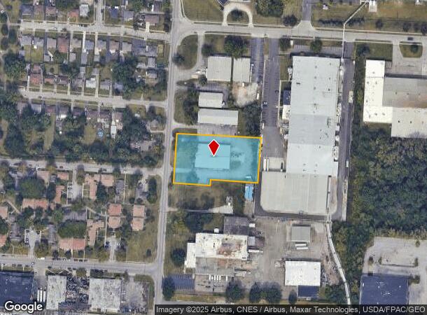
2080 Fairwood Ave, Columbus, OH 43207

Current Lease Availabilities
NEARBY LISTINGS FOR SALE OR LEASE
Property Detail
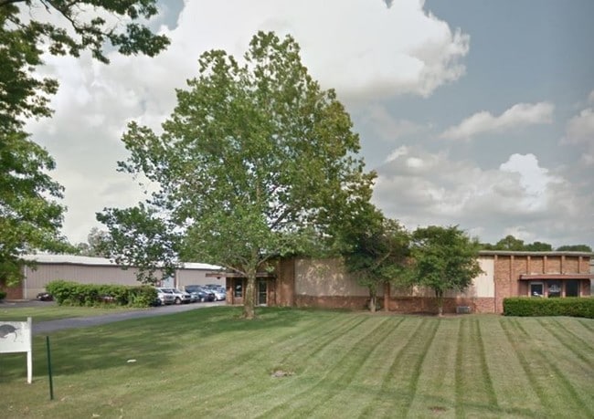
2080 Fairwood Ave
010-112466
Refugee Lands
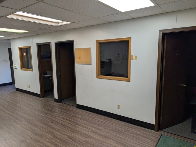
Warehouse
FAIRWOOD AVE 1.675 AC R22 T5 S26 1/2S38
X
Franklin
39049C0337K
Ohio
2024
1.49 AC
2024
Downtown South
008730
Columbus
14,892 SF
Columbus, OH
DEMOGRAPHICS near 2080 Fairwood Ave
1 Mile
3 Mile
5 Mile
2024 Total Population
8,812
98,404
245,781
2029 Population
8,978
99,719
248,681
Pop Growth 2024-2029
+ 1.88%
+ 1.34%
+ 1.18%
Average Age
40
38
38
2024 Total Households
3,516
42,757
107,149
HH Growth 2024-2029
+ 2.02%
+ 1.37%
+ 1.28%
Median Household Inc
$38,760
$53,695
$52,664
Avg Household Size
2.30
2.20
2.20
2024 Avg HH Vehicles
1.00
2.00
1.00
Median Home Value
$85,806
$210,497
$188,287
Median Year Built
1959
1955
1962
Nearby Places
- Restaurants
- Banks
- Shops
- Fitness
- Groceries
PUBLIC TRANSPORTATION
AIRPORT
John Glenn Columbus International
DRIVE
WALK
Distance
John Glenn Columbus International
16 min
8.7 mi
Rickenbacker International
DRIVE
WALK
Distance
Rickenbacker International
17 min
9.1 mi
Freight Ports
Port of Toledo
DRIVE
WALK
Distance
Port of Toledo
191 min
153.5 mi
Nearby Properties
Address
Land Use
TOTAL SIZE
Lot Size
Zoning
Address
Land Use
TOTAL SIZE
Lot Size
Zoning
1,949,795 SF
20.56 AC
Address
Land Use
TOTAL SIZE
Lot Size
Zoning
1,467,891 SF
10.49 AC
Address
Land Use
TOTAL SIZE
Lot Size
Zoning
477,854 SF
0.72 AC
Address
Land Use
TOTAL SIZE
Lot Size
Zoning
339,231 SF
0.73 AC
Address
Land Use
TOTAL SIZE
Lot Size
Zoning
859,800 SF
68.91 AC
Address
Land Use
TOTAL SIZE
Lot Size
Zoning
573,031 SF
5.88 AC
Address
Land Use
TOTAL SIZE
Lot Size
Zoning
496,729 SF
3.47 AC
Address
Land Use
TOTAL SIZE
Lot Size
Zoning
360,962 SF
33.91 AC
Address
Land Use
TOTAL SIZE
Lot Size
Zoning
523,793 SF
6.94 AC
Address
Land Use
TOTAL SIZE
Lot Size
Zoning
157,856 SF
0.74 AC
Address
Land Use
TOTAL SIZE
Lot Size
Zoning
192,038 SF
2.84 AC
Address
Land Use
TOTAL SIZE
Lot Size
Zoning
503,279 SF
1.99 AC
Address
Land Use
TOTAL SIZE
Lot Size
Zoning
143,397 SF
25.50 AC
Address
Land Use
TOTAL SIZE
Lot Size
Zoning
245,142 SF
11.56 AC
Address
Land Use
TOTAL SIZE
Lot Size
Zoning
536,612 SF
10.96 AC
Address
Land Use
TOTAL SIZE
Lot Size
Zoning
127,270 SF
4.41 AC
Address
Land Use
TOTAL SIZE
Lot Size
Zoning
163,713 SF
69.84 AC
Address
Land Use
TOTAL SIZE
Lot Size
Zoning
462,840 SF
27.07 AC
Address
Land Use
TOTAL SIZE
Lot Size
Zoning
386,669 SF
32.15 AC
Address
Land Use
TOTAL SIZE
Lot Size
Zoning
209,884 SF
3.04 AC
Address
Land Use
TOTAL SIZE
Lot Size
Zoning
215,324 SF
4.23 AC
Address
Land Use
TOTAL SIZE
Lot Size
Zoning
361,060 SF
1.49 AC
Address
Land Use
TOTAL SIZE
Lot Size
Zoning
705,600 SF
43.41 AC
Address
Land Use
TOTAL SIZE
Lot Size
Zoning
604,078 SF
50.18 AC
Address
Land Use
TOTAL SIZE
Lot Size
Zoning
79,472 SF
8.45 AC
Address
Land Use
TOTAL SIZE
Lot Size
Zoning
169,066 SF
11.72 AC
Address
Land Use
TOTAL SIZE
Lot Size
Zoning
761,098 SF
35.07 AC
Address
Land Use
TOTAL SIZE
Lot Size
Zoning
132,772 SF
0.62 AC
Address
Land Use
TOTAL SIZE
Lot Size
Zoning
517,865 SF
2.90 AC
Address
Land Use
TOTAL SIZE
Lot Size
Zoning
113,547 SF
5.71 AC
The World's #1 Commercial Real Estate Marketplace
Connect with us
© 2025 CoStar Group
The information above has been obtained from sources believed reliable. While we do not doubt its accuracy we have not verified it and make no guarantee, warranty or representation about it. It is your responsibility to independently confirm its accuracy and completeness. Any projections, opinions, assumptions, or estimates used are for example only and do not represent the current or future performance of the property. The value of this transaction to you depends on tax and other factors which should be evaluated by your tax, financial, and legal advisors. You and your advisors should conduct a careful, independent investigation of the property to determine to your satisfaction the suitability of the property for your needs.