Property Record
2080 Summit Row Blvd, Powell, OH 43065


Property Detail
2080 Summit Row Blvd
Columbus, OH
SMOKY ROW RD SMOKY RIDGE EST 3 1.009 ACRES RES A
610-189985
Franklin
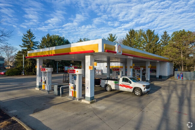
Servicestation
Ohio
B and X Area of moderate flood hazard, usually the area between the limits of the 100-year and 500-year floods.
35
2024
1.01 AC
2025
Bethel Rd
006393
Columbus
2,675 SF
NEARBY LISTINGS FOR SALE OR LEASE
DEMOGRAPHICS near 2080 Summit Row Blvd
1 mile
3 mile
5 mile
2025 Total Population
13,042
75,709
206,121
2030 Population
13,302
78,638
215,235
Pop Growth 2025-2030
+ 1.99%
+ 3.87%
+ 4.42%
Average Age
39
39
39
2025 Total Households
4,709
29,339
81,640
HH Growth 2025-2030
+ 2.10%
+ 4.01%
+ 4.42%
Median Household Inc
$129,901
$122,693
$112,211
Avg Household Size
2.70
2.50
2.50
2025 Avg HH Vehicles
2.00
2.00
2.00
Median Home Value
$372,042
$452,041
$438,934
Median Year Built
1985
1989
1990
Nearby Places
Map Layers
Map Styles
 Street
 Aerial
Transit
 Traffic
 Biking
Places
Listings with unknown addresses are not visible on the map
- Restaurants
- Banks
- Shops
- Fitness
- Groceries
PUBLIC TRANSPORTATION
AIRPORT
John Glenn Columbus International
Drive
Walk
Distance
John Glenn Columbus International
28 min
19.4 mi
Rickenbacker International
Drive
Walk
Distance
Rickenbacker International
42 min
29.7 mi
Freight Ports
Port of Toledo
Drive
Walk
Distance
Port of Toledo
167 min
132.0 mi
Nearby Properties
Address
Land Use
TOTAL SIZE
Lot Size
Zoning
Address
Land Use
TOTAL SIZE
Lot Size
Zoning
90.16 AC
Address
Land Use
TOTAL SIZE
Lot Size
Zoning
56,770 SF
22.62 AC
Address
Land Use
TOTAL SIZE
Lot Size
Zoning
232,579 SF
54.30 AC
Address
Land Use
TOTAL SIZE
Lot Size
Zoning
173,618 SF
1.13 AC
Address
Land Use
TOTAL SIZE
Lot Size
Zoning
261,872 SF
53.89 AC
Address
Land Use
TOTAL SIZE
Lot Size
Zoning
200,609 SF
21.87 AC
Address
Land Use
TOTAL SIZE
Lot Size
Zoning
115,032 SF
12.81 AC
Address
Land Use
TOTAL SIZE
Lot Size
Zoning
42,494 SF
0.19 AC
Address
Land Use
TOTAL SIZE
Lot Size
Zoning
184,139 SF
20.57 AC
Address
Land Use
TOTAL SIZE
Lot Size
Zoning
257,993 SF
9.98 AC
Address
Land Use
TOTAL SIZE
Lot Size
Zoning
266,792 SF
9.03 AC
Address
Land Use
TOTAL SIZE
Lot Size
Zoning
413,781 SF
78.36 AC
Address
Land Use
TOTAL SIZE
Lot Size
Zoning
323,955 SF
31.18 AC
Address
Land Use
TOTAL SIZE
Lot Size
Zoning
162,728 SF
4.80 AC
Address
Land Use
TOTAL SIZE
Lot Size
Zoning
216,100 SF
28.17 AC
Address
Land Use
TOTAL SIZE
Lot Size
Zoning
168,323 SF
22.61 AC
Address
Land Use
TOTAL SIZE
Lot Size
Zoning
111,376 SF
0.55 AC
Address
Land Use
TOTAL SIZE
Lot Size
Zoning
122,663 SF
0.60 AC
Address
Land Use
TOTAL SIZE
Lot Size
Zoning
57,864 SF
5.76 AC
Address
Land Use
TOTAL SIZE
Lot Size
Zoning
159,901 SF
19.97 AC
Address
Land Use
TOTAL SIZE
Lot Size
Zoning
183,424 SF
9.21 AC
Address
Land Use
TOTAL SIZE
Lot Size
Zoning
131,905 SF
6.32 AC
Address
Land Use
TOTAL SIZE
Lot Size
Zoning
112,840 SF
11.68 AC
Address
Land Use
TOTAL SIZE
Lot Size
Zoning
128,522 SF
13.43 AC
Address
Land Use
TOTAL SIZE
Lot Size
Zoning
69.13 AC
Address
Land Use
TOTAL SIZE
Lot Size
Zoning
151,623 SF
27.47 AC
Address
Land Use
TOTAL SIZE
Lot Size
Zoning
148,499 SF
18.03 AC
Address
Land Use
TOTAL SIZE
Lot Size
Zoning
60,188 SF
0.76 AC
Address
Land Use
TOTAL SIZE
Lot Size
Zoning
153,766 SF
3.98 AC
The World's #1 Commercial Real Estate Marketplace
Connect with us
© 2026 CoStar Group
The information above has been obtained from sources believed reliable. While we do not doubt its accuracy we have not verified it and make no guarantee, warranty or representation about it. It is your responsibility to independently confirm its accuracy and completeness. Any projections, opinions, assumptions, or estimates used are for example only and do not represent the current or future performance of the property. The value of this transaction to you depends on tax and other factors which should be evaluated by your tax, financial, and legal advisors. You and your advisors should conduct a careful, independent investigation of the property to determine to your satisfaction the suitability of the property for your needs.