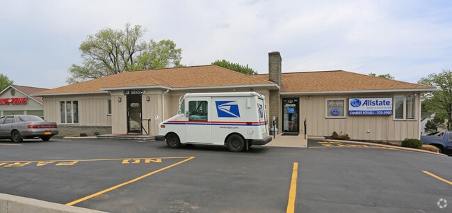
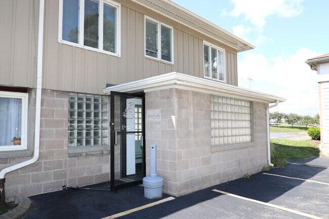
Property Record
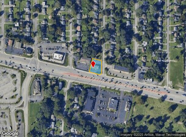
2080 W Ridge Rd, Rochester, NY 14626
NEARBY LISTINGS FOR SALE OR LEASE
Property Detail
2080 W Ridge Rd
262800-074-150-0014-015-000
20TR L96 T1 RIDGE ROAD 148-87 L15 L16
Officebuilding
Monroe
X
New York
36055C0183G
15.000
2025
0.37 AC
2024
Northwest
014003
Rochester
4,360 SF
Rochester, NY
DEMOGRAPHICS near 2080 W Ridge Rd
1 Mile
3 Mile
5 Mile
2024 Total Population
9,484
86,563
227,058
2029 Population
9,299
85,495
223,713
Pop Growth 2024-2029
(1.95%)
(1.23%)
(1.47%)
Average Age
43
41
40
2024 Total Households
4,292
37,272
94,796
HH Growth 2024-2029
(2.03%)
(1.28%)
(1.54%)
Median Household Inc
$73,069
$60,412
$54,819
Avg Household Size
2.10
2.20
2.30
2024 Avg HH Vehicles
2.00
2.00
1.00
Median Home Value
$142,749
$142,363
$144,486
Median Year Built
1964
1965
1961
Nearby Places
- Restaurants
- Banks
- Shops
- Fitness
- Groceries
PUBLIC TRANSPORTATION
COMMUTER RAIL
DRIVE
WALK
Distance
11 min
6.4 mi
AIRPORT
Frederick Douglass/Greater Rochester International
DRIVE
WALK
Distance
Frederick Douglass/Greater Rochester International
13 min
8.2 mi
SALE & LEASE HISTORY
LISTING DATE
SALE/LEASE

Oct 15, 2021
For Lease
Jan 04, 2022
For Lease
Dec 27, 2023
For Lease
Aug 18, 2021
For Lease
Aug 01, 2022
For Lease
Nearby Properties
Address
Land Use
TOTAL SIZE
Lot Size
Zoning
Address
Land Use
TOTAL SIZE
Lot Size
Zoning
181,500 SF
57.85 AC
Address
Land Use
TOTAL SIZE
Lot Size
Zoning
64,041 SF
42.66 AC
Address
Land Use
TOTAL SIZE
Lot Size
Zoning
57,550 SF
46.61 AC
05 - COMME
Address
Land Use
TOTAL SIZE
Lot Size
Zoning
18,831 SF
70.63 AC
Address
Land Use
TOTAL SIZE
Lot Size
Zoning
Address
Land Use
TOTAL SIZE
Lot Size
Zoning
330,700 SF
66.90 AC
Address
Land Use
TOTAL SIZE
Lot Size
Zoning
37,487 SF
47.63 AC
Address
Land Use
TOTAL SIZE
Lot Size
Zoning
225,793 SF
32.60 AC
Address
Land Use
TOTAL SIZE
Lot Size
Zoning
227,808 SF
69.10 AC
Address
Land Use
TOTAL SIZE
Lot Size
Zoning
2.63 AC
Address
Land Use
TOTAL SIZE
Lot Size
Zoning
273,663 SF
80.37 AC
Address
Land Use
TOTAL SIZE
Lot Size
Zoning
274,700 SF
24.79 AC
Address
Land Use
TOTAL SIZE
Lot Size
Zoning
6,617 SF
275.73 AC
Address
Land Use
TOTAL SIZE
Lot Size
Zoning
3,710 SF
30.20 AC
05 - COMME
Address
Land Use
TOTAL SIZE
Lot Size
Zoning
119,777 SF
14.38 AC
06 - INDUS
Address
Land Use
TOTAL SIZE
Lot Size
Zoning
391,478 SF
29.27 AC
Address
Land Use
TOTAL SIZE
Lot Size
Zoning
565.09 AC
Address
Land Use
TOTAL SIZE
Lot Size
Zoning
250,500 SF
18 AC
Address
Land Use
TOTAL SIZE
Lot Size
Zoning
119,983 SF
17.80 AC
03 - MULTI
Address
Land Use
TOTAL SIZE
Lot Size
Zoning
1,899,594 SF
87.90 AC
Address
Land Use
TOTAL SIZE
Lot Size
Zoning
Address
Land Use
TOTAL SIZE
Lot Size
Zoning
2,855 SF
243.50 AC
Address
Land Use
TOTAL SIZE
Lot Size
Zoning
179,837 SF
8.01 AC
Address
Land Use
TOTAL SIZE
Lot Size
Zoning
149,541 SF
6.10 AC
03 - MULTI
Address
Land Use
TOTAL SIZE
Lot Size
Zoning
116,394 SF
28.72 AC
05 - COMME
Address
Land Use
TOTAL SIZE
Lot Size
Zoning
521,507 SF
37.98 AC
Address
Land Use
TOTAL SIZE
Lot Size
Zoning
67,000 SF
3.86 AC
Address
Land Use
TOTAL SIZE
Lot Size
Zoning
206,603 SF
13.35 AC
Address
Land Use
TOTAL SIZE
Lot Size
Zoning
104,880 SF
9 AC
05 - COMME
Address
Land Use
TOTAL SIZE
Lot Size
Zoning
145,943 SF
16.15 AC
05 - COMME
The World's #1 Commercial Real Estate Marketplace
Connect with us
© 2025 CoStar Group
The information above has been obtained from sources believed reliable. While we do not doubt its accuracy we have not verified it and make no guarantee, warranty or representation about it. It is your responsibility to independently confirm its accuracy and completeness. Any projections, opinions, assumptions, or estimates used are for example only and do not represent the current or future performance of the property. The value of this transaction to you depends on tax and other factors which should be evaluated by your tax, financial, and legal advisors. You and your advisors should conduct a careful, independent investigation of the property to determine to your satisfaction the suitability of the property for your needs.