Property Record
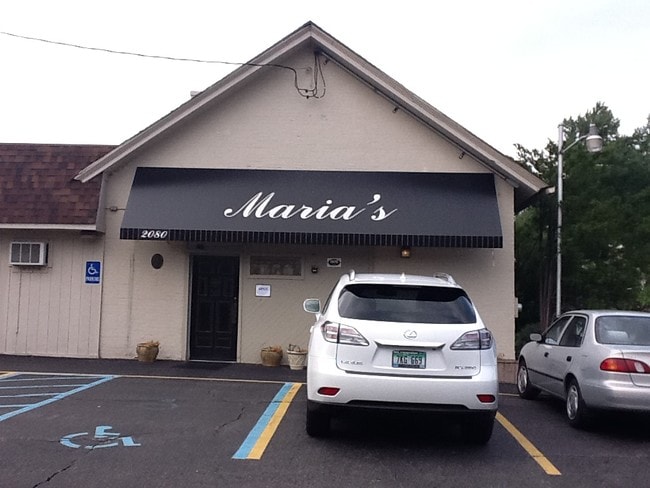
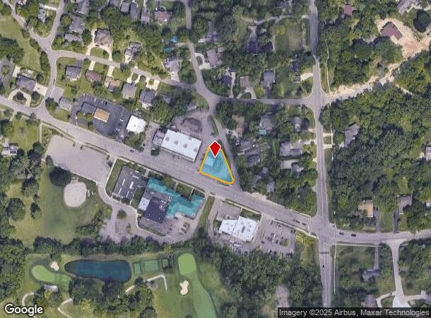
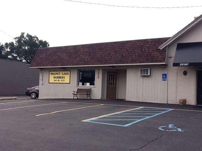
2080-2090 Walnut Lake Rd, West Bloomfield, MI 48323
NEARBY LISTINGS FOR SALE OR LEASE
Property Detail
2080-2090 Walnut Lake Rd
Detroit-Warren-Dearborn, MI
Herndons Walnut Lake Estates
18-25-279-022
T2N, R9E, SEC 25 AMENDED PLAT OF LOTS 438, 439, 440, 441, 442, 443, & 444 HERNDON'S WALNUT LAKE ESTATES NO 1 PART OF LOT 440 & 442 BEG AT SE COR OF LOT 440, TH N 67-45-48 W 15.15 FT, TH N 22-14-12 E 114.40 FT, TH S 67-45-48 E 52.43 FT, TH S 20-36-48
Stripcommercialcenter
Oakland
X
Michigan
26125C0512F
438-444
2024
0.27 AC
2024
Bloomfield West
156400
Detroit
2,488 SF
DEMOGRAPHICS near 2080-2090 Walnut Lake Rd
1 Mile
3 Mile
5 Mile
2024 Total Population
5,060
49,594
149,554
2029 Population
5,000
49,190
148,387
Pop Growth 2024-2029
(1.19%)
(0.81%)
(0.78%)
Average Age
43
45
44
2024 Total Households
1,769
19,068
60,007
HH Growth 2024-2029
(1.13%)
(0.72%)
(0.71%)
Median Household Inc
$163,446
$138,509
$110,808
Avg Household Size
2.80
2.50
2.40
2024 Avg HH Vehicles
2.00
2.00
2.00
Median Home Value
$526,941
$467,509
$417,173
Median Year Built
1967
1972
1972
Nearby Places
Map Layers
Map Styles
 Street
 Aerial
- Restaurants
- Banks
- Shops
- Fitness
- Groceries
PUBLIC TRANSPORTATION
COMMUTER RAIL
Troy Amtrak Station (Wolverine - Amtrak)
DRIVE
WALK
Distance
Troy Amtrak Station (Wolverine - Amtrak)
17 min
7.6 mi
Pontiac Amtrak Station (Wolverine - Amtrak)
DRIVE
WALK
Distance
Pontiac Amtrak Station (Wolverine - Amtrak)
15 min
7.7 mi
AIRPORT
Windsor International
DRIVE
WALK
Distance
Windsor International
57 min
33.6 mi
Detroit Metro Wayne County
DRIVE
WALK
Distance
Detroit Metro Wayne County
46 min
34.8 mi
Freight Ports
Port of Toledo
DRIVE
WALK
Distance
Port of Toledo
96 min
76.4 mi
Nearby Properties
Address
Land Use
TOTAL SIZE
Lot Size
Zoning
Address
Land Use
TOTAL SIZE
Lot Size
Zoning
315,206 SF
3.85 AC
AI
Address
Land Use
TOTAL SIZE
Lot Size
Zoning
121,382 SF
10.84 AC
BI
Address
Land Use
TOTAL SIZE
Lot Size
Zoning
167,882 SF
16.18 AC
BI
Address
Land Use
TOTAL SIZE
Lot Size
Zoning
271,650 SF
12.88 AC
BI
Address
Land Use
TOTAL SIZE
Lot Size
Zoning
352,098 SF
28.94 AC
BI
Address
Land Use
TOTAL SIZE
Lot Size
Zoning
Address
Land Use
TOTAL SIZE
Lot Size
Zoning
246,695 SF
18.46 AC
BI
Address
Land Use
TOTAL SIZE
Lot Size
Zoning
255,136 SF
21.19 AC
AI
Address
Land Use
TOTAL SIZE
Lot Size
Zoning
276,825 SF
19.05 AC
AI
Address
Land Use
TOTAL SIZE
Lot Size
Zoning
142,043 SF
17.87 AC
AI
Address
Land Use
TOTAL SIZE
Lot Size
Zoning
218,023 SF
21.80 AC
AI
Address
Land Use
TOTAL SIZE
Lot Size
Zoning
158,279 SF
3.63 AC
BI
Address
Land Use
TOTAL SIZE
Lot Size
Zoning
167,790 SF
13.33 AC
BI
Address
Land Use
TOTAL SIZE
Lot Size
Zoning
89,878 SF
11.31 AC
BI
Address
Land Use
TOTAL SIZE
Lot Size
Zoning
243,820 SF
19.71 AC
AI
Address
Land Use
TOTAL SIZE
Lot Size
Zoning
45,893 SF
5.62 AC
AI
Address
Land Use
TOTAL SIZE
Lot Size
Zoning
139,227 SF
13.13 AC
BI
Address
Land Use
TOTAL SIZE
Lot Size
Zoning
102,093 SF
4.44 AC
BI
Address
Land Use
TOTAL SIZE
Lot Size
Zoning
198,917 SF
13.17 AC
AI
Address
Land Use
TOTAL SIZE
Lot Size
Zoning
97,626 SF
9.42 AC
BI
Address
Land Use
TOTAL SIZE
Lot Size
Zoning
0.96 AC
AI
Address
Land Use
TOTAL SIZE
Lot Size
Zoning
87,292 SF
2 AC
BI
Address
Land Use
TOTAL SIZE
Lot Size
Zoning
71,588 SF
3.72 AC
BI
Address
Land Use
TOTAL SIZE
Lot Size
Zoning
Address
Land Use
TOTAL SIZE
Lot Size
Zoning
47,573 SF
3.83 AC
BI
Address
Land Use
TOTAL SIZE
Lot Size
Zoning
27,442 SF
3.81 AC
BI
Address
Land Use
TOTAL SIZE
Lot Size
Zoning
Address
Land Use
TOTAL SIZE
Lot Size
Zoning
48,040 SF
3.08 AC
BI
Address
Land Use
TOTAL SIZE
Lot Size
Zoning
97,331 SF
5.21 AC
BI
Address
Land Use
TOTAL SIZE
Lot Size
Zoning
158.79 AC
The World's #1 Commercial Real Estate Marketplace
Connect with us
© 2025 CoStar Group
The information above has been obtained from sources believed reliable. While we do not doubt its accuracy we have not verified it and make no guarantee, warranty or representation about it. It is your responsibility to independently confirm its accuracy and completeness. Any projections, opinions, assumptions, or estimates used are for example only and do not represent the current or future performance of the property. The value of this transaction to you depends on tax and other factors which should be evaluated by your tax, financial, and legal advisors. You and your advisors should conduct a careful, independent investigation of the property to determine to your satisfaction the suitability of the property for your needs.