Property Record
2084 Jodeco Rd, Stockbridge, GA 30281


NEARBY LISTINGS FOR SALE OR LEASE
Property Detail
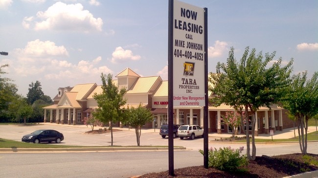
2084 Jodeco Rd
0053-01-022-002
TRACT D
Stripcommercialcenter
Henry
X
Georgia
13151C0151D
1.01 AC
2025
Riverdale/Jonesboro
2025
Atlanta
070113
Atlanta-Sandy Springs-Roswell, GA
9,860 SF
DEMOGRAPHICS near 2084 Jodeco Rd
1 Mile
3 Mile
5 Mile
2024 Total Population
3,311
35,672
96,462
2029 Population
3,559
38,900
104,837
Pop Growth 2024-2029
+ 7.49%
+ 9.05%
+ 8.68%
Average Age
41
39
38
2024 Total Households
1,168
12,568
34,784
HH Growth 2024-2029
+ 7.45%
+ 9.05%
+ 8.73%
Median Household Inc
$87,500
$81,630
$73,792
Avg Household Size
2.80
2.80
2.70
2024 Avg HH Vehicles
2.00
2.00
2.00
Median Home Value
$189,399
$260,098
$241,692
Median Year Built
1989
1997
1997
Nearby Places
Map Layers
Map Styles
 Street
 Aerial
- Restaurants
- Banks
- Shops
- Fitness
- Groceries
PUBLIC TRANSPORTATION
AIRPORT
Hartsfield - Jackson Atlanta International
DRIVE
WALK
Distance
Hartsfield - Jackson Atlanta International
27 min
19.7 mi
SALE & LEASE HISTORY
LISTING DATE
SALE/LEASE

Jul 30, 2020
For Lease
Jul 03, 2025
For Lease
Dec 06, 2016
For Lease
Nearby Properties
Address
Land Use
TOTAL SIZE
Lot Size
Zoning
Address
Land Use
TOTAL SIZE
Lot Size
Zoning
16,649 SF
29.98 AC
RM
Address
Land Use
TOTAL SIZE
Lot Size
Zoning
27,850 SF
15.19 AC
Address
Land Use
TOTAL SIZE
Lot Size
Zoning
106,512 SF
10.76 AC
Address
Land Use
TOTAL SIZE
Lot Size
Zoning
22,400 SF
45.37 AC
RM
Address
Land Use
TOTAL SIZE
Lot Size
Zoning
39,169 SF
7.54 AC
RM
Address
Land Use
TOTAL SIZE
Lot Size
Zoning
59,445 SF
20.17 AC
PD
Address
Land Use
TOTAL SIZE
Lot Size
Zoning
476,716 SF
28.93 AC
C2
Address
Land Use
TOTAL SIZE
Lot Size
Zoning
30,396 SF
21.12 AC
Address
Land Use
TOTAL SIZE
Lot Size
Zoning
4,010 SF
37.60 AC
C2
Address
Land Use
TOTAL SIZE
Lot Size
Zoning
29,934 SF
18.18 AC
C2
Address
Land Use
TOTAL SIZE
Lot Size
Zoning
5,485 SF
27.03 AC
RM
Address
Land Use
TOTAL SIZE
Lot Size
Zoning
19,140 SF
40.11 AC
RM
Address
Land Use
TOTAL SIZE
Lot Size
Zoning
707,800 SF
27.81 AC
M1
Address
Land Use
TOTAL SIZE
Lot Size
Zoning
498,160 SF
44.14 AC
M1
Address
Land Use
TOTAL SIZE
Lot Size
Zoning
9,264 SF
26.63 AC
RM
Address
Land Use
TOTAL SIZE
Lot Size
Zoning
510,053 SF
39.93 AC
M1
Address
Land Use
TOTAL SIZE
Lot Size
Zoning
25,508 SF
26.03 AC
RM
Address
Land Use
TOTAL SIZE
Lot Size
Zoning
76,608 SF
26.99 AC
R2
Address
Land Use
TOTAL SIZE
Lot Size
Zoning
127,960 SF
93.84 AC
RA
Address
Land Use
TOTAL SIZE
Lot Size
Zoning
439,225 SF
19.81 AC
M1
Address
Land Use
TOTAL SIZE
Lot Size
Zoning
72,898 SF
24 AC
C3
Address
Land Use
TOTAL SIZE
Lot Size
Zoning
399,189 SF
29.60 AC
M1
Address
Land Use
TOTAL SIZE
Lot Size
Zoning
269,100 SF
30.64 AC
Address
Land Use
TOTAL SIZE
Lot Size
Zoning
151,123 SF
26.05 AC
C3
Address
Land Use
TOTAL SIZE
Lot Size
Zoning
425,476 SF
58.85 AC
PD
Address
Land Use
TOTAL SIZE
Lot Size
Zoning
74,395 SF
49.35 AC
PD
Address
Land Use
TOTAL SIZE
Lot Size
Zoning
111,398 SF
15.54 AC
C2
Address
Land Use
TOTAL SIZE
Lot Size
Zoning
653,368 SF
17.84 AC
Address
Land Use
TOTAL SIZE
Lot Size
Zoning
68,500 SF
140.42 AC
R2
Address
Land Use
TOTAL SIZE
Lot Size
Zoning
216,361 SF
27.44 AC
C3
The World's #1 Commercial Real Estate Marketplace
Connect with us
© 2025 CoStar Group
The information above has been obtained from sources believed reliable. While we do not doubt its accuracy we have not verified it and make no guarantee, warranty or representation about it. It is your responsibility to independently confirm its accuracy and completeness. Any projections, opinions, assumptions, or estimates used are for example only and do not represent the current or future performance of the property. The value of this transaction to you depends on tax and other factors which should be evaluated by your tax, financial, and legal advisors. You and your advisors should conduct a careful, independent investigation of the property to determine to your satisfaction the suitability of the property for your needs.