Property Record
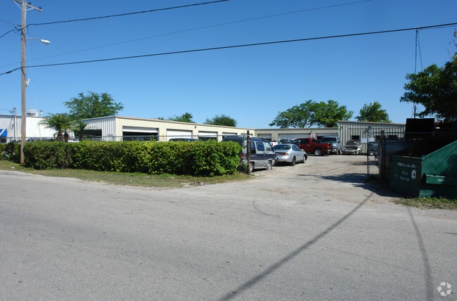
2084 Range Rd, Clearwater, FL 33765


Property Detail
2084 Range Rd
12-29-15-70182-100-1200
PINELLAS GROVES NE 1/4, SEC 12-29-15 PART OF LOTS 11 & 12 DESC FROM SW COR OF NW 1/4 OF NE 1/4 OF SD SEC TH N00D 17E 30FT TH S89D2002E 906.62FT FOR POB TH N00D0554E 200FT TH S89D2002E 282.6FT TH S00D0554W 200FT TH N89D2002W 282.6FT TO POB
Warehouse
Pinellas
M1
Florida
B and X Area of moderate flood hazard, usually the area between the limits of the 100-year and 500-year floods.
11,12
2024
1.30 AC
2025
North Pinellas
026703
Tampa/St Petersburg
18,200 SF
Tampa-St. Petersburg-Clearwater, FL
NEARBY LISTINGS FOR SALE OR LEASE
DEMOGRAPHICS near 2084 Range Rd
1 mile
3 mile
5 mile
2025 Total Population
10,191
123,956
247,098
2030 Population
10,200
124,363
248,702
Pop Growth 2025-2030
+ 0.09%
+ 0.33%
+ 0.65%
Average Age
43
45
47
2025 Total Households
3,455
55,607
113,935
HH Growth 2025-2030
(0.49%)
+ 0.21%
+ 0.56%
Median Household Inc
$58,466
$63,639
$67,950
Avg Household Size
2.30
2.10
2.10
2025 Avg HH Vehicles
2.00
1.00
2.00
Median Home Value
$377,591
$332,230
$369,608
Median Year Built
1975
1975
1976
Nearby Places
Map Layers
Map Styles
 Street
 Aerial
Transit
 Traffic
 Biking
Places
Listings with unknown addresses are not visible on the map
- Restaurants
- Banks
- Shops
- Fitness
- Groceries
PUBLIC TRANSPORTATION
AIRPORT
St Pete-Clearwater International
Drive
Walk
Distance
St Pete-Clearwater International
15 min
8.4 mi
Tampa International
Drive
Walk
Distance
Tampa International
28 min
16.3 mi
Freight Ports
Port of Tampa Bay
Drive
Walk
Distance
Port of Tampa Bay
42 min
24.8 mi
Nearby Properties
Address
Land Use
TOTAL SIZE
Lot Size
Zoning
Address
Land Use
TOTAL SIZE
Lot Size
Zoning
513,938 SF
22.84 AC
Address
Land Use
TOTAL SIZE
Lot Size
Zoning
524,588 SF
17.15 AC
Address
Land Use
TOTAL SIZE
Lot Size
Zoning
470,181 SF
29.93 AC
Address
Land Use
TOTAL SIZE
Lot Size
Zoning
675,202 SF
43.24 AC
Address
Land Use
TOTAL SIZE
Lot Size
Zoning
724,220 SF
22.95 AC
Address
Land Use
TOTAL SIZE
Lot Size
Zoning
435,202 SF
9.80 AC
R3
Address
Land Use
TOTAL SIZE
Lot Size
Zoning
389,810 SF
16.93 AC
Address
Land Use
TOTAL SIZE
Lot Size
Zoning
452,179 SF
5.75 AC
R4
Address
Land Use
TOTAL SIZE
Lot Size
Zoning
460,041 SF
44.28 AC
Address
Land Use
TOTAL SIZE
Lot Size
Zoning
288,467 SF
43.51 AC
Address
Land Use
TOTAL SIZE
Lot Size
Zoning
305,970 SF
39.74 AC
Address
Land Use
TOTAL SIZE
Lot Size
Zoning
384,016 SF
12.06 AC
Address
Land Use
TOTAL SIZE
Lot Size
Zoning
492,016 SF
19.86 AC
Address
Land Use
TOTAL SIZE
Lot Size
Zoning
313,486 SF
18.42 AC
Address
Land Use
TOTAL SIZE
Lot Size
Zoning
325,591 SF
31.97 AC
Address
Land Use
TOTAL SIZE
Lot Size
Zoning
352,647 SF
14.88 AC
Address
Land Use
TOTAL SIZE
Lot Size
Zoning
278,505 SF
38.67 AC
Address
Land Use
TOTAL SIZE
Lot Size
Zoning
171,150 SF
17.58 AC
Address
Land Use
TOTAL SIZE
Lot Size
Zoning
284,609 SF
15.57 AC
Address
Land Use
TOTAL SIZE
Lot Size
Zoning
662,010 SF
33.76 AC
Address
Land Use
TOTAL SIZE
Lot Size
Zoning
318,555 SF
6.60 AC
Address
Land Use
TOTAL SIZE
Lot Size
Zoning
492,747 SF
19.89 AC
Address
Land Use
TOTAL SIZE
Lot Size
Zoning
321,395 SF
25.22 AC
Address
Land Use
TOTAL SIZE
Lot Size
Zoning
223,944 SF
12.13 AC
Address
Land Use
TOTAL SIZE
Lot Size
Zoning
239,340 SF
17.27 AC
Address
Land Use
TOTAL SIZE
Lot Size
Zoning
235,506 SF
9.95 AC
Address
Land Use
TOTAL SIZE
Lot Size
Zoning
258,472 SF
18.23 AC
Address
Land Use
TOTAL SIZE
Lot Size
Zoning
251,016 SF
10.10 AC
AE
Address
Land Use
TOTAL SIZE
Lot Size
Zoning
284,000 SF
36.09 AC
Address
Land Use
TOTAL SIZE
Lot Size
Zoning
228,892 SF
2.52 AC
The World's #1 Commercial Real Estate Marketplace
Connect with us
© 2026 CoStar Group
The information above has been obtained from sources believed reliable. While we do not doubt its accuracy we have not verified it and make no guarantee, warranty or representation about it. It is your responsibility to independently confirm its accuracy and completeness. Any projections, opinions, assumptions, or estimates used are for example only and do not represent the current or future performance of the property. The value of this transaction to you depends on tax and other factors which should be evaluated by your tax, financial, and legal advisors. You and your advisors should conduct a careful, independent investigation of the property to determine to your satisfaction the suitability of the property for your needs.