Property Record
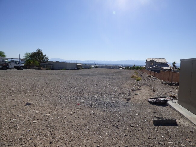
2085 N Hollywood Blvd, Las Vegas, NV 89156


This Property Is For Sale
NEARBY LISTINGS FOR SALE OR LEASE
Property Detail
2085 N Hollywood Blvd
Las Vegas-Henderson-North Las Vegas, NV
Hollywood Plaza Coml Sub
140-22-617-002
HOLLYWOOD PLAZA COML SUB PLAT BOOK 125 PAGE 96 LOT 2
Vacantlandnec
Clark
X
Nevada
32003C2185F
2
2025
2.07 AC
2025
North Las Vegas
006202
Las Vegas
DEMOGRAPHICS near 2085 N Hollywood Blvd
1 Mile
3 Mile
5 Mile
2024 Total Population
21,614
86,466
275,058
2029 Population
23,033
92,368
293,728
Pop Growth 2024-2029
+ 6.57%
+ 6.83%
+ 6.79%
Average Age
37
36
35
2024 Total Households
7,013
26,540
84,522
HH Growth 2024-2029
+ 6.57%
+ 6.80%
+ 6.82%
Median Household Inc
$57,932
$50,731
$44,074
Avg Household Size
3.00
3.20
3.10
2024 Avg HH Vehicles
2.00
2.00
2.00
Median Home Value
$280,550
$276,574
$245,916
Median Year Built
1992
1990
1989
Nearby Places
Map Layers
Map Styles
 Street
 Aerial
- Restaurants
- Banks
- Shops
- Fitness
- Groceries
PUBLIC TRANSPORTATION
AIRPORT
Harry Reid International
DRIVE
WALK
Distance
Harry Reid International
25 min
15.6 mi
Boulder City Municipal
DRIVE
WALK
Distance
Boulder City Municipal
40 min
26.9 mi
Freight Ports
Port of Long Beach
DRIVE
WALK
Distance
Port of Long Beach
329 min
292.2 mi
Nearby Properties
Address
Land Use
TOTAL SIZE
Lot Size
Zoning
Address
Land Use
TOTAL SIZE
Lot Size
Zoning
90.41 AC
Address
Land Use
TOTAL SIZE
Lot Size
Zoning
342,160 SF
37.72 AC
RT
Address
Land Use
TOTAL SIZE
Lot Size
Zoning
43.25 AC
PF
Address
Land Use
TOTAL SIZE
Lot Size
Zoning
20.91 AC
PF
Address
Land Use
TOTAL SIZE
Lot Size
Zoning
1,008 SF
31.47 AC
PF
Address
Land Use
TOTAL SIZE
Lot Size
Zoning
4.34 AC
RE
Address
Land Use
TOTAL SIZE
Lot Size
Zoning
19.30 AC
RE
Address
Land Use
TOTAL SIZE
Lot Size
Zoning
223,422 SF
18.21 AC
R3
Address
Land Use
TOTAL SIZE
Lot Size
Zoning
3,183 SF
18.35 AC
R3
Address
Land Use
TOTAL SIZE
Lot Size
Zoning
9.11 AC
PF
Address
Land Use
TOTAL SIZE
Lot Size
Zoning
11.81 AC
RE
Address
Land Use
TOTAL SIZE
Lot Size
Zoning
4,236 SF
0.61 AC
R4
Address
Land Use
TOTAL SIZE
Lot Size
Zoning
13.84 AC
PF
Address
Land Use
TOTAL SIZE
Lot Size
Zoning
133,481 SF
6.17 AC
MD
Address
Land Use
TOTAL SIZE
Lot Size
Zoning
20 AC
PF
Address
Land Use
TOTAL SIZE
Lot Size
Zoning
33,009 SF
16.84 AC
PF
Address
Land Use
TOTAL SIZE
Lot Size
Zoning
3,260 SF
0.04 AC
Address
Land Use
TOTAL SIZE
Lot Size
Zoning
287,008 SF
4.33 AC
Address
Land Use
TOTAL SIZE
Lot Size
Zoning
5,478 SF
8.87 AC
R4
Address
Land Use
TOTAL SIZE
Lot Size
Zoning
36.52 AC
PF
Address
Land Use
TOTAL SIZE
Lot Size
Zoning
2,304 SF
12.36 AC
RPD16
Address
Land Use
TOTAL SIZE
Lot Size
Zoning
270,984 SF
11.69 AC
M1
Address
Land Use
TOTAL SIZE
Lot Size
Zoning
269,182 SF
12.86 AC
M1
Address
Land Use
TOTAL SIZE
Lot Size
Zoning
2,286 SF
4.51 AC
Address
Land Use
TOTAL SIZE
Lot Size
Zoning
269,182 SF
13.03 AC
M1
Address
Land Use
TOTAL SIZE
Lot Size
Zoning
269,182 SF
12.85 AC
M1
Address
Land Use
TOTAL SIZE
Lot Size
Zoning
16.55 AC
Address
Land Use
TOTAL SIZE
Lot Size
Zoning
1,590 SF
3.80 AC
Address
Land Use
TOTAL SIZE
Lot Size
Zoning
6,791 SF
10.92 AC
PF
The World's #1 Commercial Real Estate Marketplace
Connect with us
© 2026 CoStar Group
The information above has been obtained from sources believed reliable. While we do not doubt its accuracy we have not verified it and make no guarantee, warranty or representation about it. It is your responsibility to independently confirm its accuracy and completeness. Any projections, opinions, assumptions, or estimates used are for example only and do not represent the current or future performance of the property. The value of this transaction to you depends on tax and other factors which should be evaluated by your tax, financial, and legal advisors. You and your advisors should conduct a careful, independent investigation of the property to determine to your satisfaction the suitability of the property for your needs.