Property Record
2086 Us Highway 130, North Brunswick, NJ 08902


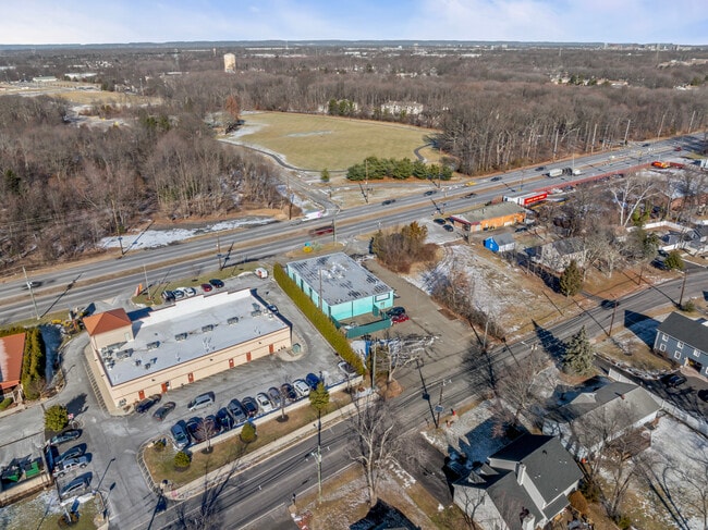

This Property Is For Sale
Current Lease Availabilities
NEARBY LISTINGS FOR SALE OR LEASE
Property Detail
2086 Us Highway 130
14-00225-0000-00018
112X235
Storemultistory
Middlesex
X
New Jersey
34023C0136F
18
2024
0.60 AC
2025
Brunswick/Exit 9
006209
Northern New Jersey
6,200 SF
New York-Jersey City-White Plains, NY-NJ
DEMOGRAPHICS near 2086 Us Highway 130
1 Mile
3 Mile
5 Mile
2024 Total Population
9,683
69,652
223,357
2029 Population
9,612
69,250
222,288
Pop Growth 2024-2029
(0.73%)
(0.58%)
(0.48%)
Average Age
38
39
38
2024 Total Households
3,121
24,208
75,002
HH Growth 2024-2029
(0.80%)
(0.62%)
(0.34%)
Median Household Inc
$113,390
$108,981
$98,481
Avg Household Size
3.00
2.80
2.80
2024 Avg HH Vehicles
2.00
2.00
2.00
Median Home Value
$434,663
$415,147
$405,049
Median Year Built
1990
1980
1979
Nearby Places
Map Layers
Map Styles
 Street
 Aerial
- Restaurants
- Banks
- Shops
- Fitness
- Groceries
PUBLIC TRANSPORTATION
COMMUTER RAIL
Jersey Avenue (Northeast Corridor Line - NJ Transit Commuter Rail (NJ Transit))
DRIVE
WALK
Distance
Jersey Avenue (Northeast Corridor Line - NJ Transit Commuter Rail (NJ Transit))
13 min
4.1 mi
New Brunswick (Northeast Corridor Line - NJ Transit Commuter Rail (NJ Transit))
DRIVE
WALK
Distance
New Brunswick (Northeast Corridor Line - NJ Transit Commuter Rail (NJ Transit))
12 min
5.4 mi
AIRPORT
Trenton Mercer
DRIVE
WALK
Distance
Trenton Mercer
38 min
25.3 mi
Newark Liberty International
DRIVE
WALK
Distance
Newark Liberty International
41 min
31.4 mi
Freight Ports
New York Container Terminal
DRIVE
WALK
Distance
New York Container Terminal
36 min
24.2 mi
Nearby Properties
Address
Land Use
TOTAL SIZE
Lot Size
Zoning
Address
Land Use
TOTAL SIZE
Lot Size
Zoning
31.07 AC
ERR
Address
Land Use
TOTAL SIZE
Lot Size
Zoning
543,945 SF
48.46 AC
B-I
Address
Land Use
TOTAL SIZE
Lot Size
Zoning
34.75 AC
CR
Address
Land Use
TOTAL SIZE
Lot Size
Zoning
27.23 AC
CR
Address
Land Use
TOTAL SIZE
Lot Size
Zoning
103.93 AC
ERR
Address
Land Use
TOTAL SIZE
Lot Size
Zoning
46.85 AC
ERR
Address
Land Use
TOTAL SIZE
Lot Size
Zoning
283,080 SF
34.62 AC
CR
Address
Land Use
TOTAL SIZE
Lot Size
Zoning
419,094 SF
49.17 AC
CR
Address
Land Use
TOTAL SIZE
Lot Size
Zoning
18.50 AC
I-2
Address
Land Use
TOTAL SIZE
Lot Size
Zoning
27.88 AC
C2
Address
Land Use
TOTAL SIZE
Lot Size
Zoning
46.33 AC
I2
Address
Land Use
TOTAL SIZE
Lot Size
Zoning
95,064 SF
14.41 AC
CR
Address
Land Use
TOTAL SIZE
Lot Size
Zoning
42.66 AC
PUD2
Address
Land Use
TOTAL SIZE
Lot Size
Zoning
192,072 SF
19.83 AC
CR
Address
Land Use
TOTAL SIZE
Lot Size
Zoning
23.39 AC
PUD2
Address
Land Use
TOTAL SIZE
Lot Size
Zoning
54,886 SF
5.21 AC
C-6
Address
Land Use
TOTAL SIZE
Lot Size
Zoning
4,066 SF
30.42 AC
CR
Address
Land Use
TOTAL SIZE
Lot Size
Zoning
10 AC
I-2
Address
Land Use
TOTAL SIZE
Lot Size
Zoning
27.47 AC
R5
Address
Land Use
TOTAL SIZE
Lot Size
Zoning
9,100 SF
9.54 AC
B-I
Address
Land Use
TOTAL SIZE
Lot Size
Zoning
47,794 SF
3.80 AC
I-2E
Address
Land Use
TOTAL SIZE
Lot Size
Zoning
6,750 SF
8 AC
B-I
Address
Land Use
TOTAL SIZE
Lot Size
Zoning
20.01 AC
C2
Address
Land Use
TOTAL SIZE
Lot Size
Zoning
Address
Land Use
TOTAL SIZE
Lot Size
Zoning
17.13 AC
PUD2
Address
Land Use
TOTAL SIZE
Lot Size
Zoning
23.74 AC
I-2
Address
Land Use
TOTAL SIZE
Lot Size
Zoning
5.62 AC
R-5A
Address
Land Use
TOTAL SIZE
Lot Size
Zoning
48.73 AC
ERR
Address
Land Use
TOTAL SIZE
Lot Size
Zoning
5.96 AC
R7
Address
Land Use
TOTAL SIZE
Lot Size
Zoning
249 SF
19.46 AC
R6
The World's #1 Commercial Real Estate Marketplace
Connect with us
© 2026 CoStar Group
The information above has been obtained from sources believed reliable. While we do not doubt its accuracy we have not verified it and make no guarantee, warranty or representation about it. It is your responsibility to independently confirm its accuracy and completeness. Any projections, opinions, assumptions, or estimates used are for example only and do not represent the current or future performance of the property. The value of this transaction to you depends on tax and other factors which should be evaluated by your tax, financial, and legal advisors. You and your advisors should conduct a careful, independent investigation of the property to determine to your satisfaction the suitability of the property for your needs.