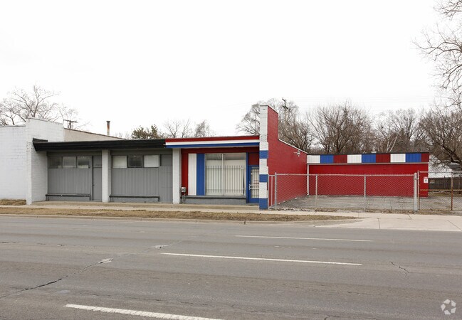
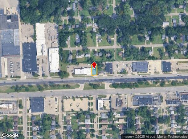
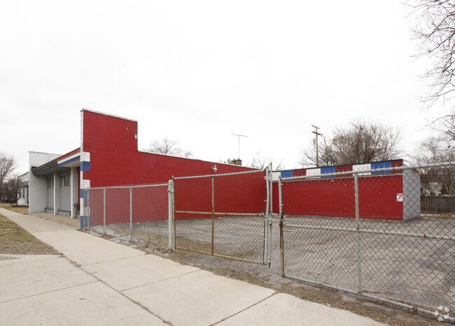
Property Record
20860 W 8 Mile Rd, Southfield, MI 48075
NEARBY LISTINGS FOR SALE OR LEASE
Property Detail
20860 W 8 Mile Rd
Detroit-Warren-Dearborn, MI
Baseline-Evergreen Sub
24-34-456-013
T1N,R10E,SEC 34 79-1 BASELINE-EVERGREEN SUB LOTS 79 & 80, ALSO ELY PART OF LOT 81 MEAS 7.57 FT ALG S LOT LINE & 7.50 FT ALG N
Barberhairsalon
Oakland
X
Michigan
26163C0100E
79-81
2024
0.11 AC
2022
Southfield
162400
Detroit
620 SF
DEMOGRAPHICS near 20860 W 8 Mile Rd
1 Mile
3 Mile
5 Mile
2024 Total Population
13,069
117,190
327,772
2029 Population
12,769
114,966
320,993
Pop Growth 2024-2029
(2.30%)
(1.90%)
(2.07%)
Average Age
41
40
40
2024 Total Households
5,362
48,042
135,631
HH Growth 2024-2029
(2.28%)
(1.94%)
(2.09%)
Median Household Inc
$48,582
$46,767
$51,620
Avg Household Size
2.40
2.30
2.30
2024 Avg HH Vehicles
1.00
1.00
1.00
Median Home Value
$97,579
$113,833
$139,819
Median Year Built
1955
1956
1955
Nearby Places
Map Layers
Map Styles
 Street
 Aerial
- Restaurants
- Banks
- Shops
- Fitness
- Groceries
PUBLIC TRANSPORTATION
COMMUTER RAIL
Royal Oak Amtrak (Wolverine - Amtrak)
DRIVE
WALK
Distance
Royal Oak Amtrak (Wolverine - Amtrak)
17 min
9.0 mi
AIRPORT
Windsor International
DRIVE
WALK
Distance
Windsor International
45 min
24.5 mi
Detroit Metro Wayne County
DRIVE
WALK
Distance
Detroit Metro Wayne County
38 min
24.9 mi
Freight Ports
Port of Toledo
DRIVE
WALK
Distance
Port of Toledo
87 min
66.9 mi
Nearby Properties
Address
Land Use
TOTAL SIZE
Lot Size
Zoning
Address
Land Use
TOTAL SIZE
Lot Size
Zoning
2,373,792 SF
17.35 AC
RC
Address
Land Use
TOTAL SIZE
Lot Size
Zoning
882,862 SF
8.22 AC
RC
Address
Land Use
TOTAL SIZE
Lot Size
Zoning
588 SF
53.02 AC
RM
Address
Land Use
TOTAL SIZE
Lot Size
Zoning
460,062 SF
10.01 AC
RC
Address
Land Use
TOTAL SIZE
Lot Size
Zoning
535,287 SF
9.26 AC
RC
Address
Land Use
TOTAL SIZE
Lot Size
Zoning
383,602 SF
36.60 AC
I-1
Address
Land Use
TOTAL SIZE
Lot Size
Zoning
859,104 SF
9.59 AC
RC
Address
Land Use
TOTAL SIZE
Lot Size
Zoning
655,519 SF
9.18 AC
ERO
Address
Land Use
TOTAL SIZE
Lot Size
Zoning
280,500 SF
3.58 AC
RC
Address
Land Use
TOTAL SIZE
Lot Size
Zoning
350,140 SF
27.11 AC
RC
Address
Land Use
TOTAL SIZE
Lot Size
Zoning
344,960 SF
8.90 AC
RC
Address
Land Use
TOTAL SIZE
Lot Size
Zoning
300,830 SF
54 AC
LI
Address
Land Use
TOTAL SIZE
Lot Size
Zoning
120,093 SF
38.18 AC
TV-R
Address
Land Use
TOTAL SIZE
Lot Size
Zoning
210 SF
20.52 AC
R-2
Address
Land Use
TOTAL SIZE
Lot Size
Zoning
304 SF
6.99 AC
RC
Address
Land Use
TOTAL SIZE
Lot Size
Zoning
307,002 SF
14.61 AC
RC
Address
Land Use
TOTAL SIZE
Lot Size
Zoning
174 SF
14.17 AC
RM
Address
Land Use
TOTAL SIZE
Lot Size
Zoning
273,000 SF
17.31 AC
LI
Address
Land Use
TOTAL SIZE
Lot Size
Zoning
202,736 SF
20 AC
PD
Address
Land Use
TOTAL SIZE
Lot Size
Zoning
397,200 SF
14.07 AC
RMU
Address
Land Use
TOTAL SIZE
Lot Size
Zoning
10.32 AC
LI
Address
Land Use
TOTAL SIZE
Lot Size
Zoning
133,544 SF
19.65 AC
ERO
Address
Land Use
TOTAL SIZE
Lot Size
Zoning
143,700 SF
3.27 AC
PD
Address
Land Use
TOTAL SIZE
Lot Size
Zoning
97,082 SF
67.47 AC
TV-R
Address
Land Use
TOTAL SIZE
Lot Size
Zoning
110,540 SF
15.30 AC
RC
Address
Land Use
TOTAL SIZE
Lot Size
Zoning
178,854 SF
9.43 AC
RC
Address
Land Use
TOTAL SIZE
Lot Size
Zoning
163,661 SF
8.92 AC
PD
Address
Land Use
TOTAL SIZE
Lot Size
Zoning
161,208 SF
7.49 AC
ERO-M
Address
Land Use
TOTAL SIZE
Lot Size
Zoning
129 SF
15.16 AC
RM
Address
Land Use
TOTAL SIZE
Lot Size
Zoning
216 SF
13.14 AC
RM
The World's #1 Commercial Real Estate Marketplace
Connect with us
© 2025 CoStar Group
The information above has been obtained from sources believed reliable. While we do not doubt its accuracy we have not verified it and make no guarantee, warranty or representation about it. It is your responsibility to independently confirm its accuracy and completeness. Any projections, opinions, assumptions, or estimates used are for example only and do not represent the current or future performance of the property. The value of this transaction to you depends on tax and other factors which should be evaluated by your tax, financial, and legal advisors. You and your advisors should conduct a careful, independent investigation of the property to determine to your satisfaction the suitability of the property for your needs.