Property Record
2087 Wallace Rd, Webberville, MI 48892

Save to a Folder
{{folder.Name}}
{{folder.ListingIds.length}} Properties
{{folder.ListingIds.length}} Property
Create a New Folder
Property Detail
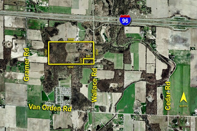
2087 Wallace Rd
Lansing-East Lansing, MI
SE 1/4 OF SEC 13 EXC N 80 AC THEREOF ALSO EXC BEG @ SE COR OF SEC 13 -N87D24'05W ALNG S SEC LN 850 FT -N3D30'00"W PLL WITH E
08-08-13-400-006
INGHAM
Agriculturalland
Michigan
B and X Area of moderate flood hazard, usually the area between the limits of the 100-year and 500-year floods.
75.50 AC
2025
Mason/SE Ingham County
2026
West Michigan
005900
NEARBY LISTINGS FOR SALE OR LEASE
DEMOGRAPHICS near 2087 Wallace Rd
1 mile
3 mile
5 mile
2025 Total Population
725
5,120
12,390
2030 Population
720
5,192
12,508
Pop Growth 2025-2030
(0.69%)
+ 1.41%
+ 0.95%
Average Age
38
40
40
2025 Total Households
265
1,928
4,708
HH Growth 2025-2030
(0.38%)
+ 1.50%
+ 0.93%
Median Household Inc
$86,619
$83,848
$84,002
Avg Household Size
2.70
2.70
2.60
2025 Avg HH Vehicles
2.00
2.00
2.00
Median Home Value
$154,687
$182,791
$218,323
Median Year Built
1976
1983
1982
Nearby Places
Map Layers
Map Styles
 Street
 Aerial
Layers
 Traffic
 Biking
Places
Listings with unknown addresses are not visible on the map
- Restaurants
- Banks
- Shops
- Fitness
- Groceries
PUBLIC TRANSPORTATION
AIRPORT
Capital Region International
Drive
Walk
Distance
Capital Region International
46 min
30.1 mi
Freight Ports
Port of Toledo
Drive
Walk
Distance
Port of Toledo
130 min
103.0 mi
Nearby Properties
Address
Land Use
TOTAL SIZE
Lot Size
Zoning
Address
Land Use
TOTAL SIZE
Lot Size
Zoning
395,500 SF
76.08 AC
Address
Land Use
TOTAL SIZE
Lot Size
Zoning
23,952 SF
Address
Land Use
TOTAL SIZE
Lot Size
Zoning
109,576 SF
10.02 AC
Address
Land Use
TOTAL SIZE
Lot Size
Zoning
13,019 SF
10.18 AC
Address
Land Use
TOTAL SIZE
Lot Size
Zoning
43.74 AC
Address
Land Use
TOTAL SIZE
Lot Size
Zoning
16,080 SF
6.48 AC
Address
Land Use
TOTAL SIZE
Lot Size
Zoning
2,557 SF
17.73 AC
Address
Land Use
TOTAL SIZE
Lot Size
Zoning
36,100 SF
2 AC
Address
Land Use
TOTAL SIZE
Lot Size
Zoning
7,725 SF
69.97 AC
AR
Address
Land Use
TOTAL SIZE
Lot Size
Zoning
3,322 SF
6.98 AC
Address
Land Use
TOTAL SIZE
Lot Size
Zoning
138,275 SF
36.53 AC
Address
Land Use
TOTAL SIZE
Lot Size
Zoning
3,778 SF
233.76 AC
AR
Address
Land Use
TOTAL SIZE
Lot Size
Zoning
29,576 SF
4 AC
Address
Land Use
TOTAL SIZE
Lot Size
Zoning
39,942 SF
10.41 AC
AR
Address
Land Use
TOTAL SIZE
Lot Size
Zoning
39.45 AC
I-2
Address
Land Use
TOTAL SIZE
Lot Size
Zoning
2,500 SF
2.73 AC
Address
Land Use
TOTAL SIZE
Lot Size
Zoning
20,400 SF
10.69 AC
Address
Land Use
TOTAL SIZE
Lot Size
Zoning
30,000 SF
7.03 AC
Address
Land Use
TOTAL SIZE
Lot Size
Zoning
8.77 AC
MHP
Address
Land Use
TOTAL SIZE
Lot Size
Zoning
26,200 SF
4.12 AC
Address
Land Use
TOTAL SIZE
Lot Size
Zoning
2,404 SF
50.08 AC
AR
Address
Land Use
TOTAL SIZE
Lot Size
Zoning
1,024 SF
2.20 AC
Address
Land Use
TOTAL SIZE
Lot Size
Zoning
3,180 SF
80 AC
AR
Address
Land Use
TOTAL SIZE
Lot Size
Zoning
55.84 AC
MP
Address
Land Use
TOTAL SIZE
Lot Size
Zoning
145.16 AC
Address
Land Use
TOTAL SIZE
Lot Size
Zoning
141.84 AC
Address
Land Use
TOTAL SIZE
Lot Size
Zoning
1,990 SF
60 AC
AR
Address
Land Use
TOTAL SIZE
Lot Size
Zoning
2,432 SF
2.10 AC
Address
Land Use
TOTAL SIZE
Lot Size
Zoning
1,288 SF
4.65 AC
Address
Land Use
TOTAL SIZE
Lot Size
Zoning
3,324 SF
1.20 AC
The World's #1 Commercial Real Estate Marketplace
Connect with us
© 2026 CoStar Group
The information above has been obtained from sources believed reliable. While we do not doubt its accuracy we have not verified it and make no guarantee, warranty or representation about it. It is your responsibility to independently confirm its accuracy and completeness. Any projections, opinions, assumptions, or estimates used are for example only and do not represent the current or future performance of the property. The value of this transaction to you depends on tax and other factors which should be evaluated by your tax, financial, and legal advisors. You and your advisors should conduct a careful, independent investigation of the property to determine to your satisfaction the suitability of the property for your needs.