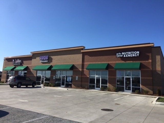
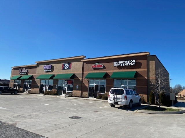
Property Record
2089 Lascassas Pike, Murfreesboro, TN 37130
NEARBY LISTINGS FOR SALE OR LEASE
Property Detail
2089 Lascassas Pike
081J-C-016.01-000
Emerald Place 2Nd Resub Lot 3
Stripcommercialcenter
Rutherford
AE
Tennessee
47189C0400E
7
2025
1.09 AC
2025
Rutherford County
041401
Nashville
7,200 SF
Nashville-Davidson--Murfreesboro--Franklin, TN
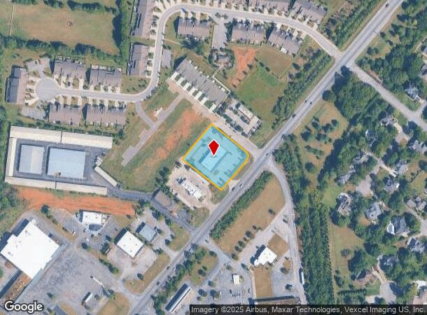
DEMOGRAPHICS near 2089 Lascassas Pike
1 mile
3 mile
5 mile
2024 Total Population
12,599
62,335
102,207
2029 Population
14,701
71,261
116,745
Pop Growth 2024-2029
+ 16.68%
+ 14.32%
+ 14.22%
Average Age
33
36
37
2024 Total Households
4,975
24,921
39,864
HH Growth 2024-2029
+ 16.22%
+ 14.08%
+ 14.02%
Median Household Inc
$60,236
$62,987
$65,111
Avg Household Size
2.50
2.40
2.40
2024 Avg HH Vehicles
2.00
2.00
2.00
Median Home Value
$386,746
$336,433
$332,443
Median Year Built
1999
1991
1992
Nearby Places
Map Layers
Map Styles
 Street
 Aerial
Transit
 Traffic
 Biking
Places
Listings with unknown addresses are not visible on the map
- Restaurants
- Banks
- Shops
- Fitness
- Groceries
PUBLIC TRANSPORTATION
AIRPORT
Nashville International
Drive
Walk
Distance
Nashville International
43 min
31.7 mi
SALE & LEASE HISTORY
LISTING DATE
SALE/LEASE

Jan 29, 2020
For Lease
Jan 08, 2019
For Lease
Apr 18, 2023
For Lease
Nearby Properties
Address
Land Use
TOTAL SIZE
Lot Size
Zoning
Address
Land Use
TOTAL SIZE
Lot Size
Zoning
30,630 SF
8.50 AC
Address
Land Use
TOTAL SIZE
Lot Size
Zoning
166,604 SF
2.21 AC
Address
Land Use
TOTAL SIZE
Lot Size
Zoning
233,821 SF
15.50 AC
Address
Land Use
TOTAL SIZE
Lot Size
Zoning
8,142 SF
21.98 AC
Address
Land Use
TOTAL SIZE
Lot Size
Zoning
238,794 SF
71.70 AC
Address
Land Use
TOTAL SIZE
Lot Size
Zoning
128,141 SF
21.80 AC
Address
Land Use
TOTAL SIZE
Lot Size
Zoning
146,555 SF
3.22 AC
Address
Land Use
TOTAL SIZE
Lot Size
Zoning
130,261 SF
18.01 AC
Address
Land Use
TOTAL SIZE
Lot Size
Zoning
4,842 SF
17.80 AC
Address
Land Use
TOTAL SIZE
Lot Size
Zoning
49,622 SF
12.70 AC
CH
Address
Land Use
TOTAL SIZE
Lot Size
Zoning
1,488 SF
17.26 AC
RM16
Address
Land Use
TOTAL SIZE
Lot Size
Zoning
106,006 SF
17.20 AC
Address
Land Use
TOTAL SIZE
Lot Size
Zoning
78,768 SF
1.50 AC
Address
Land Use
TOTAL SIZE
Lot Size
Zoning
3,104 SF
16.01 AC
RM16
Address
Land Use
TOTAL SIZE
Lot Size
Zoning
403,206 SF
63.11 AC
Address
Land Use
TOTAL SIZE
Lot Size
Zoning
120,638 SF
20.55 AC
Address
Land Use
TOTAL SIZE
Lot Size
Zoning
57,146 SF
3.47 AC
Address
Land Use
TOTAL SIZE
Lot Size
Zoning
24,816 SF
22 AC
RM12
Address
Land Use
TOTAL SIZE
Lot Size
Zoning
11,449 SF
25.50 AC
RM16
Address
Land Use
TOTAL SIZE
Lot Size
Zoning
92,559 SF
14.23 AC
Address
Land Use
TOTAL SIZE
Lot Size
Zoning
110,449 SF
7.29 AC
Address
Land Use
TOTAL SIZE
Lot Size
Zoning
88,406 SF
27.10 AC
Address
Land Use
TOTAL SIZE
Lot Size
Zoning
74,803 SF
10.16 AC
Address
Land Use
TOTAL SIZE
Lot Size
Zoning
174,185 SF
25.23 AC
Address
Land Use
TOTAL SIZE
Lot Size
Zoning
19,989 SF
168 AC
Address
Land Use
TOTAL SIZE
Lot Size
Zoning
152,768 SF
1.19 AC
Address
Land Use
TOTAL SIZE
Lot Size
Zoning
49,341 SF
0.23 AC
Address
Land Use
TOTAL SIZE
Lot Size
Zoning
148,437 SF
7.50 AC
PUDC
Address
Land Use
TOTAL SIZE
Lot Size
Zoning
64,434 SF
12.50 AC
Address
Land Use
TOTAL SIZE
Lot Size
Zoning
117,016 SF
20.50 AC
The World's #1 Commercial Real Estate Marketplace
Connect with us
© 2026 CoStar Group
The information above has been obtained from sources believed reliable. While we do not doubt its accuracy we have not verified it and make no guarantee, warranty or representation about it. It is your responsibility to independently confirm its accuracy and completeness. Any projections, opinions, assumptions, or estimates used are for example only and do not represent the current or future performance of the property. The value of this transaction to you depends on tax and other factors which should be evaluated by your tax, financial, and legal advisors. You and your advisors should conduct a careful, independent investigation of the property to determine to your satisfaction the suitability of the property for your needs.