Property Record
2089 Us Highway 165 E, England, AR 72046
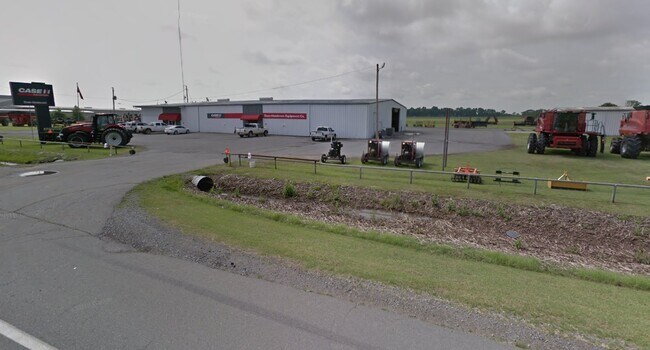


Property Detail
2089 Us Highway 165 E
001-02701-000
PT E1/2 NW(638.5X 682.2 LESS HWY
Autorepair
Lonoke
B and X Area of moderate flood hazard, usually the area between the limits of the 100-year and 500-year floods.
Arkansas
2023
9.74 AC
2025
Lonoke County
020700
Little Rock/N Little Rock
22,145 SF
Little Rock-North Little Rock-Conway, AR
NEARBY LISTINGS FOR SALE OR LEASE
-
-
View all England listings for sale on LoopNet.com
DEMOGRAPHICS near 2089 Us Highway 165 E
1 mile
3 mile
5 mile
2025 Total Population
36
2,774
3,381
2030 Population
38
2,860
3,480
Pop Growth 2025-2030
+ 5.56%
+ 3.10%
+ 2.93%
Average Age
43
43
43
2025 Total Households
15
1,183
1,309
HH Growth 2025-2030
+ 6.67%
+ 3.21%
+ 3.44%
Median Household Inc
$52,500
$47,619
$48,266
Avg Household Size
2.10
2.20
2.20
2025 Avg HH Vehicles
2.00
2.00
2.00
Median Home Value
$99,999
$102,083
$101,316
Median Year Built
1974
1972
1972
Nearby Places
Map Layers
Map Styles
 Street
 Aerial
Layers
 Traffic
 Biking
Places
Listings with unknown addresses are not visible on the map
- Restaurants
- Banks
- Shops
- Fitness
- Groceries
PUBLIC TRANSPORTATION
AIRPORT
Bill and Hillary Clinton Ntl/Adams Field
Drive
Walk
Distance
Bill and Hillary Clinton Ntl/Adams Field
38 min
25.2 mi
Nearby Properties
Address
Land Use
TOTAL SIZE
Lot Size
Zoning
Address
Land Use
TOTAL SIZE
Lot Size
Zoning
9,950 SF
4.60 AC
Address
Land Use
TOTAL SIZE
Lot Size
Zoning
26,548 SF
2.02 AC
Address
Land Use
TOTAL SIZE
Lot Size
Zoning
31,360 SF
10 AC
Address
Land Use
TOTAL SIZE
Lot Size
Zoning
3,718 SF
1.17 AC
Address
Land Use
TOTAL SIZE
Lot Size
Zoning
34,420 SF
9.28 AC
Address
Land Use
TOTAL SIZE
Lot Size
Zoning
15,018 SF
1.51 AC
Address
Land Use
TOTAL SIZE
Lot Size
Zoning
17,940 SF
1.14 AC
Address
Land Use
TOTAL SIZE
Lot Size
Zoning
9,370 SF
1.99 AC
Address
Land Use
TOTAL SIZE
Lot Size
Zoning
9,104 SF
1.28 AC
Address
Land Use
TOTAL SIZE
Lot Size
Zoning
1,200 SF
38 AC
Address
Land Use
TOTAL SIZE
Lot Size
Zoning
20,880 SF
1.20 AC
Address
Land Use
TOTAL SIZE
Lot Size
Zoning
80 AC
Address
Land Use
TOTAL SIZE
Lot Size
Zoning
5,280 SF
1.72 AC
Address
Land Use
TOTAL SIZE
Lot Size
Zoning
7,285 SF
0.92 AC
Address
Land Use
TOTAL SIZE
Lot Size
Zoning
Address
Land Use
TOTAL SIZE
Lot Size
Zoning
7,000 SF
0.08 AC
Address
Land Use
TOTAL SIZE
Lot Size
Zoning
283.37 AC
Address
Land Use
TOTAL SIZE
Lot Size
Zoning
21,869 SF
3.14 AC
Address
Land Use
TOTAL SIZE
Lot Size
Zoning
8,464 SF
0.11 AC
Address
Land Use
TOTAL SIZE
Lot Size
Zoning
8,880 SF
1.62 AC
Address
Land Use
TOTAL SIZE
Lot Size
Zoning
7,200 SF
0.40 AC
Address
Land Use
TOTAL SIZE
Lot Size
Zoning
4,569 SF
0.40 AC
Address
Land Use
TOTAL SIZE
Lot Size
Zoning
3,660 SF
0.08 AC
Address
Land Use
TOTAL SIZE
Lot Size
Zoning
7,856 SF
2.68 AC
Address
Land Use
TOTAL SIZE
Lot Size
Zoning
13,179 SF
0.32 AC
Address
Land Use
TOTAL SIZE
Lot Size
Zoning
3,680 SF
Address
Land Use
TOTAL SIZE
Lot Size
Zoning
3,432 SF
1.59 AC
Address
Land Use
TOTAL SIZE
Lot Size
Zoning
6,000 SF
2 AC
The World's #1 Commercial Real Estate Marketplace
Connect with us
© 2026 CoStar Group
The information above has been obtained from sources believed reliable. While we do not doubt its accuracy we have not verified it and make no guarantee, warranty or representation about it. It is your responsibility to independently confirm its accuracy and completeness. Any projections, opinions, assumptions, or estimates used are for example only and do not represent the current or future performance of the property. The value of this transaction to you depends on tax and other factors which should be evaluated by your tax, financial, and legal advisors. You and your advisors should conduct a careful, independent investigation of the property to determine to your satisfaction the suitability of the property for your needs.