Property Record
209 Centennial Ave, Cranford, NJ 07016
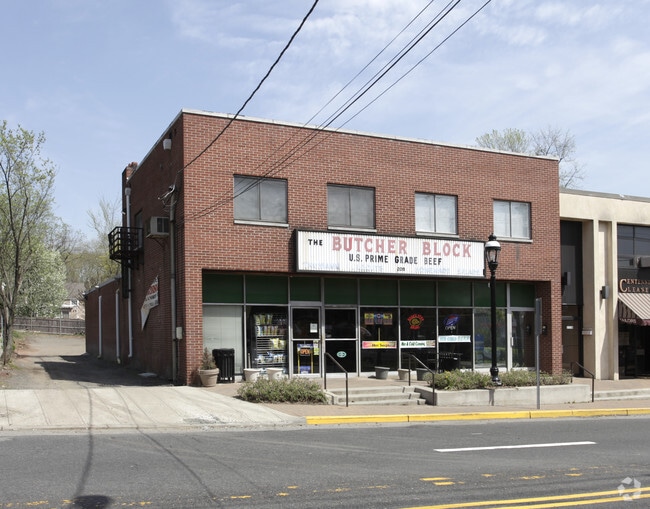

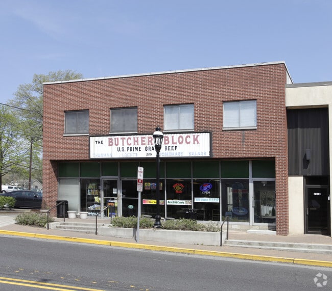
Property Detail
209 Centennial Ave
03-00529-0000-00018
Union
Storemultistory
New Jersey
B and X Area of moderate flood hazard, usually the area between the limits of the 100-year and 500-year floods.
18
2024
0.20 AC
2025
Parkway Cranford Corridor
037200
Northern New Jersey
3,160 SF
Newark, NJ
NEARBY LISTINGS FOR SALE OR LEASE
DEMOGRAPHICS near 209 Centennial Ave
1 mile
3 mile
5 mile
2025 Total Population
18,252
181,583
474,962
2030 Population
19,362
190,846
497,159
Pop Growth 2025-2030
+ 6.08%
+ 5.10%
+ 4.67%
Average Age
42
41
41
2025 Total Households
7,163
66,780
169,589
HH Growth 2025-2030
+ 6.21%
+ 5.18%
+ 4.82%
Median Household Inc
$120,386
$112,566
$106,730
Avg Household Size
2.50
2.70
2.70
2025 Avg HH Vehicles
2.00
2.00
2.00
Median Home Value
$649,969
$525,360
$512,769
Median Year Built
1953
1956
1957
Nearby Places
Map Layers
Map Styles
 Street
 Aerial
Layers
 Traffic
 Biking
Places
Listings with unknown addresses are not visible on the map
- Restaurants
- Banks
- Shops
- Fitness
- Groceries
PUBLIC TRANSPORTATION
TRANSIT/SUBWAY
Cranford (Raritan Valley Line - NJ Transit Commuter Rail (NJ Transit))
Drive
Walk
Distance
Cranford (Raritan Valley Line - NJ Transit Commuter Rail (NJ Transit))
2 min
14 min
0.7 mi
COMMUTER RAIL
Cranford (Raritan Valley Line - NJ Transit Commuter Rail (NJ Transit))
Drive
Walk
Distance
Cranford (Raritan Valley Line - NJ Transit Commuter Rail (NJ Transit))
2 min
13 min
0.7 mi
Garwood (Raritan Valley Line - NJ Transit Commuter Rail (NJ Transit))
Drive
Walk
Distance
Garwood (Raritan Valley Line - NJ Transit Commuter Rail (NJ Transit))
6 min
1.8 mi
AIRPORT
Newark Liberty International
Drive
Walk
Distance
Newark Liberty International
19 min
12.0 mi
LaGuardia
Drive
Walk
Distance
LaGuardia
54 min
31.2 mi
John F Kennedy International
Drive
Walk
Distance
John F Kennedy International
60 min
36.4 mi
Freight Ports
New York Container Terminal
Drive
Walk
Distance
New York Container Terminal
18 min
9.3 mi
Nearby Properties
Address
Land Use
TOTAL SIZE
Lot Size
Zoning
Address
Land Use
TOTAL SIZE
Lot Size
Zoning
107.41 AC
Address
Land Use
TOTAL SIZE
Lot Size
Zoning
Address
Land Use
TOTAL SIZE
Lot Size
Zoning
78.47 AC
Address
Land Use
TOTAL SIZE
Lot Size
Zoning
Address
Land Use
TOTAL SIZE
Lot Size
Zoning
10.11 AC
Address
Land Use
TOTAL SIZE
Lot Size
Zoning
8.43 AC
Address
Land Use
TOTAL SIZE
Lot Size
Zoning
29.03 AC
IL
Address
Land Use
TOTAL SIZE
Lot Size
Zoning
151.20 AC
O
Address
Land Use
TOTAL SIZE
Lot Size
Zoning
3,538 SF
112 AC
Address
Land Use
TOTAL SIZE
Lot Size
Zoning
9.42 AC
Address
Land Use
TOTAL SIZE
Lot Size
Zoning
159,434 SF
11.93 AC
IL
Address
Land Use
TOTAL SIZE
Lot Size
Zoning
19.90 AC
P
Address
Land Use
TOTAL SIZE
Lot Size
Zoning
197 AC
RA
Address
Land Use
TOTAL SIZE
Lot Size
Zoning
182 SF
13.80 AC
Address
Land Use
TOTAL SIZE
Lot Size
Zoning
17,416 SF
19.42 AC
Address
Land Use
TOTAL SIZE
Lot Size
Zoning
Address
Land Use
TOTAL SIZE
Lot Size
Zoning
10.15 AC
RA
Address
Land Use
TOTAL SIZE
Lot Size
Zoning
56,476 SF
141.63 AC
Address
Land Use
TOTAL SIZE
Lot Size
Zoning
4.13 AC
Address
Land Use
TOTAL SIZE
Lot Size
Zoning
3.87 AC
CG
Address
Land Use
TOTAL SIZE
Lot Size
Zoning
Address
Land Use
TOTAL SIZE
Lot Size
Zoning
31,002 SF
3.64 AC
Address
Land Use
TOTAL SIZE
Lot Size
Zoning
Address
Land Use
TOTAL SIZE
Lot Size
Zoning
224.81 AC
Address
Land Use
TOTAL SIZE
Lot Size
Zoning
8.77 AC
Address
Land Use
TOTAL SIZE
Lot Size
Zoning
8.84 AC
Address
Land Use
TOTAL SIZE
Lot Size
Zoning
23.96 AC
Address
Land Use
TOTAL SIZE
Lot Size
Zoning
Address
Land Use
TOTAL SIZE
Lot Size
Zoning
10.16 AC
Address
Land Use
TOTAL SIZE
Lot Size
Zoning
7.63 AC
The World's #1 Commercial Real Estate Marketplace
Connect with us
© 2026 CoStar Group
The information above has been obtained from sources believed reliable. While we do not doubt its accuracy we have not verified it and make no guarantee, warranty or representation about it. It is your responsibility to independently confirm its accuracy and completeness. Any projections, opinions, assumptions, or estimates used are for example only and do not represent the current or future performance of the property. The value of this transaction to you depends on tax and other factors which should be evaluated by your tax, financial, and legal advisors. You and your advisors should conduct a careful, independent investigation of the property to determine to your satisfaction the suitability of the property for your needs.