Property Record
209 Laurence Dr, Heath, TX 75032
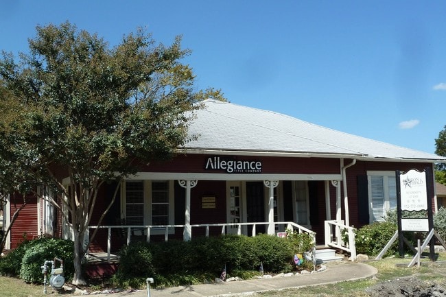
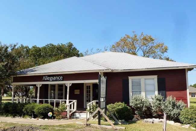
Property Detail
209 Laurence Dr
Dallas-Fort Worth-Arlington, TX
A0207 E TEAL, TRACT 59, ACRES 0.46
12729
ROCKWALL
Commercialnec
Texas
2024
0.48 AC
2025
Rockwall
040507
Dallas/Ft Worth
2,537 SF
NEARBY LISTINGS FOR SALE OR LEASE
DEMOGRAPHICS near 209 Laurence Dr
1 mile
3 mile
5 mile
2025 Total Population
2,118
25,881
79,691
2030 Population
2,553
32,143
96,084
Pop Growth 2025-2030
+ 20.54%
+ 24.20%
+ 20.57%
Average Age
41
38
37
2025 Total Households
721
8,522
27,458
HH Growth 2025-2030
+ 20.25%
+ 22.68%
+ 18.91%
Median Household Inc
$177,391
$120,640
$94,756
Avg Household Size
2.90
3.00
2.80
2025 Avg HH Vehicles
3.00
2.00
2.00
Median Home Value
$742,816
$463,997
$386,605
Median Year Built
2006
2009
2005
Nearby Places
Map Layers
Map Styles
 Street
 Aerial
Transit
 Traffic
 Biking
Places
Listings with unknown addresses are not visible on the map
- Restaurants
- Banks
- Shops
- Fitness
- Groceries
PUBLIC TRANSPORTATION
AIRPORT
Dallas Love Field
Drive
Walk
Distance
Dallas Love Field
43 min
29.3 mi
Freight Ports
Port of Shreveport
Drive
Walk
Distance
Port of Shreveport
198 min
183.3 mi
SALE & LEASE HISTORY
LISTING DATE
SALE/LEASE

Oct 17, 2017
For Lease
Feb 15, 2019
For Lease
Aug 25, 2025
For Lease
Nearby Properties
Address
Land Use
TOTAL SIZE
Lot Size
Zoning
Address
Land Use
TOTAL SIZE
Lot Size
Zoning
326,408 SF
74.12 AC
Address
Land Use
TOTAL SIZE
Lot Size
Zoning
226,384 SF
36.03 AC
Address
Land Use
TOTAL SIZE
Lot Size
Zoning
101,842 SF
12.13 AC
Address
Land Use
TOTAL SIZE
Lot Size
Zoning
36,633 SF
4.79 AC
Address
Land Use
TOTAL SIZE
Lot Size
Zoning
67,511 SF
12.36 AC
Address
Land Use
TOTAL SIZE
Lot Size
Zoning
10,175 SF
18.88 AC
Address
Land Use
TOTAL SIZE
Lot Size
Zoning
43,574 SF
5.51 AC
Address
Land Use
TOTAL SIZE
Lot Size
Zoning
49,053 SF
8.14 AC
Address
Land Use
TOTAL SIZE
Lot Size
Zoning
31,250 SF
2.04 AC
Address
Land Use
TOTAL SIZE
Lot Size
Zoning
54,949 SF
5.62 AC
Address
Land Use
TOTAL SIZE
Lot Size
Zoning
54,107 SF
10.55 AC
Address
Land Use
TOTAL SIZE
Lot Size
Zoning
17,180 SF
1.64 AC
Address
Land Use
TOTAL SIZE
Lot Size
Zoning
20,315 SF
2.22 AC
Address
Land Use
TOTAL SIZE
Lot Size
Zoning
20,084 SF
3.10 AC
Address
Land Use
TOTAL SIZE
Lot Size
Zoning
5,246 SF
Address
Land Use
TOTAL SIZE
Lot Size
Zoning
12,000 SF
147.17 AC
Address
Land Use
TOTAL SIZE
Lot Size
Zoning
12,705 SF
3.08 AC
Address
Land Use
TOTAL SIZE
Lot Size
Zoning
7,200 SF
139.90 AC
Address
Land Use
TOTAL SIZE
Lot Size
Zoning
14,225 SF
1.36 AC
Address
Land Use
TOTAL SIZE
Lot Size
Zoning
11,484 SF
1.04 AC
Address
Land Use
TOTAL SIZE
Lot Size
Zoning
57,230 SF
4.73 AC
Address
Land Use
TOTAL SIZE
Lot Size
Zoning
25,907 SF
6 AC
Address
Land Use
TOTAL SIZE
Lot Size
Zoning
17,054 SF
26.69 AC
Address
Land Use
TOTAL SIZE
Lot Size
Zoning
183.55 AC
Address
Land Use
TOTAL SIZE
Lot Size
Zoning
24,762 SF
7.37 AC
Address
Land Use
TOTAL SIZE
Lot Size
Zoning
10,967 SF
1.27 AC
Address
Land Use
TOTAL SIZE
Lot Size
Zoning
18,428 SF
3.61 AC
Address
Land Use
TOTAL SIZE
Lot Size
Zoning
14,941 SF
1.43 AC
Address
Land Use
TOTAL SIZE
Lot Size
Zoning
2,697 SF
8.05 AC
Address
Land Use
TOTAL SIZE
Lot Size
Zoning
14,587 SF
1.79 AC
The World's #1 Commercial Real Estate Marketplace
Connect with us
© 2026 CoStar Group
The information above has been obtained from sources believed reliable. While we do not doubt its accuracy we have not verified it and make no guarantee, warranty or representation about it. It is your responsibility to independently confirm its accuracy and completeness. Any projections, opinions, assumptions, or estimates used are for example only and do not represent the current or future performance of the property. The value of this transaction to you depends on tax and other factors which should be evaluated by your tax, financial, and legal advisors. You and your advisors should conduct a careful, independent investigation of the property to determine to your satisfaction the suitability of the property for your needs.