Property Record
2090 Ne Waldo Rd, Gainesville, FL 32609
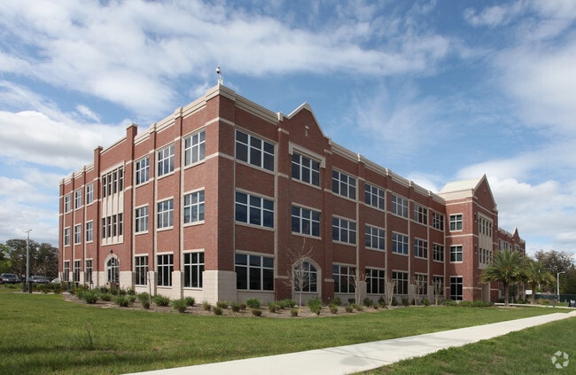

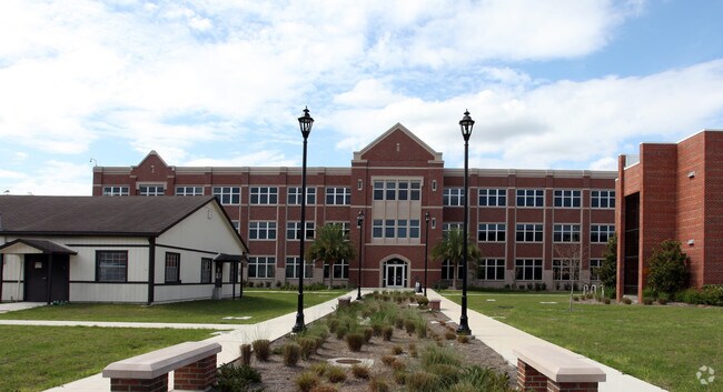
Property Detail
2090 Ne Waldo Rd
10808-000-000
COM AT INTERSECTION OF GLEN SPRINGS RD & STATE RD NO 24 RUN 2 28 2/3 DEG W 672.32 FT TO POB NW PERPENDICULAR TO HIWAY 1045 FT SW PARALLEL TO HIWAY 617 FT SE PERPENDICULAR TO HIWAY 1045 FT NE NE ALONG HIWAY 622 FT TO BEG BY LEGISLATURE & OR 553/142(LE
Stateproperty
Alachua
ED
Florida
B and X Area of moderate flood hazard, usually the area between the limits of the 100-year and 500-year floods.
14.81 AC
0
Northwest Gainesville
2025
Other Market Areas
000400
Gainesville, FL
3 SF
NEARBY LISTINGS FOR SALE OR LEASE
DEMOGRAPHICS near 2090 Ne Waldo Rd
1 mile
3 mile
5 mile
2025 Total Population
6,822
48,327
103,782
2030 Population
7,111
50,008
107,532
Pop Growth 2025-2030
+ 4.24%
+ 3.48%
+ 3.61%
Average Age
37
36
35
2025 Total Households
2,619
20,076
40,484
HH Growth 2025-2030
+ 4.66%
+ 3.72%
+ 4.22%
Median Household Inc
$54,233
$39,779
$47,733
Avg Household Size
2.50
2.20
2.20
2025 Avg HH Vehicles
1.00
1.00
2.00
Median Home Value
$180,110
$189,405
$242,096
Median Year Built
1971
1974
1977
Nearby Places
Map Layers
Map Styles
 Street
 Aerial
Layers
 Traffic
 Biking
Places
Listings with unknown addresses are not visible on the map
- Restaurants
- Banks
- Shops
- Fitness
- Groceries
PUBLIC TRANSPORTATION
AIRPORT
Gainesville Regional
Drive
Walk
Distance
Gainesville Regional
8 min
2.8 mi
Freight Ports
Jacksonville Port
Drive
Walk
Distance
Jacksonville Port
94 min
72.6 mi
Nearby Properties
Address
Land Use
TOTAL SIZE
Lot Size
Zoning
Address
Land Use
TOTAL SIZE
Lot Size
Zoning
430,590 SF
16.95 AC
ED
Address
Land Use
TOTAL SIZE
Lot Size
Zoning
959,910 SF
2.50 AC
PD
Address
Land Use
TOTAL SIZE
Lot Size
Zoning
334,819 SF
1.79 AC
U9
Address
Land Use
TOTAL SIZE
Lot Size
Zoning
357,020 SF
20 AC
ED
Address
Land Use
TOTAL SIZE
Lot Size
Zoning
25.64 AC
PS
Address
Land Use
TOTAL SIZE
Lot Size
Zoning
594,946 SF
4.47 AC
DT
Address
Land Use
TOTAL SIZE
Lot Size
Zoning
271,079 SF
0.94 AC
PD
Address
Land Use
TOTAL SIZE
Lot Size
Zoning
279,647 SF
1.66 AC
PD
Address
Land Use
TOTAL SIZE
Lot Size
Zoning
117,563 SF
1.61 AC
U8
Address
Land Use
TOTAL SIZE
Lot Size
Zoning
362,539 SF
2.11 AC
U8
Address
Land Use
TOTAL SIZE
Lot Size
Zoning
299,737 SF
1.14 AC
DT
Address
Land Use
TOTAL SIZE
Lot Size
Zoning
404,722 SF
2.82 AC
U6
Address
Land Use
TOTAL SIZE
Lot Size
Zoning
444,350 SF
4.38 AC
DT
Address
Land Use
TOTAL SIZE
Lot Size
Zoning
1,331,605 SF
32.61 AC
ED
Address
Land Use
TOTAL SIZE
Lot Size
Zoning
943,515 SF
42.98 AC
INST
Address
Land Use
TOTAL SIZE
Lot Size
Zoning
60,480 SF
117.68 AC
PS
Address
Land Use
TOTAL SIZE
Lot Size
Zoning
346,154 SF
22.02 AC
U6
Address
Land Use
TOTAL SIZE
Lot Size
Zoning
378,985 SF
7.21 AC
PD
Address
Land Use
TOTAL SIZE
Lot Size
Zoning
308,599 SF
639 AC
A
Address
Land Use
TOTAL SIZE
Lot Size
Zoning
199,720 SF
1.10 AC
U9
Address
Land Use
TOTAL SIZE
Lot Size
Zoning
87,350 SF
13.16 AC
ED
Address
Land Use
TOTAL SIZE
Lot Size
Zoning
161,840 SF
2.25 AC
U6
Address
Land Use
TOTAL SIZE
Lot Size
Zoning
254,026 SF
24.75 AC
RMF6
Address
Land Use
TOTAL SIZE
Lot Size
Zoning
341,625 SF
1,093.63 AC
AF
Address
Land Use
TOTAL SIZE
Lot Size
Zoning
81,674 SF
4.21 AC
U6
Address
Land Use
TOTAL SIZE
Lot Size
Zoning
125,495 SF
19.11 AC
ED
Address
Land Use
TOTAL SIZE
Lot Size
Zoning
70,788 SF
1.13 AC
DT
Address
Land Use
TOTAL SIZE
Lot Size
Zoning
126,971 SF
0.87 AC
U9
Address
Land Use
TOTAL SIZE
Lot Size
Zoning
420,913 SF
42.82 AC
PS
The World's #1 Commercial Real Estate Marketplace
Connect with us
© 2026 CoStar Group
The information above has been obtained from sources believed reliable. While we do not doubt its accuracy we have not verified it and make no guarantee, warranty or representation about it. It is your responsibility to independently confirm its accuracy and completeness. Any projections, opinions, assumptions, or estimates used are for example only and do not represent the current or future performance of the property. The value of this transaction to you depends on tax and other factors which should be evaluated by your tax, financial, and legal advisors. You and your advisors should conduct a careful, independent investigation of the property to determine to your satisfaction the suitability of the property for your needs.