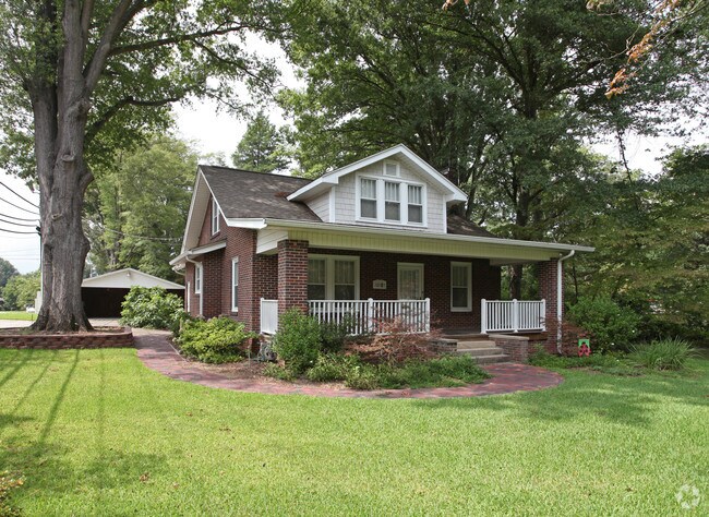
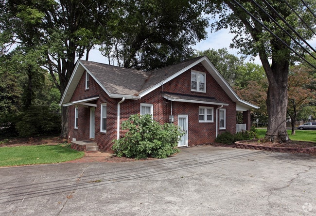
Property Record
20901 N Main St, Cornelius, NC 28031
NEARBY LISTINGS FOR SALE OR LEASE
Property Detail
20901 N Main St
Charlotte-Concord-Gastonia, NC-SC
Carolina Park
003-204-17
M43-933
Commercialnec
Mecklenburg
X
North Carolina
3710464300K
17
2024
0.78 AC
2025
Northeast/I-77
006408
Charlotte
1,744 SF
DEMOGRAPHICS near 20901 N Main St
1 Mile
3 Mile
5 Mile
2024 Total Population
8,477
41,228
91,102
2029 Population
8,902
43,793
97,886
Pop Growth 2024-2029
+ 5.01%
+ 6.22%
+ 7.45%
Average Age
43
41
41
2024 Total Households
3,841
16,946
36,175
HH Growth 2024-2029
+ 4.97%
+ 6.41%
+ 7.51%
Median Household Inc
$94,728
$106,838
$111,901
Avg Household Size
2.20
2.30
2.50
2024 Avg HH Vehicles
2.00
2.00
2.00
Median Home Value
$464,666
$448,936
$453,364
Median Year Built
2002
2000
2001
Nearby Places
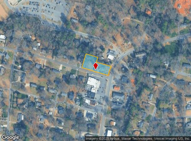
Map Layers
Map Styles
 Street
 Aerial
- Restaurants
- Banks
- Shops
- Fitness
- Groceries
PUBLIC TRANSPORTATION
AIRPORT
Concord-Padgett Regional
DRIVE
WALK
Distance
Concord-Padgett Regional
26 min
14.5 mi
Charlotte/Douglas International
DRIVE
WALK
Distance
Charlotte/Douglas International
39 min
26.5 mi
Freight Ports
North Charleston Terminal
DRIVE
WALK
Distance
North Charleston Terminal
251 min
218.7 mi
Nearby Properties
Address
Land Use
TOTAL SIZE
Lot Size
Zoning
Address
Land Use
TOTAL SIZE
Lot Size
Zoning
1,664,047 SF
221.21 AC
CC
Address
Land Use
TOTAL SIZE
Lot Size
Zoning
569,776 SF
49.01 AC
VIP
Address
Land Use
TOTAL SIZE
Lot Size
Zoning
4,552 SF
92.49 AC
HC(CD)
Address
Land Use
TOTAL SIZE
Lot Size
Zoning
320,754 SF
40.55 AC
NR
Address
Land Use
TOTAL SIZE
Lot Size
Zoning
222,382 SF
31.89 AC
NR
Address
Land Use
TOTAL SIZE
Lot Size
Zoning
223,720 SF
18.42 AC
VC
Address
Land Use
TOTAL SIZE
Lot Size
Zoning
187,250 SF
22.35 AC
NR
Address
Land Use
TOTAL SIZE
Lot Size
Zoning
245,990 SF
5.21 AC
Address
Land Use
TOTAL SIZE
Lot Size
Zoning
14,382 SF
4.40 AC
CM
Address
Land Use
TOTAL SIZE
Lot Size
Zoning
239,596 SF
19.24 AC
NMX
Address
Land Use
TOTAL SIZE
Lot Size
Zoning
247,940 SF
32.28 AC
RP
Address
Land Use
TOTAL SIZE
Lot Size
Zoning
163,432 SF
3.40 AC
LPA
Address
Land Use
TOTAL SIZE
Lot Size
Zoning
166,340 SF
14.67 AC
C
Address
Land Use
TOTAL SIZE
Lot Size
Zoning
139,697 SF
19.75 AC
NR
Address
Land Use
TOTAL SIZE
Lot Size
Zoning
194,079 SF
10.03 AC
LPA
Address
Land Use
TOTAL SIZE
Lot Size
Zoning
14,824 SF
5.76 AC
CM
Address
Land Use
TOTAL SIZE
Lot Size
Zoning
139,665 SF
14.37 AC
HC
Address
Land Use
TOTAL SIZE
Lot Size
Zoning
109,316 SF
7.03 AC
NR
Address
Land Use
TOTAL SIZE
Lot Size
Zoning
85,617 SF
12.36 AC
VC
Address
Land Use
TOTAL SIZE
Lot Size
Zoning
96,656 SF
2.45 AC
CZ(MPD)
Address
Land Use
TOTAL SIZE
Lot Size
Zoning
81,162 SF
41.09 AC
NR
Address
Land Use
TOTAL SIZE
Lot Size
Zoning
72,450 SF
14.50 AC
C
Address
Land Use
TOTAL SIZE
Lot Size
Zoning
83,520 SF
3.98 AC
NR
Address
Land Use
TOTAL SIZE
Lot Size
Zoning
193,689 SF
17.89 AC
NR
Address
Land Use
TOTAL SIZE
Lot Size
Zoning
119,077 SF
4.25 AC
C
Address
Land Use
TOTAL SIZE
Lot Size
Zoning
71 AC
CC
Address
Land Use
TOTAL SIZE
Lot Size
Zoning
142,187 SF
18.88 AC
VIP
Address
Land Use
TOTAL SIZE
Lot Size
Zoning
132,319 SF
16.64 AC
Address
Land Use
TOTAL SIZE
Lot Size
Zoning
92,768 SF
10.66 AC
HLI
Address
Land Use
TOTAL SIZE
Lot Size
Zoning
38,161 SF
2.57 AC
CM
The World's #1 Commercial Real Estate Marketplace
Connect with us
© 2026 CoStar Group
The information above has been obtained from sources believed reliable. While we do not doubt its accuracy we have not verified it and make no guarantee, warranty or representation about it. It is your responsibility to independently confirm its accuracy and completeness. Any projections, opinions, assumptions, or estimates used are for example only and do not represent the current or future performance of the property. The value of this transaction to you depends on tax and other factors which should be evaluated by your tax, financial, and legal advisors. You and your advisors should conduct a careful, independent investigation of the property to determine to your satisfaction the suitability of the property for your needs.