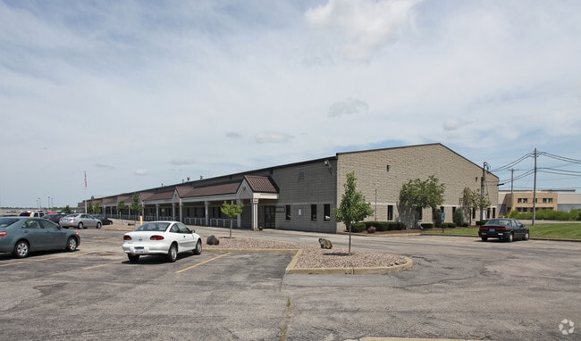
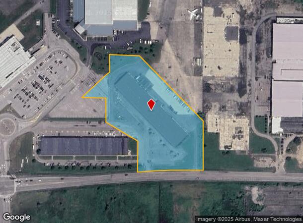
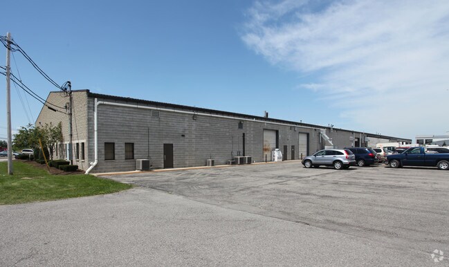
Property Record
2091 Niag Falls Blvd N, Niagara Falls, NY 14303
NEARBY LISTINGS FOR SALE OR LEASE
Property Detail
2091 Niag Falls Blvd N
294000-146-000-0001-008-012
8/97 13006 .01
Industrialgeneral
Niagara
X
New York
36063C0327E
8.012
2025
6.10 AC
2024
Outlying Niagara County
021700
Buffalo/Niagara Falls
4,950 SF
Buffalo-Cheektowaga-Niagara Falls, NY
DEMOGRAPHICS near 2091 Niag Falls Blvd N
1 Mile
3 Mile
5 Mile
2024 Total Population
3,253
28,880
72,769
2029 Population
3,215
28,497
71,807
Pop Growth 2024-2029
(1.17%)
(1.33%)
(1.32%)
Average Age
46
44
43
2024 Total Households
1,645
13,064
31,328
HH Growth 2024-2029
(1.28%)
(1.34%)
(1.39%)
Median Household Inc
$53,926
$61,901
$66,445
Avg Household Size
1.90
2.20
2.30
2024 Avg HH Vehicles
1.00
2.00
2.00
Median Home Value
$145,981
$163,836
$166,995
Median Year Built
1973
1959
1958
Nearby Places
Map Layers
Map Styles
 Street
 Aerial
- Restaurants
- Banks
- Shops
- Fitness
- Groceries
PUBLIC TRANSPORTATION
COMMUTER RAIL
DRIVE
WALK
Distance
13 min
6.3 mi
DRIVE
WALK
Distance
13 min
6.6 mi
AIRPORT
Niagara Falls International
DRIVE
WALK
Distance
Niagara Falls International
2 min
0.5 mi
Buffalo Niagara International
DRIVE
WALK
Distance
Buffalo Niagara International
33 min
18.0 mi
Nearby Properties
Address
Land Use
TOTAL SIZE
Lot Size
Zoning
Address
Land Use
TOTAL SIZE
Lot Size
Zoning
3,600 SF
72.50 AC
Address
Land Use
TOTAL SIZE
Lot Size
Zoning
181,549 SF
81.90 AC
Address
Land Use
TOTAL SIZE
Lot Size
Zoning
410,860 SF
35.20 AC
05 - COMME
Address
Land Use
TOTAL SIZE
Lot Size
Zoning
0.30 AC
R1-C
Address
Land Use
TOTAL SIZE
Lot Size
Zoning
160.52 AC
06 - INDUS
Address
Land Use
TOTAL SIZE
Lot Size
Zoning
58,226 SF
16.40 AC
Address
Land Use
TOTAL SIZE
Lot Size
Zoning
36.90 AC
06 - INDUS
Address
Land Use
TOTAL SIZE
Lot Size
Zoning
240,000 SF
35.50 AC
05 - COMME
Address
Land Use
TOTAL SIZE
Lot Size
Zoning
325.10 AC
06 - INDUS
Address
Land Use
TOTAL SIZE
Lot Size
Zoning
Address
Land Use
TOTAL SIZE
Lot Size
Zoning
211,484 SF
18.30 AC
C3
Address
Land Use
TOTAL SIZE
Lot Size
Zoning
10,647 SF
14 AC
C3
Address
Land Use
TOTAL SIZE
Lot Size
Zoning
33.14 AC
C3
Address
Land Use
TOTAL SIZE
Lot Size
Zoning
6,369 SF
12.58 AC
C3
Address
Land Use
TOTAL SIZE
Lot Size
Zoning
117,095 SF
8.91 AC
C3
Address
Land Use
TOTAL SIZE
Lot Size
Zoning
1,200 SF
49.80 AC
05 - COMME
Address
Land Use
TOTAL SIZE
Lot Size
Zoning
131,133 SF
14.60 AC
05 - COMME
Address
Land Use
TOTAL SIZE
Lot Size
Zoning
101,390 SF
12.16 AC
C3
Address
Land Use
TOTAL SIZE
Lot Size
Zoning
8.40 AC
Address
Land Use
TOTAL SIZE
Lot Size
Zoning
Address
Land Use
TOTAL SIZE
Lot Size
Zoning
134,148 SF
2.90 AC
C1-A
Address
Land Use
TOTAL SIZE
Lot Size
Zoning
110,668 SF
11.70 AC
C3
Address
Land Use
TOTAL SIZE
Lot Size
Zoning
136,218 SF
7.70 AC
R1-C
Address
Land Use
TOTAL SIZE
Lot Size
Zoning
134.90 AC
02
Address
Land Use
TOTAL SIZE
Lot Size
Zoning
30,315 SF
14 AC
Address
Land Use
TOTAL SIZE
Lot Size
Zoning
12,558 SF
3.23 AC
R1-A
Address
Land Use
TOTAL SIZE
Lot Size
Zoning
57,680 SF
7.64 AC
C3
Address
Land Use
TOTAL SIZE
Lot Size
Zoning
200.67 AC
06 - INDUS
Address
Land Use
TOTAL SIZE
Lot Size
Zoning
11,776 SF
13.75 AC
03 - MULTI
Address
Land Use
TOTAL SIZE
Lot Size
Zoning
1,200 SF
8.16 AC
C3
The World's #1 Commercial Real Estate Marketplace
Connect with us
© 2026 CoStar Group
The information above has been obtained from sources believed reliable. While we do not doubt its accuracy we have not verified it and make no guarantee, warranty or representation about it. It is your responsibility to independently confirm its accuracy and completeness. Any projections, opinions, assumptions, or estimates used are for example only and do not represent the current or future performance of the property. The value of this transaction to you depends on tax and other factors which should be evaluated by your tax, financial, and legal advisors. You and your advisors should conduct a careful, independent investigation of the property to determine to your satisfaction the suitability of the property for your needs.