Property Record
20929 Bridge St, Southfield, MI 48033

NEARBY LISTINGS FOR SALE OR LEASE
Property Detail
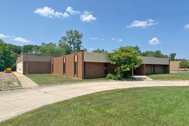
20929 Bridge St
Detroit-Warren-Dearborn, MI
Industrial Park Sub
24-32-451-013
T1N,R10E,SEC 32 INDUSTRIAL PARK SUB LOT 1, ALSO LOTS 50 & 51
Distributionwarehouseregional
Oakland
AE
Michigan
26163C0060E
1,50-51
2024
1.71 AC
2025
Southfield
162500
Detroit
15,976 SF
DEMOGRAPHICS near 20929 Bridge St
1 Mile
3 Mile
5 Mile
2024 Total Population
8,306
88,960
264,051
2029 Population
8,067
86,950
258,173
Pop Growth 2024-2029
(2.88%)
(2.26%)
(2.23%)
Average Age
40
41
41
2024 Total Households
3,707
38,072
110,925
HH Growth 2024-2029
(2.91%)
(2.29%)
(2.24%)
Median Household Inc
$42,198
$49,098
$57,155
Avg Household Size
2.20
2.30
2.30
2024 Avg HH Vehicles
1.00
1.00
2.00
Median Home Value
$99,077
$127,736
$164,523
Median Year Built
1956
1957
1958
Nearby Places
Map Layers
Map Styles
 Street
 Aerial
- Restaurants
- Banks
- Shops
- Fitness
- Groceries
PUBLIC TRANSPORTATION
AIRPORT
Detroit Metro Wayne County
DRIVE
WALK
Distance
Detroit Metro Wayne County
39 min
21.1 mi
Windsor International
DRIVE
WALK
Distance
Windsor International
48 min
28.8 mi
Freight Ports
Port of Toledo
DRIVE
WALK
Distance
Port of Toledo
90 min
71.1 mi
SALE & LEASE HISTORY
LISTING DATE
SALE/LEASE

Mar 07, 2018
For Sale
Jul 19, 2023
For Sale
Nearby Properties
Address
Land Use
TOTAL SIZE
Lot Size
Zoning
Address
Land Use
TOTAL SIZE
Lot Size
Zoning
383,602 SF
36.60 AC
I-1
Address
Land Use
TOTAL SIZE
Lot Size
Zoning
301,269 SF
25.47 AC
OS
Address
Land Use
TOTAL SIZE
Lot Size
Zoning
405,020 SF
18.74 AC
RMM
Address
Land Use
TOTAL SIZE
Lot Size
Zoning
325,654 SF
7.45 AC
ERO
Address
Land Use
TOTAL SIZE
Lot Size
Zoning
311,298 SF
31.66 AC
BI
Address
Land Use
TOTAL SIZE
Lot Size
Zoning
210 SF
20.52 AC
R-2
Address
Land Use
TOTAL SIZE
Lot Size
Zoning
397,200 SF
14.07 AC
RMU
Address
Land Use
TOTAL SIZE
Lot Size
Zoning
209,000 SF
11.21 AC
ERO
Address
Land Use
TOTAL SIZE
Lot Size
Zoning
174 SF
14.17 AC
RM
Address
Land Use
TOTAL SIZE
Lot Size
Zoning
204 SF
11.31 AC
RM
Address
Land Use
TOTAL SIZE
Lot Size
Zoning
202,736 SF
20 AC
PD
Address
Land Use
TOTAL SIZE
Lot Size
Zoning
97,082 SF
67.47 AC
TV-R
Address
Land Use
TOTAL SIZE
Lot Size
Zoning
Address
Land Use
TOTAL SIZE
Lot Size
Zoning
124,306 SF
5.04 AC
ERO-M
Address
Land Use
TOTAL SIZE
Lot Size
Zoning
143,700 SF
3.27 AC
PD
Address
Land Use
TOTAL SIZE
Lot Size
Zoning
307,002 SF
14.61 AC
RC
Address
Land Use
TOTAL SIZE
Lot Size
Zoning
158,092 SF
11.75 AC
B-3
Address
Land Use
TOTAL SIZE
Lot Size
Zoning
168 SF
13.03 AC
RMM
Address
Land Use
TOTAL SIZE
Lot Size
Zoning
129 SF
15.16 AC
RM
Address
Land Use
TOTAL SIZE
Lot Size
Zoning
230,048 SF
11.06 AC
RC
Address
Land Use
TOTAL SIZE
Lot Size
Zoning
635,934 SF
31 AC
ERO-M
Address
Land Use
TOTAL SIZE
Lot Size
Zoning
152 SF
7.32 AC
RM
Address
Land Use
TOTAL SIZE
Lot Size
Zoning
138,104 SF
8.66 AC
AI
Address
Land Use
TOTAL SIZE
Lot Size
Zoning
106,867 SF
ERO
Address
Land Use
TOTAL SIZE
Lot Size
Zoning
143,941 SF
11.66 AC
PD
Address
Land Use
TOTAL SIZE
Lot Size
Zoning
192,038 SF
16.26 AC
C-2
Address
Land Use
TOTAL SIZE
Lot Size
Zoning
83,514 SF
5.66 AC
OS
Address
Land Use
TOTAL SIZE
Lot Size
Zoning
Address
Land Use
TOTAL SIZE
Lot Size
Zoning
131,781 SF
8.74 AC
RM
Address
Land Use
TOTAL SIZE
Lot Size
Zoning
120 SF
8.41 AC
RM
The World's #1 Commercial Real Estate Marketplace
Connect with us
© 2025 CoStar Group
The information above has been obtained from sources believed reliable. While we do not doubt its accuracy we have not verified it and make no guarantee, warranty or representation about it. It is your responsibility to independently confirm its accuracy and completeness. Any projections, opinions, assumptions, or estimates used are for example only and do not represent the current or future performance of the property. The value of this transaction to you depends on tax and other factors which should be evaluated by your tax, financial, and legal advisors. You and your advisors should conduct a careful, independent investigation of the property to determine to your satisfaction the suitability of the property for your needs.