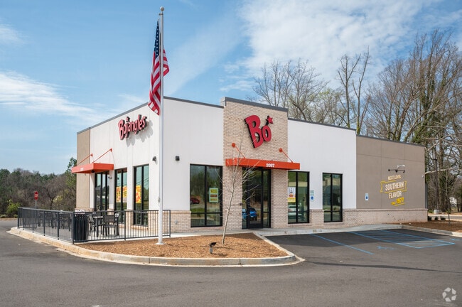
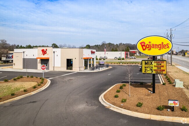
Property Record
2097 Southport Rd, Spartanburg, SC 29306
NEARBY LISTINGS FOR SALE OR LEASE
Property Detail
2097 Southport Rd
Spartanburg, SC
Associated Realty Partners
7-21-02-005.01
TRACT B ASSOCIATED REALTY PARTNERS SURVEY PB 181-765
Commercialnec
Spartanburg
0
South Carolina
2025
1.13 AC
021100
Lower Spartanburg Cty
2,827 SF
Greenville/Spartanburg
DEMOGRAPHICS near 2097 Southport Rd
1 Mile
3 Mile
5 Mile
2024 Total Population
3,005
29,782
74,977
2029 Population
3,414
33,751
85,129
Pop Growth 2024-2029
+ 13.61%
+ 13.33%
+ 13.54%
Average Age
41
40
40
2024 Total Households
1,255
12,634
30,496
HH Growth 2024-2029
+ 13.78%
+ 13.57%
+ 14.00%
Median Household Inc
$55,000
$48,981
$48,294
Avg Household Size
2.30
2.30
2.30
2024 Avg HH Vehicles
2.00
2.00
2.00
Median Home Value
$155,069
$187,105
$171,738
Median Year Built
1972
1970
1974
Nearby Places
Map Layers
Map Styles
 Street
 Aerial
- Restaurants
- Banks
- Shops
- Fitness
- Groceries
PUBLIC TRANSPORTATION
COMMUTER RAIL
Spartanburg Amtrak Station (Crescent - Amtrak)
DRIVE
WALK
Distance
Spartanburg Amtrak Station (Crescent - Amtrak)
10 min
4.2 mi
AIRPORT
Greenville Spartanburg International
DRIVE
WALK
Distance
Greenville Spartanburg International
38 min
23.4 mi
Freight Ports
North Charleston Terminal
DRIVE
WALK
Distance
North Charleston Terminal
220 min
194.2 mi
SALE & LEASE HISTORY
LISTING DATE
SALE/LEASE

Feb 10, 2023
For Sale
Nearby Properties
Address
Land Use
TOTAL SIZE
Lot Size
Zoning
Address
Land Use
TOTAL SIZE
Lot Size
Zoning
7,245 SF
18.10 AC
Address
Land Use
TOTAL SIZE
Lot Size
Zoning
31,913 SF
1.03 AC
Address
Land Use
TOTAL SIZE
Lot Size
Zoning
31,054 SF
0.48 AC
Address
Land Use
TOTAL SIZE
Lot Size
Zoning
2,022 SF
3.50 AC
Address
Land Use
TOTAL SIZE
Lot Size
Zoning
2,864 SF
3.72 AC
Address
Land Use
TOTAL SIZE
Lot Size
Zoning
19,796 SF
3.56 AC
Address
Land Use
TOTAL SIZE
Lot Size
Zoning
18,443 SF
0.58 AC
Address
Land Use
TOTAL SIZE
Lot Size
Zoning
25,380 SF
0.75 AC
Address
Land Use
TOTAL SIZE
Lot Size
Zoning
106,389 SF
3.15 AC
Address
Land Use
TOTAL SIZE
Lot Size
Zoning
6,879 SF
135.30 AC
Address
Land Use
TOTAL SIZE
Lot Size
Zoning
3,363 SF
8.10 AC
Address
Land Use
TOTAL SIZE
Lot Size
Zoning
173,817 SF
0.85 AC
Address
Land Use
TOTAL SIZE
Lot Size
Zoning
3,254 SF
0.83 AC
Address
Land Use
TOTAL SIZE
Lot Size
Zoning
15,302 SF
0.74 AC
Address
Land Use
TOTAL SIZE
Lot Size
Zoning
67,704 SF
0.50 AC
Address
Land Use
TOTAL SIZE
Lot Size
Zoning
9,408 SF
0.47 AC
Address
Land Use
TOTAL SIZE
Lot Size
Zoning
3,848 SF
0.53 AC
Address
Land Use
TOTAL SIZE
Lot Size
Zoning
5,414 SF
10.55 AC
Address
Land Use
TOTAL SIZE
Lot Size
Zoning
4,039 SF
1.53 AC
Address
Land Use
TOTAL SIZE
Lot Size
Zoning
5,089 SF
0.80 AC
Address
Land Use
TOTAL SIZE
Lot Size
Zoning
2,908 SF
1.51 AC
Address
Land Use
TOTAL SIZE
Lot Size
Zoning
43,869 SF
8.58 AC
Address
Land Use
TOTAL SIZE
Lot Size
Zoning
8,596 SF
1 AC
Address
Land Use
TOTAL SIZE
Lot Size
Zoning
700 SF
6.31 AC
Address
Land Use
TOTAL SIZE
Lot Size
Zoning
138,099 SF
6.45 AC
Address
Land Use
TOTAL SIZE
Lot Size
Zoning
3,464 SF
0.19 AC
Address
Land Use
TOTAL SIZE
Lot Size
Zoning
2,921 SF
0.34 AC
Address
Land Use
TOTAL SIZE
Lot Size
Zoning
3,876 SF
0.23 AC
Address
Land Use
TOTAL SIZE
Lot Size
Zoning
3,946 SF
0.53 AC
Address
Land Use
TOTAL SIZE
Lot Size
Zoning
2,879 SF
The World's #1 Commercial Real Estate Marketplace
Connect with us
© 2026 CoStar Group
The information above has been obtained from sources believed reliable. While we do not doubt its accuracy we have not verified it and make no guarantee, warranty or representation about it. It is your responsibility to independently confirm its accuracy and completeness. Any projections, opinions, assumptions, or estimates used are for example only and do not represent the current or future performance of the property. The value of this transaction to you depends on tax and other factors which should be evaluated by your tax, financial, and legal advisors. You and your advisors should conduct a careful, independent investigation of the property to determine to your satisfaction the suitability of the property for your needs.