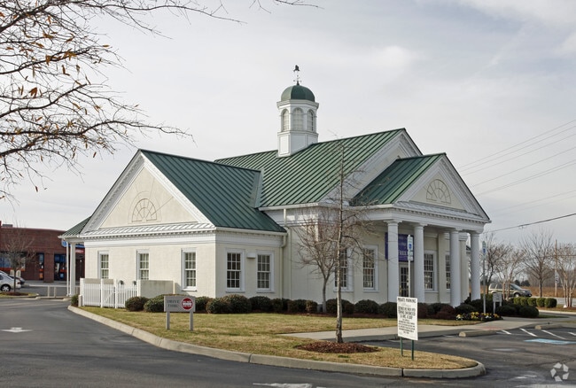
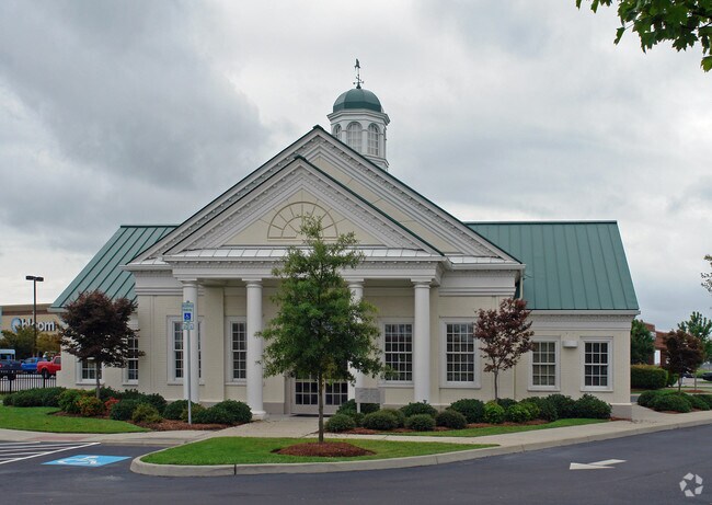
Property Record
2098 Princess Anne Rd, Virginia Beach, VA 23456
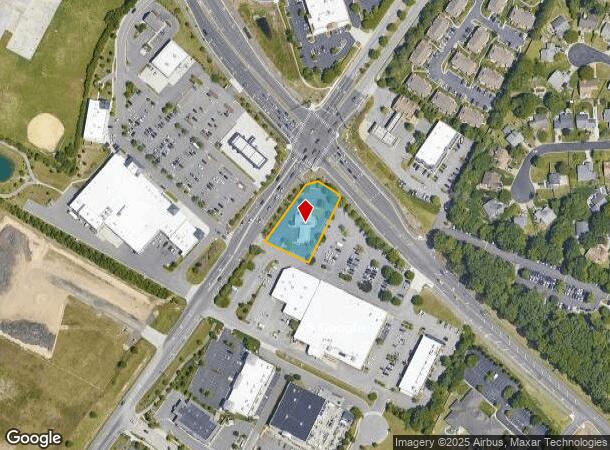
NEARBY LISTINGS FOR SALE OR LEASE
Property Detail
2098 Princess Anne Rd
2414-22-3684
D2 Prcl D1
Financialbuilding
OF THE LAND OF PRINCES SBORO DEV CO INC PAR C1C 0.7143 AC
X
Virginia Beach
5155310119G
Virginia
2024
0.71 AC
2025
General Booth Corr
045424
Hampton Roads
2,447 SF
Virginia Beach-Norfolk-Newport News, VA-NC
DEMOGRAPHICS near 2098 Princess Anne Rd
1 Mile
3 Mile
5 Mile
2024 Total Population
8,009
42,540
72,402
2029 Population
7,891
41,961
71,865
Pop Growth 2024-2029
(1.47%)
(1.36%)
(0.74%)
Average Age
39
39
39
2024 Total Households
2,692
14,722
24,654
HH Growth 2024-2029
(1.63%)
(1.47%)
(0.74%)
Median Household Inc
$127,655
$111,688
$106,588
Avg Household Size
2.90
2.80
2.80
2024 Avg HH Vehicles
2.00
2.00
2.00
Median Home Value
$455,530
$400,634
$394,054
Median Year Built
1995
1990
1991
Nearby Places
- Restaurants
- Banks
- Shops
- Fitness
- Groceries
PUBLIC TRANSPORTATION
AIRPORT
Norfolk International
DRIVE
WALK
Distance
Norfolk International
34 min
20.5 mi
Freight Ports
Virginia Port Authority - Portsmouth
DRIVE
WALK
Distance
Virginia Port Authority - Portsmouth
42 min
23.5 mi
Nearby Properties
Address
Land Use
TOTAL SIZE
Lot Size
Zoning
Address
Land Use
TOTAL SIZE
Lot Size
Zoning
675,493 SF
33.56 AC
AG1
Address
Land Use
TOTAL SIZE
Lot Size
Zoning
356,343 SF
104.97 AC
Address
Land Use
TOTAL SIZE
Lot Size
Zoning
17,551 SF
68.66 AC
AG1
Address
Land Use
TOTAL SIZE
Lot Size
Zoning
249,927 SF
23.95 AC
B2
Address
Land Use
TOTAL SIZE
Lot Size
Zoning
303,706 SF
13.62 AC
AG2
Address
Land Use
TOTAL SIZE
Lot Size
Zoning
409,152 SF
29.42 AC
I2
Address
Land Use
TOTAL SIZE
Lot Size
Zoning
3 SF
15.73 AC
A18
Address
Land Use
TOTAL SIZE
Lot Size
Zoning
342,735 SF
49.62 AC
PDH2
Address
Land Use
TOTAL SIZE
Lot Size
Zoning
219,000 SF
75.18 AC
I1
Address
Land Use
TOTAL SIZE
Lot Size
Zoning
186,971 SF
23.87 AC
O2
Address
Land Use
TOTAL SIZE
Lot Size
Zoning
229,042 SF
36.70 AC
AG1
Address
Land Use
TOTAL SIZE
Lot Size
Zoning
253,540 SF
38.45 AC
I1
Address
Land Use
TOTAL SIZE
Lot Size
Zoning
211,322 SF
40.10 AC
I1
Address
Land Use
TOTAL SIZE
Lot Size
Zoning
5.88 AC
B4
Address
Land Use
TOTAL SIZE
Lot Size
Zoning
147,757 SF
15.74 AC
B2
Address
Land Use
TOTAL SIZE
Lot Size
Zoning
112,724 SF
15.79 AC
R20
Address
Land Use
TOTAL SIZE
Lot Size
Zoning
203,385 SF
18.51 AC
B2
Address
Land Use
TOTAL SIZE
Lot Size
Zoning
188,679 SF
32.41 AC
AG1
Address
Land Use
TOTAL SIZE
Lot Size
Zoning
97,943 SF
11.92 AC
B2
Address
Land Use
TOTAL SIZE
Lot Size
Zoning
137,390 SF
AG2
Address
Land Use
TOTAL SIZE
Lot Size
Zoning
98,080 SF
15.71 AC
O2
Address
Land Use
TOTAL SIZE
Lot Size
Zoning
85,953 SF
13.19 AC
B2
Address
Land Use
TOTAL SIZE
Lot Size
Zoning
1 SF
218.01 AC
AG1
Address
Land Use
TOTAL SIZE
Lot Size
Zoning
112,843 SF
6.21 AC
O2
Address
Land Use
TOTAL SIZE
Lot Size
Zoning
87,332 SF
19.62 AC
I2
Address
Land Use
TOTAL SIZE
Lot Size
Zoning
71,031 SF
11.29 AC
R20
Address
Land Use
TOTAL SIZE
Lot Size
Zoning
88,596 SF
15.05 AC
AG1
Address
Land Use
TOTAL SIZE
Lot Size
Zoning
60,954 SF
123.90 AC
I2
Address
Land Use
TOTAL SIZE
Lot Size
Zoning
126,572 SF
0.01 AC
B2
Address
Land Use
TOTAL SIZE
Lot Size
Zoning
68,162 SF
6.57 AC
B2
The World's #1 Commercial Real Estate Marketplace
Connect with us
© 2025 CoStar Group
The information above has been obtained from sources believed reliable. While we do not doubt its accuracy we have not verified it and make no guarantee, warranty or representation about it. It is your responsibility to independently confirm its accuracy and completeness. Any projections, opinions, assumptions, or estimates used are for example only and do not represent the current or future performance of the property. The value of this transaction to you depends on tax and other factors which should be evaluated by your tax, financial, and legal advisors. You and your advisors should conduct a careful, independent investigation of the property to determine to your satisfaction the suitability of the property for your needs.