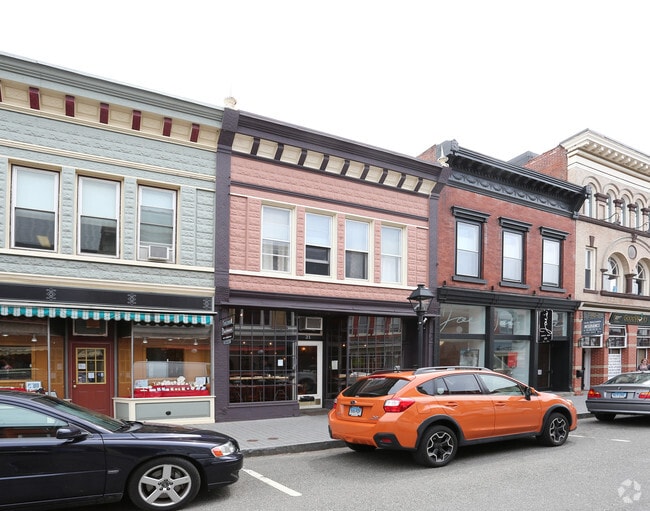
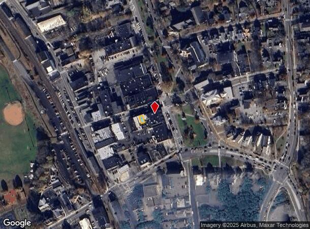
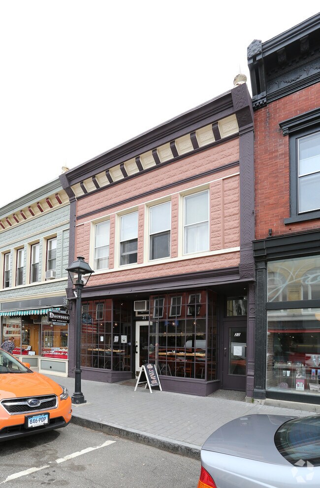
Property Record
21 Bank St, New Milford, CT 06776
NEARBY LISTINGS FOR SALE OR LEASE
Property Detail
21 Bank St
Torrington, CT
09 Clove Court
NMIL-000028-000004-000035
Litchfield
Commercialbuilding
Connecticut
2025
35
2025
0.02 AC
425700
New Milford/SW Litchfield
1,668 SF
Hartford
DEMOGRAPHICS near 21 Bank St
1 Mile
3 Mile
5 Mile
2024 Total Population
5,862
19,427
30,817
2029 Population
5,814
19,414
30,956
Pop Growth 2024-2029
(0.82%)
(0.07%)
+ 0.45%
Average Age
41
42
43
2024 Total Households
2,526
7,684
12,203
HH Growth 2024-2029
(0.83%)
(0.09%)
+ 0.47%
Median Household Inc
$66,445
$85,906
$95,837
Avg Household Size
2.30
2.50
2.50
2024 Avg HH Vehicles
2.00
2.00
2.00
Median Home Value
$301,398
$341,827
$369,686
Median Year Built
1970
1975
1974
Nearby Places
Map Layers
Map Styles
 Street
 Aerial
- Restaurants
- Banks
- Shops
- Fitness
- Groceries
PUBLIC TRANSPORTATION
AIRPORT
Tweed/New Haven
DRIVE
WALK
Distance
Tweed/New Haven
72 min
44.8 mi
Freight Ports
Port of New Haven
DRIVE
WALK
Distance
Port of New Haven
66 min
42.6 mi
SALE & LEASE HISTORY
LISTING DATE
SALE/LEASE

Oct 10, 2016
For Sale
Jun 20, 2018
For Sale
Nearby Properties
Address
Land Use
TOTAL SIZE
Lot Size
Zoning
Address
Land Use
TOTAL SIZE
Lot Size
Zoning
6.13 AC
R8
Address
Land Use
TOTAL SIZE
Lot Size
Zoning
1,643 SF
69.12 AC
R40
Address
Land Use
TOTAL SIZE
Lot Size
Zoning
42.62 AC
B1/RI
Address
Land Use
TOTAL SIZE
Lot Size
Zoning
24.95 AC
R40/MR
Address
Land Use
TOTAL SIZE
Lot Size
Zoning
227,659 SF
21.89 AC
I
Address
Land Use
TOTAL SIZE
Lot Size
Zoning
59.87 AC
RI
Address
Land Use
TOTAL SIZE
Lot Size
Zoning
41.87 AC
R40/B1
Address
Land Use
TOTAL SIZE
Lot Size
Zoning
33 AC
RR
Address
Land Use
TOTAL SIZE
Lot Size
Zoning
10.30 AC
B2
Address
Land Use
TOTAL SIZE
Lot Size
Zoning
79,524 SF
38.54 AC
R40
Address
Land Use
TOTAL SIZE
Lot Size
Zoning
75,257 SF
16.70 AC
R40
Address
Land Use
TOTAL SIZE
Lot Size
Zoning
7.61 AC
BI
Address
Land Use
TOTAL SIZE
Lot Size
Zoning
73,075 SF
8.79 AC
B1
Address
Land Use
TOTAL SIZE
Lot Size
Zoning
51,277 SF
12.31 AC
R40
Address
Land Use
TOTAL SIZE
Lot Size
Zoning
22,345 SF
0.76 AC
VC
Address
Land Use
TOTAL SIZE
Lot Size
Zoning
25,450 SF
9.16 AC
I
Address
Land Use
TOTAL SIZE
Lot Size
Zoning
4.46 AC
RM
Address
Land Use
TOTAL SIZE
Lot Size
Zoning
6.09 AC
I
Address
Land Use
TOTAL SIZE
Lot Size
Zoning
9,000 SF
342.45 AC
I/R40
Address
Land Use
TOTAL SIZE
Lot Size
Zoning
43,828 SF
1.29 AC
R8
Address
Land Use
TOTAL SIZE
Lot Size
Zoning
73,510 SF
16.94 AC
RI
Address
Land Use
TOTAL SIZE
Lot Size
Zoning
6.90 AC
B1
Address
Land Use
TOTAL SIZE
Lot Size
Zoning
2,811 SF
2 AC
MR
Address
Land Use
TOTAL SIZE
Lot Size
Zoning
10.04 AC
I
Address
Land Use
TOTAL SIZE
Lot Size
Zoning
12,916 SF
1.86 AC
B1
Address
Land Use
TOTAL SIZE
Lot Size
Zoning
5.46 AC
B1
Address
Land Use
TOTAL SIZE
Lot Size
Zoning
14 AC
B1
Address
Land Use
TOTAL SIZE
Lot Size
Zoning
14.04 AC
R40
Address
Land Use
TOTAL SIZE
Lot Size
Zoning
45,942 SF
3.17 AC
B1
Address
Land Use
TOTAL SIZE
Lot Size
Zoning
1,446 SF
5.22 AC
I
The World's #1 Commercial Real Estate Marketplace
Connect with us
© 2025 CoStar Group
The information above has been obtained from sources believed reliable. While we do not doubt its accuracy we have not verified it and make no guarantee, warranty or representation about it. It is your responsibility to independently confirm its accuracy and completeness. Any projections, opinions, assumptions, or estimates used are for example only and do not represent the current or future performance of the property. The value of this transaction to you depends on tax and other factors which should be evaluated by your tax, financial, and legal advisors. You and your advisors should conduct a careful, independent investigation of the property to determine to your satisfaction the suitability of the property for your needs.