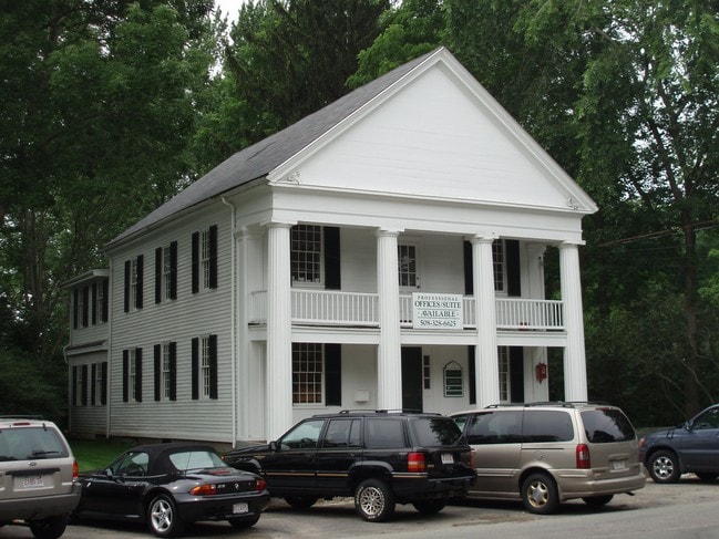
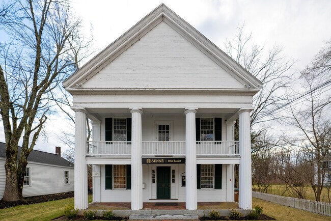
Property Record
21 Cochituate Rd, Wayland, MA 01778

Current Lease Availabilities
NEARBY LISTINGS FOR SALE OR LEASE
Property Detail
21 Cochituate Rd
WAYL-000023-000000-000046
Middlesex
Officebuilding
Massachusetts
X
46
25021C0005E
0.14 AC
2025
Concord/Maynard
2025
Boston
366202
Boston-Cambridge-Newton, MA-NH
3,500 SF
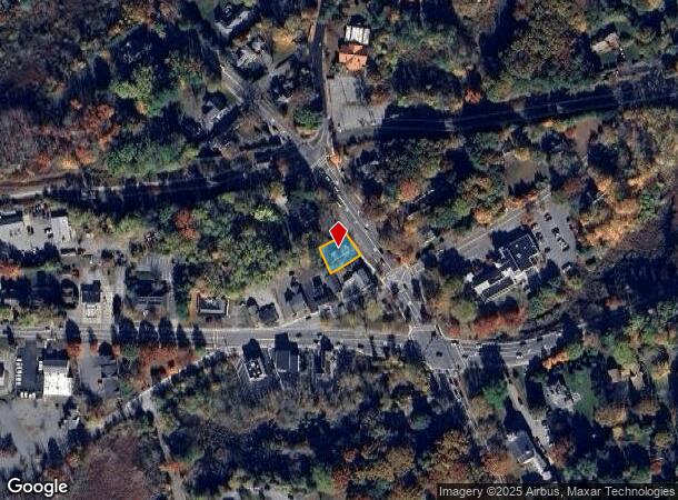
DEMOGRAPHICS near 21 Cochituate Rd
1 Mile
3 Mile
5 Mile
2024 Total Population
2,498
22,821
89,064
2029 Population
2,507
22,762
88,406
Pop Growth 2024-2029
+ 0.36%
(0.26%)
(0.74%)
Average Age
44
43
43
2024 Total Households
898
8,241
32,648
HH Growth 2024-2029
+ 0.45%
(0.33%)
(0.81%)
Median Household Inc
$220,758
$205,567
$171,999
Avg Household Size
2.70
2.70
2.70
2024 Avg HH Vehicles
2.00
2.00
2.00
Median Home Value
$879,978
$886,853
$825,872
Median Year Built
1967
1967
1964
Nearby Places
Map Layers
Map Styles
 Street
 Aerial
- Restaurants
- Banks
- Shops
- Fitness
- Groceries
PUBLIC TRANSPORTATION
COMMUTER RAIL
Kendal Green (Fitchburg/South Acton Line - Massachusetts Bay Transportation Authority Commuter Rail (Purple Line))
DRIVE
WALK
Distance
Kendal Green (Fitchburg/South Acton Line - Massachusetts Bay Transportation Authority Commuter Rail (Purple Line))
9 min
4.8 mi
Lincoln (Fitchburg/South Acton Line - Massachusetts Bay Transportation Authority Commuter Rail (Purple Line))
DRIVE
WALK
Distance
Lincoln (Fitchburg/South Acton Line - Massachusetts Bay Transportation Authority Commuter Rail (Purple Line))
9 min
4.9 mi
AIRPORT
General Edward Lawrence Logan International
DRIVE
WALK
Distance
General Edward Lawrence Logan International
35 min
22.2 mi
Worcester Regional
DRIVE
WALK
Distance
Worcester Regional
52 min
32.5 mi
Freight Ports
Port of Boston
DRIVE
WALK
Distance
Port of Boston
34 min
20.5 mi
Nearby Properties
Address
Land Use
TOTAL SIZE
Lot Size
Zoning
Address
Land Use
TOTAL SIZE
Lot Size
Zoning
118,696 SF
65.79 AC
A
Address
Land Use
TOTAL SIZE
Lot Size
Zoning
87,102 SF
8.26 AC
R40
Address
Land Use
TOTAL SIZE
Lot Size
Zoning
136,919 SF
13.42 AC
M
Address
Land Use
TOTAL SIZE
Lot Size
Zoning
51,524 SF
67.86 AC
R40
Address
Land Use
TOTAL SIZE
Lot Size
Zoning
13,752 SF
37.43 AC
A
Address
Land Use
TOTAL SIZE
Lot Size
Zoning
114,000 SF
31.53 AC
PRD
Address
Land Use
TOTAL SIZE
Lot Size
Zoning
44,301 SF
11.50 AC
LC
Address
Land Use
TOTAL SIZE
Lot Size
Zoning
118,301 SF
28.83 AC
R20
Address
Land Use
TOTAL SIZE
Lot Size
Zoning
154.71 AC
A
Address
Land Use
TOTAL SIZE
Lot Size
Zoning
146.18 AC
A
Address
Land Use
TOTAL SIZE
Lot Size
Zoning
27.16 AC
RESA
Address
Land Use
TOTAL SIZE
Lot Size
Zoning
28.26 AC
LID
Address
Land Use
TOTAL SIZE
Lot Size
Zoning
101 AC
RG
Address
Land Use
TOTAL SIZE
Lot Size
Zoning
53.75 AC
Address
Land Use
TOTAL SIZE
Lot Size
Zoning
56,202 SF
37 AC
R30
Address
Land Use
TOTAL SIZE
Lot Size
Zoning
18,011 SF
10.01 AC
R60
Address
Land Use
TOTAL SIZE
Lot Size
Zoning
60,193 SF
15.67 AC
ID
Address
Land Use
TOTAL SIZE
Lot Size
Zoning
2,502 SF
1.38 AC
A
Address
Land Use
TOTAL SIZE
Lot Size
Zoning
66,589 SF
25.82 AC
R60
Address
Land Use
TOTAL SIZE
Lot Size
Zoning
74,133 SF
7.32 AC
ID
Address
Land Use
TOTAL SIZE
Lot Size
Zoning
50,738 SF
17.60 AC
R40
Address
Land Use
TOTAL SIZE
Lot Size
Zoning
1,504 SF
15.51 AC
Address
Land Use
TOTAL SIZE
Lot Size
Zoning
50,665 SF
9.71 AC
R30
Address
Land Use
TOTAL SIZE
Lot Size
Zoning
10,836 SF
6.55 AC
A
Address
Land Use
TOTAL SIZE
Lot Size
Zoning
58,818 SF
3.10 AC
R30
Address
Land Use
TOTAL SIZE
Lot Size
Zoning
18,558 SF
50 AC
A
Address
Land Use
TOTAL SIZE
Lot Size
Zoning
59,681 SF
21.26 AC
RESC
Address
Land Use
TOTAL SIZE
Lot Size
Zoning
8,320 SF
19.42 AC
A
Address
Land Use
TOTAL SIZE
Lot Size
Zoning
6.30 AC
VBD
Address
Land Use
TOTAL SIZE
Lot Size
Zoning
48.48 AC
A
The World's #1 Commercial Real Estate Marketplace
Connect with us
© 2026 CoStar Group
The information above has been obtained from sources believed reliable. While we do not doubt its accuracy we have not verified it and make no guarantee, warranty or representation about it. It is your responsibility to independently confirm its accuracy and completeness. Any projections, opinions, assumptions, or estimates used are for example only and do not represent the current or future performance of the property. The value of this transaction to you depends on tax and other factors which should be evaluated by your tax, financial, and legal advisors. You and your advisors should conduct a careful, independent investigation of the property to determine to your satisfaction the suitability of the property for your needs.