Property Record
21 Dwight Rd, Longmeadow, MA 01106
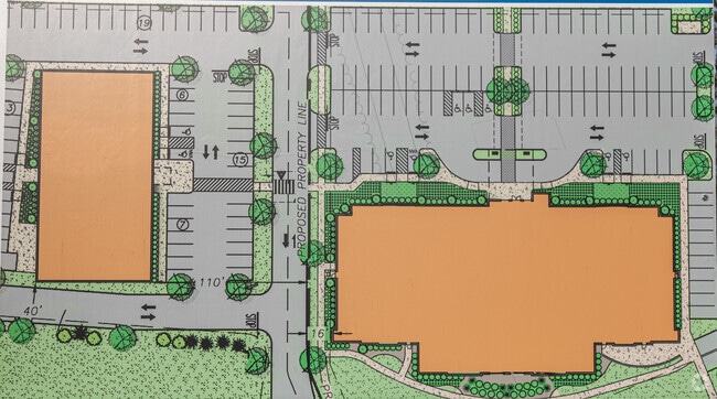

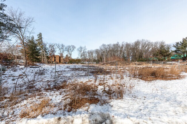
Property Detail
21 Dwight Rd
234 30 35A
Hampden
Commercialbuilding
Massachusetts
PRO
35a
B and X Area of moderate flood hazard, usually the area between the limits of the 100-year and 500-year floods.
7.23 AC
2025
Hampden County
2025
Hartford
813303
Springfield, MA
53,298 SF
NEARBY LISTINGS FOR SALE OR LEASE
DEMOGRAPHICS near 21 Dwight Rd
1 mile
3 mile
5 mile
2025 Total Population
6,261
71,637
170,310
2030 Population
6,287
71,585
170,537
Pop Growth 2025-2030
+ 0.42%
(0.07%)
+ 0.13%
Average Age
45
41
40
2025 Total Households
2,452
26,700
64,320
HH Growth 2025-2030
+ 0.41%
(0.04%)
+ 0.12%
Median Household Inc
$99,712
$80,329
$65,768
Avg Household Size
2.40
2.50
2.50
2025 Avg HH Vehicles
2.00
2.00
2.00
Median Home Value
$360,707
$309,891
$286,090
Median Year Built
1963
1953
1955
Nearby Places
Map Layers
Map Styles
 Street
 Aerial
Transit
 Traffic
 Biking
Places
Listings with unknown addresses are not visible on the map
- Restaurants
- Banks
- Shops
- Fitness
- Groceries
PUBLIC TRANSPORTATION
COMMUTER RAIL
Drive
Walk
Distance
11 min
5.4 mi
AIRPORT
Bradley International
Drive
Walk
Distance
Bradley International
35 min
15.1 mi
Nearby Properties
Address
Land Use
TOTAL SIZE
Lot Size
Zoning
Address
Land Use
TOTAL SIZE
Lot Size
Zoning
236,616 SF
31.07 AC
RA1
Address
Land Use
TOTAL SIZE
Lot Size
Zoning
162,232 SF
3.06 AC
R2
Address
Land Use
TOTAL SIZE
Lot Size
Zoning
69.62 AC
MFHD
Address
Land Use
TOTAL SIZE
Lot Size
Zoning
232,510 SF
61.40 AC
RB
Address
Land Use
TOTAL SIZE
Lot Size
Zoning
142,872 SF
57.41 AC
INDG
Address
Land Use
TOTAL SIZE
Lot Size
Zoning
8,712 SF
25.08 AC
RA1
Address
Land Use
TOTAL SIZE
Lot Size
Zoning
42,412 SF
2.22 AC
SR2B1
Address
Land Use
TOTAL SIZE
Lot Size
Zoning
127,645 SF
20 AC
RC
Address
Land Use
TOTAL SIZE
Lot Size
Zoning
9.69 AC
B
Address
Land Use
TOTAL SIZE
Lot Size
Zoning
27,200 SF
13.22 AC
MULT
Address
Land Use
TOTAL SIZE
Lot Size
Zoning
121.07 AC
I-1
Address
Land Use
TOTAL SIZE
Lot Size
Zoning
84,605 SF
13.15 AC
RB
Address
Land Use
TOTAL SIZE
Lot Size
Zoning
4,400 SF
675 AC
SR1R2
Address
Land Use
TOTAL SIZE
Lot Size
Zoning
62,548 SF
10.50 AC
R1
Address
Land Use
TOTAL SIZE
Lot Size
Zoning
38,850 SF
10.06 AC
R1
Address
Land Use
TOTAL SIZE
Lot Size
Zoning
19,380 SF
3.30 AC
R2
Address
Land Use
TOTAL SIZE
Lot Size
Zoning
10,344 SF
9.54 AC
R4
Address
Land Use
TOTAL SIZE
Lot Size
Zoning
121 AC
A-1
Address
Land Use
TOTAL SIZE
Lot Size
Zoning
55,881 SF
2 AC
R2
Address
Land Use
TOTAL SIZE
Lot Size
Zoning
513,160 SF
38 AC
INDG
Address
Land Use
TOTAL SIZE
Lot Size
Zoning
183,248 SF
4.47 AC
R4
Address
Land Use
TOTAL SIZE
Lot Size
Zoning
57,328 SF
11.15 AC
INDG
Address
Land Use
TOTAL SIZE
Lot Size
Zoning
62,262 SF
18.69 AC
SR1R4
Address
Land Use
TOTAL SIZE
Lot Size
Zoning
154,126 SF
9.27 AC
Address
Land Use
TOTAL SIZE
Lot Size
Zoning
39,860 SF
3.94 AC
R1
Address
Land Use
TOTAL SIZE
Lot Size
Zoning
48,012 SF
0.25 AC
R2
Address
Land Use
TOTAL SIZE
Lot Size
Zoning
15,360 SF
3.62 AC
R1
Address
Land Use
TOTAL SIZE
Lot Size
Zoning
19,122 SF
2.30 AC
R2
Address
Land Use
TOTAL SIZE
Lot Size
Zoning
114,772 SF
8.45 AC
BUS
The World's #1 Commercial Real Estate Marketplace
Connect with us
© 2026 CoStar Group
The information above has been obtained from sources believed reliable. While we do not doubt its accuracy we have not verified it and make no guarantee, warranty or representation about it. It is your responsibility to independently confirm its accuracy and completeness. Any projections, opinions, assumptions, or estimates used are for example only and do not represent the current or future performance of the property. The value of this transaction to you depends on tax and other factors which should be evaluated by your tax, financial, and legal advisors. You and your advisors should conduct a careful, independent investigation of the property to determine to your satisfaction the suitability of the property for your needs.