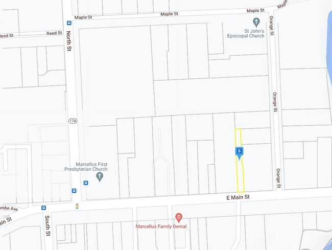
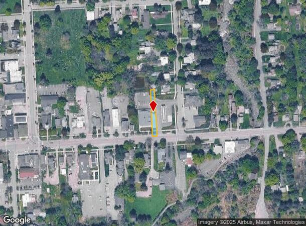
Property Record
21 E Main St, Marcellus, NY 13108
NEARBY LISTINGS FOR SALE OR LEASE
-
-
View all Marcellus listings for sale on LoopNet.com
Property Detail
21 E Main St
Syracuse, NY
FL 15
314001-004-000-0001-012-000-0000
Onondaga
Vacantlandnec
New York
X
12.000
36067C0302F
0.17 AC
2025
W Outer Onondaga County
2024
Syracuse
016502
DEMOGRAPHICS near 21 E Main St
1 Mile
3 Mile
5 Mile
2024 Total Population
3,341
6,206
19,135
2029 Population
3,370
6,158
18,812
Pop Growth 2024-2029
+ 0.87%
(0.77%)
(1.69%)
Average Age
44
45
45
2024 Total Households
1,465
2,586
7,966
HH Growth 2024-2029
+ 0.68%
(0.89%)
(1.87%)
Median Household Inc
$74,009
$85,152
$88,787
Avg Household Size
2.30
2.40
2.40
2024 Avg HH Vehicles
2.00
2.00
2.00
Median Home Value
$216,226
$232,747
$228,961
Median Year Built
1965
1964
1965
Nearby Places
- Restaurants
- Banks
- Shops
- Fitness
- Groceries
PUBLIC TRANSPORTATION
AIRPORT
Syracuse Hancock International
DRIVE
WALK
Distance
Syracuse Hancock International
32 min
19.1 mi
Freight Ports
Albany, NY Port
DRIVE
WALK
Distance
Albany, NY Port
194 min
159.5 mi
Nearby Properties
Address
Land Use
TOTAL SIZE
Lot Size
Zoning
Address
Land Use
TOTAL SIZE
Lot Size
Zoning
14,804 SF
44.18 AC
06 - INDUS
Address
Land Use
TOTAL SIZE
Lot Size
Zoning
95,675 SF
18.46 AC
02 - SINGL
Address
Land Use
TOTAL SIZE
Lot Size
Zoning
55,860 SF
61.18 AC
02 - SINGL
Address
Land Use
TOTAL SIZE
Lot Size
Zoning
Address
Land Use
TOTAL SIZE
Lot Size
Zoning
92,436 SF
7.13 AC
04 - FARM
Address
Land Use
TOTAL SIZE
Lot Size
Zoning
7,014 SF
104.01 AC
02 - SINGL
Address
Land Use
TOTAL SIZE
Lot Size
Zoning
29,736 SF
3.58 AC
05 - COMME
Address
Land Use
TOTAL SIZE
Lot Size
Zoning
24,591 SF
2.10 AC
05 - COMME
Address
Land Use
TOTAL SIZE
Lot Size
Zoning
10,191 SF
0.93 AC
05 - COMME
Address
Land Use
TOTAL SIZE
Lot Size
Zoning
0.01 AC
02 - SINGL
Address
Land Use
TOTAL SIZE
Lot Size
Zoning
0.79 AC
Address
Land Use
TOTAL SIZE
Lot Size
Zoning
29,736 SF
0.95 AC
05 - COMME
Address
Land Use
TOTAL SIZE
Lot Size
Zoning
1.43 AC
02 - SINGL
Address
Land Use
TOTAL SIZE
Lot Size
Zoning
4,000 SF
11.05 AC
07
Address
Land Use
TOTAL SIZE
Lot Size
Zoning
0.40 AC
05
Address
Land Use
TOTAL SIZE
Lot Size
Zoning
2.01 AC
Address
Land Use
TOTAL SIZE
Lot Size
Zoning
1,539 SF
3.60 AC
05 - COMME
Address
Land Use
TOTAL SIZE
Lot Size
Zoning
2,580 SF
1.31 AC
02 - SINGL
Address
Land Use
TOTAL SIZE
Lot Size
Zoning
8,490 SF
47.04 AC
02 - SINGL
Address
Land Use
TOTAL SIZE
Lot Size
Zoning
7.05 AC
06
Address
Land Use
TOTAL SIZE
Lot Size
Zoning
2,052 SF
154.33 AC
07 - MIXED
Address
Land Use
TOTAL SIZE
Lot Size
Zoning
11,772 SF
0.76 AC
05 - COMME
Address
Land Use
TOTAL SIZE
Lot Size
Zoning
5,238 SF
1.10 AC
05 - COMME
Address
Land Use
TOTAL SIZE
Lot Size
Zoning
7,754 SF
72.40 AC
02 - SINGL
Address
Land Use
TOTAL SIZE
Lot Size
Zoning
7,400 SF
126.42 AC
04 - FARM
Address
Land Use
TOTAL SIZE
Lot Size
Zoning
6.57 AC
04 - FARM
Address
Land Use
TOTAL SIZE
Lot Size
Zoning
10,404 SF
2.42 AC
02 - SINGL
Address
Land Use
TOTAL SIZE
Lot Size
Zoning
13,560 SF
0.55 AC
05 - COMME
Address
Land Use
TOTAL SIZE
Lot Size
Zoning
15,600 SF
5.62 AC
05 - COMME
Address
Land Use
TOTAL SIZE
Lot Size
Zoning
8,212 SF
0.36 AC
02 - SINGL
The World's #1 Commercial Real Estate Marketplace
Connect with us
© 2025 CoStar Group
The information above has been obtained from sources believed reliable. While we do not doubt its accuracy we have not verified it and make no guarantee, warranty or representation about it. It is your responsibility to independently confirm its accuracy and completeness. Any projections, opinions, assumptions, or estimates used are for example only and do not represent the current or future performance of the property. The value of this transaction to you depends on tax and other factors which should be evaluated by your tax, financial, and legal advisors. You and your advisors should conduct a careful, independent investigation of the property to determine to your satisfaction the suitability of the property for your needs.