Property Record
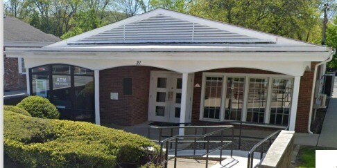
21 E Main St, Washingtonville, NY 10992

Property Detail
21 E Main St
332001-113-000-0002-011.000-0000
Orange
Financialbuilding
New York
AE The base floodplain where base flood elevations are provided. AE Zones are now used on new format FIRMs instead of A1-A30 Zones.
11.00
2024
0.45 AC
2024
Newburgh
015100
Northern New Jersey
2,076 SF
Kiryas Joel-Poughkeepsie-Newburgh, NY
NEARBY LISTINGS FOR SALE OR LEASE
DEMOGRAPHICS near 21 E Main St
1 mile
3 mile
5 mile
2025 Total Population
4,913
16,397
36,012
2030 Population
5,044
16,773
36,857
Pop Growth 2025-2030
+ 2.67%
+ 2.29%
+ 2.35%
Average Age
42
41
39
2025 Total Households
1,891
5,722
11,967
HH Growth 2025-2030
+ 2.59%
+ 2.38%
+ 2.36%
Median Household Inc
$86,041
$105,935
$107,376
Avg Household Size
2.50
2.80
2.90
2025 Avg HH Vehicles
2.00
2.00
2.00
Median Home Value
$386,768
$420,699
$447,877
Median Year Built
1983
1980
1979
Nearby Places
Map Layers
Map Styles
 Street
 Aerial
Transit
 Traffic
 Biking
Places
Listings with unknown addresses are not visible on the map
- Restaurants
- Banks
- Shops
- Fitness
- Groceries
PUBLIC TRANSPORTATION
COMMUTER RAIL
Salisbury Mills Cornwall (Bergen County/Port Jervis Line - NJ Transit Commuter Rail (NJ Transit), Main/Port Jervis Line - NJ Transit Commuter Rail (NJ Transit))
Drive
Walk
Distance
Salisbury Mills Cornwall (Bergen County/Port Jervis Line - NJ Transit Commuter Rail (NJ Transit), Main/Port Jervis Line - NJ Transit Commuter Rail (NJ Transit))
8 min
3.7 mi
Campbell Hall (Bergen County/Port Jervis Line - NJ Transit Commuter Rail (NJ Transit), Main/Port Jervis Line - NJ Transit Commuter Rail (NJ Transit))
Drive
Walk
Distance
Campbell Hall (Bergen County/Port Jervis Line - NJ Transit Commuter Rail (NJ Transit), Main/Port Jervis Line - NJ Transit Commuter Rail (NJ Transit))
15 min
8.7 mi
AIRPORT
New York Stewart International
Drive
Walk
Distance
New York Stewart International
16 min
7.6 mi
Freight Ports
Port Newark Container Terminal
Drive
Walk
Distance
Port Newark Container Terminal
85 min
62.1 mi
SALE & LEASE HISTORY
LISTING DATE
SALE/LEASE

Jan 31, 2025
For Sale
Nearby Properties
Address
Land Use
TOTAL SIZE
Lot Size
Zoning
Address
Land Use
TOTAL SIZE
Lot Size
Zoning
Address
Land Use
TOTAL SIZE
Lot Size
Zoning
Address
Land Use
TOTAL SIZE
Lot Size
Zoning
Address
Land Use
TOTAL SIZE
Lot Size
Zoning
10,881 SF
182.10 AC
Address
Land Use
TOTAL SIZE
Lot Size
Zoning
Address
Land Use
TOTAL SIZE
Lot Size
Zoning
82,049 SF
11.10 AC
Address
Land Use
TOTAL SIZE
Lot Size
Zoning
6,542 SF
3 AC
NB*
Address
Land Use
TOTAL SIZE
Lot Size
Zoning
15,806 SF
7 AC
NB*
Address
Land Use
TOTAL SIZE
Lot Size
Zoning
2,433 SF
89.60 AC
R4A*
Address
Land Use
TOTAL SIZE
Lot Size
Zoning
Address
Land Use
TOTAL SIZE
Lot Size
Zoning
5.20 AC
Address
Land Use
TOTAL SIZE
Lot Size
Zoning
Address
Land Use
TOTAL SIZE
Lot Size
Zoning
31.20 AC
R4A
Address
Land Use
TOTAL SIZE
Lot Size
Zoning
2,078 SF
27.40 AC
R4A
Address
Land Use
TOTAL SIZE
Lot Size
Zoning
Address
Land Use
TOTAL SIZE
Lot Size
Zoning
81.50 AC
R4A
Address
Land Use
TOTAL SIZE
Lot Size
Zoning
31,626 SF
228.90 AC
Address
Land Use
TOTAL SIZE
Lot Size
Zoning
76.30 AC
Address
Land Use
TOTAL SIZE
Lot Size
Zoning
13.20 AC
Address
Land Use
TOTAL SIZE
Lot Size
Zoning
Address
Land Use
TOTAL SIZE
Lot Size
Zoning
79.20 AC
R4A
Address
Land Use
TOTAL SIZE
Lot Size
Zoning
2,760 SF
43.50 AC
Address
Land Use
TOTAL SIZE
Lot Size
Zoning
3,928 SF
5 AC
R2A
Address
Land Use
TOTAL SIZE
Lot Size
Zoning
7,424 SF
2 AC
R2A*
Address
Land Use
TOTAL SIZE
Lot Size
Zoning
28,681 SF
2 AC
Address
Land Use
TOTAL SIZE
Lot Size
Zoning
Address
Land Use
TOTAL SIZE
Lot Size
Zoning
169.10 AC
Address
Land Use
TOTAL SIZE
Lot Size
Zoning
Address
Land Use
TOTAL SIZE
Lot Size
Zoning
Address
Land Use
TOTAL SIZE
Lot Size
Zoning
2,433 SF
391.20 AC
The World's #1 Commercial Real Estate Marketplace
Connect with us
© 2026 CoStar Group
The information above has been obtained from sources believed reliable. While we do not doubt its accuracy we have not verified it and make no guarantee, warranty or representation about it. It is your responsibility to independently confirm its accuracy and completeness. Any projections, opinions, assumptions, or estimates used are for example only and do not represent the current or future performance of the property. The value of this transaction to you depends on tax and other factors which should be evaluated by your tax, financial, and legal advisors. You and your advisors should conduct a careful, independent investigation of the property to determine to your satisfaction the suitability of the property for your needs.