Property Record
21 E State St, Colfax, IA 50054


Property Detail
21 E State St
Des Moines-West Des Moines, IA
W 205' LOT A NE NW EX HIGHWAY
11-12-127-001
Jasper
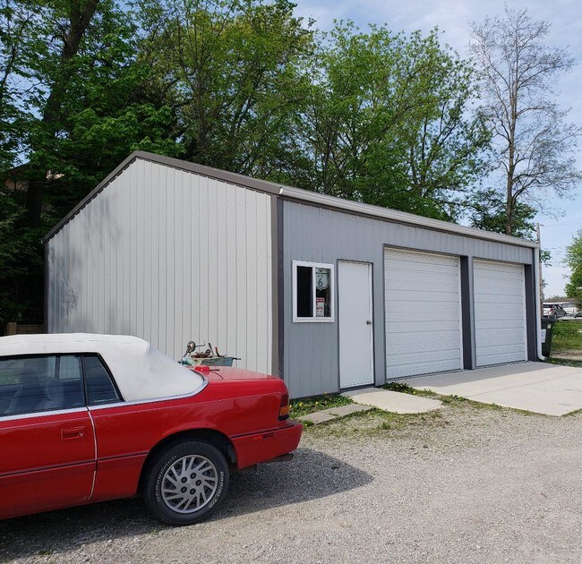
Restaurantbuilding
Iowa
B and X Area of moderate flood hazard, usually the area between the limits of the 100-year and 500-year floods.
a
2025
0.31 AC
2025
Jasper County
040700
Other Market Areas
2,097 SF
NEARBY LISTINGS FOR SALE OR LEASE
-
-
View all Colfax listings for sale on LoopNet.com
DEMOGRAPHICS near 21 E State St
1 mile
3 mile
5 mile
2025 Total Population
2,530
2,957
3,819
2030 Population
2,554
2,980
3,840
Pop Growth 2025-2030
+ 0.95%
+ 0.78%
+ 0.55%
Average Age
41
41
41
2025 Total Households
987
1,155
1,489
HH Growth 2025-2030
+ 0.91%
+ 0.69%
+ 0.47%
Median Household Inc
$85,850
$86,463
$87,595
Avg Household Size
2.40
2.40
2.50
2025 Avg HH Vehicles
2.00
2.00
2.00
Median Home Value
$183,880
$192,307
$206,419
Median Year Built
1971
1971
1972
Nearby Places
Map Layers
Map Styles
 Street
 Aerial
Layers
 Traffic
 Biking
Places
Listings with unknown addresses are not visible on the map
- Restaurants
- Banks
- Shops
- Fitness
- Groceries
PUBLIC TRANSPORTATION
AIRPORT
Des Moines International
Drive
Walk
Distance
Des Moines International
44 min
30.5 mi
SALE & LEASE HISTORY
LISTING DATE
SALE/LEASE

Jun 12, 2018
For Sale
Nearby Properties
Address
Land Use
TOTAL SIZE
Lot Size
Zoning
Address
Land Use
TOTAL SIZE
Lot Size
Zoning
30,396 SF
15 AC
Address
Land Use
TOTAL SIZE
Lot Size
Zoning
109,111 SF
17.20 AC
Address
Land Use
TOTAL SIZE
Lot Size
Zoning
47,748 SF
1.98 AC
Address
Land Use
TOTAL SIZE
Lot Size
Zoning
4,950 SF
3.30 AC
Address
Land Use
TOTAL SIZE
Lot Size
Zoning
5,472 SF
13.88 AC
Address
Land Use
TOTAL SIZE
Lot Size
Zoning
3,120 SF
2.99 AC
Address
Land Use
TOTAL SIZE
Lot Size
Zoning
7,824 SF
0.89 AC
Address
Land Use
TOTAL SIZE
Lot Size
Zoning
3,360 SF
1.53 AC
Address
Land Use
TOTAL SIZE
Lot Size
Zoning
28,346 SF
2.74 AC
Address
Land Use
TOTAL SIZE
Lot Size
Zoning
16,260 SF
2 AC
Address
Land Use
TOTAL SIZE
Lot Size
Zoning
1,900 SF
6.61 AC
Address
Land Use
TOTAL SIZE
Lot Size
Zoning
4,030 SF
0.34 AC
Address
Land Use
TOTAL SIZE
Lot Size
Zoning
2,436 SF
2.41 AC
Address
Land Use
TOTAL SIZE
Lot Size
Zoning
8,378 SF
2.41 AC
Address
Land Use
TOTAL SIZE
Lot Size
Zoning
12,500 SF
0.90 AC
Address
Land Use
TOTAL SIZE
Lot Size
Zoning
700 SF
1.03 AC
Address
Land Use
TOTAL SIZE
Lot Size
Zoning
2,850 SF
2.97 AC
Address
Land Use
TOTAL SIZE
Lot Size
Zoning
2,760 SF
0.34 AC
Address
Land Use
TOTAL SIZE
Lot Size
Zoning
0.18 AC
Address
Land Use
TOTAL SIZE
Lot Size
Zoning
8,640 SF
0.66 AC
Address
Land Use
TOTAL SIZE
Lot Size
Zoning
0.82 AC
Address
Land Use
TOTAL SIZE
Lot Size
Zoning
7,110 SF
0.52 AC
Address
Land Use
TOTAL SIZE
Lot Size
Zoning
1,200 SF
0.34 AC
Address
Land Use
TOTAL SIZE
Lot Size
Zoning
0.18 AC
Address
Land Use
TOTAL SIZE
Lot Size
Zoning
66,708 SF
3.83 AC
Address
Land Use
TOTAL SIZE
Lot Size
Zoning
0.56 AC
Address
Land Use
TOTAL SIZE
Lot Size
Zoning
7,757 SF
0.52 AC
Address
Land Use
TOTAL SIZE
Lot Size
Zoning
5,200 SF
0.51 AC
Address
Land Use
TOTAL SIZE
Lot Size
Zoning
9,000 SF
2 AC
Address
Land Use
TOTAL SIZE
Lot Size
Zoning
1,277 SF
15.70 AC
The World's #1 Commercial Real Estate Marketplace
Connect with us
© 2026 CoStar Group
The information above has been obtained from sources believed reliable. While we do not doubt its accuracy we have not verified it and make no guarantee, warranty or representation about it. It is your responsibility to independently confirm its accuracy and completeness. Any projections, opinions, assumptions, or estimates used are for example only and do not represent the current or future performance of the property. The value of this transaction to you depends on tax and other factors which should be evaluated by your tax, financial, and legal advisors. You and your advisors should conduct a careful, independent investigation of the property to determine to your satisfaction the suitability of the property for your needs.