Property Record
21 Hallock Dr, Santa Paula, CA 93060


Property Detail
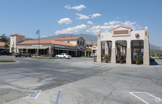
21 Hallock Dr
Oxnard-Thousand Oaks-Ventura, CA
LOT: A
107-0-044-040
Ventura
Servicestation
California
B and X Area of moderate flood hazard, usually the area between the limits of the 100-year and 500-year floods.
a
2024
2.76 AC
2025
Santa Paula/Somis
000500
Los Angeles
12,554 SF
NEARBY LISTINGS FOR SALE OR LEASE
DEMOGRAPHICS near 21 Hallock Dr
1 mile
3 mile
5 mile
2025 Total Population
5,336
30,539
33,521
2030 Population
5,458
30,556
33,590
Pop Growth 2025-2030
+ 2.29%
+ 0.06%
+ 0.21%
Average Age
38
38
38
2025 Total Households
1,497
8,812
9,783
HH Growth 2025-2030
+ 2.61%
(0.02%)
+ 0.15%
Median Household Inc
$83,049
$79,219
$81,365
Avg Household Size
3.40
3.40
3.40
2025 Avg HH Vehicles
2.00
2.00
2.00
Median Home Value
$682,112
$658,025
$655,698
Median Year Built
1972
1967
1967
Nearby Places
Map Layers
Map Styles
 Street
 Aerial
Layers
 Traffic
 Biking
Places
Listings with unknown addresses are not visible on the map
- Restaurants
- Banks
- Shops
- Fitness
- Groceries
Nearby Properties
Address
Land Use
TOTAL SIZE
Lot Size
Zoning
Address
Land Use
TOTAL SIZE
Lot Size
Zoning
12,253 SF
16.59 AC
Address
Land Use
TOTAL SIZE
Lot Size
Zoning
87,287 SF
5.86 AC
Address
Land Use
TOTAL SIZE
Lot Size
Zoning
105,773 SF
3.70 AC
M1
Address
Land Use
TOTAL SIZE
Lot Size
Zoning
41,050 SF
3.32 AC
MULT
Address
Land Use
TOTAL SIZE
Lot Size
Zoning
11.01 AC
M2
Address
Land Use
TOTAL SIZE
Lot Size
Zoning
Address
Land Use
TOTAL SIZE
Lot Size
Zoning
156.10 AC
AE
Address
Land Use
TOTAL SIZE
Lot Size
Zoning
64,759 SF
4.01 AC
Address
Land Use
TOTAL SIZE
Lot Size
Zoning
24,660 SF
1.64 AC
Address
Land Use
TOTAL SIZE
Lot Size
Zoning
31,852 SF
2.46 AC
C1PD
Address
Land Use
TOTAL SIZE
Lot Size
Zoning
36,096 SF
5.74 AC
M1L
Address
Land Use
TOTAL SIZE
Lot Size
Zoning
23,591 SF
0.94 AC
Address
Land Use
TOTAL SIZE
Lot Size
Zoning
26,228 SF
1.08 AC
Address
Land Use
TOTAL SIZE
Lot Size
Zoning
21,406 SF
6.01 AC
M1L
Address
Land Use
TOTAL SIZE
Lot Size
Zoning
66,439 SF
3.50 AC
Address
Land Use
TOTAL SIZE
Lot Size
Zoning
18,338 SF
0.96 AC
C2
Address
Land Use
TOTAL SIZE
Lot Size
Zoning
2,513 SF
38.64 AC
AE
Address
Land Use
TOTAL SIZE
Lot Size
Zoning
1.95 AC
RA
Address
Land Use
TOTAL SIZE
Lot Size
Zoning
13,210 SF
2.80 AC
M1L
Address
Land Use
TOTAL SIZE
Lot Size
Zoning
36,278 SF
8.68 AC
M-1
Address
Land Use
TOTAL SIZE
Lot Size
Zoning
21,600 SF
0.96 AC
C1
Address
Land Use
TOTAL SIZE
Lot Size
Zoning
39,410 SF
2.14 AC
M1&:
Address
Land Use
TOTAL SIZE
Lot Size
Zoning
16,708 SF
1.93 AC
C2
Address
Land Use
TOTAL SIZE
Lot Size
Zoning
38,067 SF
1.26 AC
C2
Address
Land Use
TOTAL SIZE
Lot Size
Zoning
95,501 SF
13.67 AC
M-1P
Address
Land Use
TOTAL SIZE
Lot Size
Zoning
28,944 SF
1.76 AC
MULT
Address
Land Use
TOTAL SIZE
Lot Size
Zoning
1,308 SF
1.19 AC
C2PD
Address
Land Use
TOTAL SIZE
Lot Size
Zoning
18,986 SF
0.39 AC
The World's #1 Commercial Real Estate Marketplace
Connect with us
© 2026 CoStar Group
The information above has been obtained from sources believed reliable. While we do not doubt its accuracy we have not verified it and make no guarantee, warranty or representation about it. It is your responsibility to independently confirm its accuracy and completeness. Any projections, opinions, assumptions, or estimates used are for example only and do not represent the current or future performance of the property. The value of this transaction to you depends on tax and other factors which should be evaluated by your tax, financial, and legal advisors. You and your advisors should conduct a careful, independent investigation of the property to determine to your satisfaction the suitability of the property for your needs.