Property Record
21 Highway 20 Dr Se, Cartersville, GA 30121
NEARBY LISTINGS FOR SALE OR LEASE
Property Detail
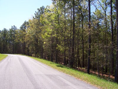
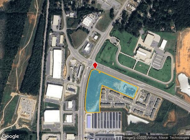
21 Highway 20 Dr Se
Atlanta-Sandy Springs-Roswell, GA
Com - Hwy 20
C101-0001-001
LL 50 DIST 4
Commercialacreage
Bartow
X
Georgia
13015C0258H
10.08 AC
2024
Bartow County
2025
Atlanta
960403
DEMOGRAPHICS near 21 Highway 20 Dr Se
1 Mile
3 Mile
5 Mile
2024 Total Population
2,715
31,541
54,417
2029 Population
3,040
34,419
59,542
Pop Growth 2024-2029
+ 11.97%
+ 9.12%
+ 9.42%
Average Age
40
38
39
2024 Total Households
1,032
12,089
20,520
HH Growth 2024-2029
+ 11.92%
+ 8.88%
+ 9.18%
Median Household Inc
$42,261
$62,986
$67,570
Avg Household Size
2.40
2.50
2.50
2024 Avg HH Vehicles
2.00
2.00
2.00
Median Home Value
$214,350
$211,412
$231,762
Median Year Built
2001
1991
1992
Nearby Places
Map Layers
Map Styles
 Street
 Aerial
- Restaurants
- Banks
- Shops
- Fitness
- Groceries
Nearby Properties
Address
Land Use
TOTAL SIZE
Lot Size
Zoning
Address
Land Use
TOTAL SIZE
Lot Size
Zoning
1,200 SF
25.69 AC
IN
Address
Land Use
TOTAL SIZE
Lot Size
Zoning
141,651 SF
181.89 AC
I1
Address
Land Use
TOTAL SIZE
Lot Size
Zoning
107,992 SF
46 AC
IN
Address
Land Use
TOTAL SIZE
Lot Size
Zoning
67,428 SF
36.96 AC
Address
Land Use
TOTAL SIZE
Lot Size
Zoning
7,488 SF
38.49 AC
IN
Address
Land Use
TOTAL SIZE
Lot Size
Zoning
194,306 SF
126.40 AC
A1
Address
Land Use
TOTAL SIZE
Lot Size
Zoning
Address
Land Use
TOTAL SIZE
Lot Size
Zoning
134,528 SF
4.71 AC
IN
Address
Land Use
TOTAL SIZE
Lot Size
Zoning
250,701 SF
15.17 AC
C1
Address
Land Use
TOTAL SIZE
Lot Size
Zoning
Address
Land Use
TOTAL SIZE
Lot Size
Zoning
90,497 SF
24.36 AC
Address
Land Use
TOTAL SIZE
Lot Size
Zoning
21,465 SF
17.30 AC
IN
Address
Land Use
TOTAL SIZE
Lot Size
Zoning
33,096 SF
15.80 AC
Address
Land Use
TOTAL SIZE
Lot Size
Zoning
1,921 SF
30.74 AC
A1
Address
Land Use
TOTAL SIZE
Lot Size
Zoning
Address
Land Use
TOTAL SIZE
Lot Size
Zoning
766,373 SF
267.91 AC
I2
Address
Land Use
TOTAL SIZE
Lot Size
Zoning
51,681 SF
16 AC
Address
Land Use
TOTAL SIZE
Lot Size
Zoning
84,852 SF
6.78 AC
A1
Address
Land Use
TOTAL SIZE
Lot Size
Zoning
91,110 SF
17.09 AC
Address
Land Use
TOTAL SIZE
Lot Size
Zoning
151,571 SF
25.82 AC
Address
Land Use
TOTAL SIZE
Lot Size
Zoning
24,256 SF
11.87 AC
R3WC
Address
Land Use
TOTAL SIZE
Lot Size
Zoning
13.86 AC
IN
Address
Land Use
TOTAL SIZE
Lot Size
Zoning
88,974 SF
5.42 AC
IN
Address
Land Use
TOTAL SIZE
Lot Size
Zoning
194,368 SF
25.02 AC
IN
Address
Land Use
TOTAL SIZE
Lot Size
Zoning
144,416 SF
40.01 AC
A1
Address
Land Use
TOTAL SIZE
Lot Size
Zoning
8,064 SF
36.63 AC
IN
Address
Land Use
TOTAL SIZE
Lot Size
Zoning
60,361 SF
13.66 AC
A1
Address
Land Use
TOTAL SIZE
Lot Size
Zoning
123,522 SF
12.52 AC
Address
Land Use
TOTAL SIZE
Lot Size
Zoning
36.25 AC
RESIDENTIA
Address
Land Use
TOTAL SIZE
Lot Size
Zoning
8,760 SF
151.31 AC
IN
The World's #1 Commercial Real Estate Marketplace
Connect with us
© 2026 CoStar Group
The information above has been obtained from sources believed reliable. While we do not doubt its accuracy we have not verified it and make no guarantee, warranty or representation about it. It is your responsibility to independently confirm its accuracy and completeness. Any projections, opinions, assumptions, or estimates used are for example only and do not represent the current or future performance of the property. The value of this transaction to you depends on tax and other factors which should be evaluated by your tax, financial, and legal advisors. You and your advisors should conduct a careful, independent investigation of the property to determine to your satisfaction the suitability of the property for your needs.