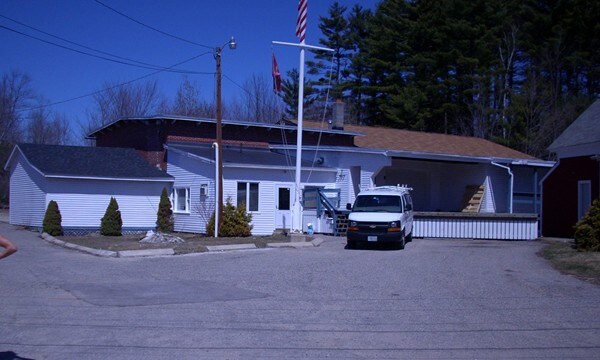
Property Record
21 Maple St, Union, NH 03887

Property Detail
21 Maple St
Commercialnec
Carroll
AGRAGR
New Hampshire
A Areas with a 1% annual chance of flooding and a 26% chance of flooding over the life of a 30-year mortgage.
1.92 AC
2025
Concord/New Hampshire North Area
2025
Other Market Areas
956000
WKFD-000241-008000
2,813 SF
NEARBY LISTINGS FOR SALE OR LEASE
-
-
View all Union listings for sale on LoopNet.com
DEMOGRAPHICS near 21 Maple St
1 mile
3 mile
5 mile
2025 Total Population
382
1,564
6,882
2030 Population
386
1,581
7,004
Pop Growth 2025-2030
+ 1.05%
+ 1.09%
+ 1.77%
Average Age
43
44
45
2025 Total Households
152
628
2,815
HH Growth 2025-2030
+ 0.66%
+ 1.11%
+ 1.78%
Median Household Inc
$86,956
$100,298
$100,903
Avg Household Size
2.50
2.50
2.40
2025 Avg HH Vehicles
2.00
2.00
2.00
Median Home Value
$316,326
$334,180
$342,242
Median Year Built
1978
1977
1978
Nearby Places
Map Layers
Map Styles
 Street
 Aerial
Transit
 Traffic
 Biking
Places
Listings with unknown addresses are not visible on the map
- Restaurants
- Banks
- Shops
- Fitness
- Groceries
PUBLIC TRANSPORTATION
AIRPORT
Portsmouth International at Pease
Drive
Walk
Distance
Portsmouth International at Pease
49 min
34.2 mi
Freight Ports
Portland, ME
Drive
Walk
Distance
Portland, ME
78 min
50.6 mi
Nearby Properties
Address
Land Use
TOTAL SIZE
Lot Size
Zoning
Address
Land Use
TOTAL SIZE
Lot Size
Zoning
29,120 SF
60.50 AC
M4C FO
Address
Land Use
TOTAL SIZE
Lot Size
Zoning
18,082 SF
29.86 AC
B1 RES
Address
Land Use
TOTAL SIZE
Lot Size
Zoning
48,339 SF
36.64 AC
B1 RES
Address
Land Use
TOTAL SIZE
Lot Size
Zoning
1,944 SF
56.71 AC
AGRAGR
Address
Land Use
TOTAL SIZE
Lot Size
Zoning
2,036 SF
4.97 AC
B&CBUS
Address
Land Use
TOTAL SIZE
Lot Size
Zoning
12,447 SF
7.16 AC
IND/CO
Address
Land Use
TOTAL SIZE
Lot Size
Zoning
92.02 AC
B1 RES
Address
Land Use
TOTAL SIZE
Lot Size
Zoning
23,675 SF
5.19 AC
IND/CO
Address
Land Use
TOTAL SIZE
Lot Size
Zoning
5,100 SF
7.18 AC
IND/CO
Address
Land Use
TOTAL SIZE
Lot Size
Zoning
20,844 SF
2.60 AC
B1 RES
Address
Land Use
TOTAL SIZE
Lot Size
Zoning
8,417 SF
3.09 AC
IND/CO
Address
Land Use
TOTAL SIZE
Lot Size
Zoning
4,612 SF
3.56 AC
B&CBUS
Address
Land Use
TOTAL SIZE
Lot Size
Zoning
12,000 SF
2.52 AC
LI INL
Address
Land Use
TOTAL SIZE
Lot Size
Zoning
1,062 SF
8.53 AC
RES3 R
Address
Land Use
TOTAL SIZE
Lot Size
Zoning
5.02 AC
B1 RES
Address
Land Use
TOTAL SIZE
Lot Size
Zoning
2,255 SF
3.10 AC
M4C FO
Address
Land Use
TOTAL SIZE
Lot Size
Zoning
4,441 SF
27.24 AC
LOW DE
Address
Land Use
TOTAL SIZE
Lot Size
Zoning
8,945 SF
0.79 AC
B&CBUS
Address
Land Use
TOTAL SIZE
Lot Size
Zoning
6,060 SF
2.95 AC
B&CBUS
Address
Land Use
TOTAL SIZE
Lot Size
Zoning
3,756 SF
20.17 AC
LOW DE
Address
Land Use
TOTAL SIZE
Lot Size
Zoning
3,250 SF
6.80 AC
RURAL
Address
Land Use
TOTAL SIZE
Lot Size
Zoning
6,267 SF
11.70 AC
LOW DE
Address
Land Use
TOTAL SIZE
Lot Size
Zoning
3,664 SF
0.91 AC
B&CBUS
Address
Land Use
TOTAL SIZE
Lot Size
Zoning
526 AC
LOW DE
Address
Land Use
TOTAL SIZE
Lot Size
Zoning
3,696 SF
12.01 AC
LOW DE
Address
Land Use
TOTAL SIZE
Lot Size
Zoning
4,065 SF
2.40 AC
M4C FO
Address
Land Use
TOTAL SIZE
Lot Size
Zoning
7,800 SF
2.22 AC
B&CBUS
Address
Land Use
TOTAL SIZE
Lot Size
Zoning
3,815 SF
0.24 AC
B&CBUS
Address
Land Use
TOTAL SIZE
Lot Size
Zoning
5,600 SF
11 AC
IND/CO
Address
Land Use
TOTAL SIZE
Lot Size
Zoning
8,600 SF
1 AC
B&CBUS
The World's #1 Commercial Real Estate Marketplace
Connect with us
© 2026 CoStar Group
The information above has been obtained from sources believed reliable. While we do not doubt its accuracy we have not verified it and make no guarantee, warranty or representation about it. It is your responsibility to independently confirm its accuracy and completeness. Any projections, opinions, assumptions, or estimates used are for example only and do not represent the current or future performance of the property. The value of this transaction to you depends on tax and other factors which should be evaluated by your tax, financial, and legal advisors. You and your advisors should conduct a careful, independent investigation of the property to determine to your satisfaction the suitability of the property for your needs.