Property Record
21 N Kings Chapel Dr, Troy, OH 45373


NEARBY LISTINGS FOR SALE OR LEASE
-
-
View all Troy listings for sale on LoopNet.com
Property Detail
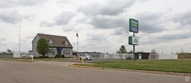
21 N Kings Chapel Dr
Dayton, OH
Subdivision Of Inlot 8871 Of Kings Tower
D08104604
IN LOT 9400
Publicstorage
Miami
X
Ohio
39109C0161F
9400
2024
4.60 AC
2024
North Dayton
365002
Cincinnati/Dayton
1,814 SF
DEMOGRAPHICS near 21 N Kings Chapel Dr
1 Mile
3 Mile
5 Mile
2024 Total Population
3,591
19,666
37,473
2029 Population
3,787
20,490
38,941
Pop Growth 2024-2029
+ 5.46%
+ 4.19%
+ 3.92%
Average Age
43
41
41
2024 Total Households
1,579
8,424
15,501
HH Growth 2024-2029
+ 5.32%
+ 4.19%
+ 3.91%
Median Household Inc
$67,871
$68,227
$69,503
Avg Household Size
2.30
2.30
2.40
2024 Avg HH Vehicles
2.00
2.00
2.00
Median Home Value
$186,325
$203,582
$200,822
Median Year Built
1993
1977
1974
Nearby Places
Map Layers
Map Styles
 Street
 Aerial
- Restaurants
- Banks
- Shops
- Fitness
- Groceries
PUBLIC TRANSPORTATION
AIRPORT
James M Cox Dayton International
DRIVE
WALK
Distance
James M Cox Dayton International
24 min
16.7 mi
Freight Ports
Port of Toledo
DRIVE
WALK
Distance
Port of Toledo
155 min
132.9 mi
Nearby Properties
Address
Land Use
TOTAL SIZE
Lot Size
Zoning
Address
Land Use
TOTAL SIZE
Lot Size
Zoning
150,128 SF
11.71 AC
Address
Land Use
TOTAL SIZE
Lot Size
Zoning
3,158 SF
113 AC
Address
Land Use
TOTAL SIZE
Lot Size
Zoning
7,200 SF
25.38 AC
Address
Land Use
TOTAL SIZE
Lot Size
Zoning
1,310 SF
12.31 AC
Address
Land Use
TOTAL SIZE
Lot Size
Zoning
75,861 SF
8 AC
Address
Land Use
TOTAL SIZE
Lot Size
Zoning
50,400 SF
54.09 AC
Address
Land Use
TOTAL SIZE
Lot Size
Zoning
536,448 SF
66.57 AC
Address
Land Use
TOTAL SIZE
Lot Size
Zoning
548,745 SF
56.35 AC
Address
Land Use
TOTAL SIZE
Lot Size
Zoning
68,679 SF
1.72 AC
Address
Land Use
TOTAL SIZE
Lot Size
Zoning
54,671 SF
15.57 AC
Address
Land Use
TOTAL SIZE
Lot Size
Zoning
94,555 SF
13.32 AC
Address
Land Use
TOTAL SIZE
Lot Size
Zoning
8.18 AC
Address
Land Use
TOTAL SIZE
Lot Size
Zoning
57,440 SF
1.81 AC
Address
Land Use
TOTAL SIZE
Lot Size
Zoning
42,118 SF
9.38 AC
Address
Land Use
TOTAL SIZE
Lot Size
Zoning
59,281 SF
10 AC
Address
Land Use
TOTAL SIZE
Lot Size
Zoning
132,772 SF
15.34 AC
Address
Land Use
TOTAL SIZE
Lot Size
Zoning
16,290 SF
1.14 AC
Address
Land Use
TOTAL SIZE
Lot Size
Zoning
8.82 AC
Address
Land Use
TOTAL SIZE
Lot Size
Zoning
160,000 SF
11.37 AC
Address
Land Use
TOTAL SIZE
Lot Size
Zoning
85.35 AC
Address
Land Use
TOTAL SIZE
Lot Size
Zoning
12.05 AC
Address
Land Use
TOTAL SIZE
Lot Size
Zoning
Address
Land Use
TOTAL SIZE
Lot Size
Zoning
3,944 SF
12.18 AC
Address
Land Use
TOTAL SIZE
Lot Size
Zoning
41,118 SF
Address
Land Use
TOTAL SIZE
Lot Size
Zoning
148,400 SF
37.74 AC
Address
Land Use
TOTAL SIZE
Lot Size
Zoning
8.95 AC
Address
Land Use
TOTAL SIZE
Lot Size
Zoning
32,633 SF
12.05 AC
Address
Land Use
TOTAL SIZE
Lot Size
Zoning
29,690 SF
2.52 AC
Address
Land Use
TOTAL SIZE
Lot Size
Zoning
16.03 AC
Address
Land Use
TOTAL SIZE
Lot Size
Zoning
12,630 SF
7.13 AC
The World's #1 Commercial Real Estate Marketplace
Connect with us
© 2025 CoStar Group
The information above has been obtained from sources believed reliable. While we do not doubt its accuracy we have not verified it and make no guarantee, warranty or representation about it. It is your responsibility to independently confirm its accuracy and completeness. Any projections, opinions, assumptions, or estimates used are for example only and do not represent the current or future performance of the property. The value of this transaction to you depends on tax and other factors which should be evaluated by your tax, financial, and legal advisors. You and your advisors should conduct a careful, independent investigation of the property to determine to your satisfaction the suitability of the property for your needs.