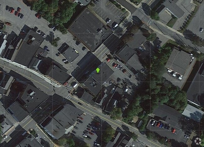
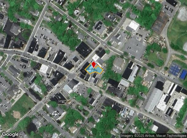
Property Record
21 N Main St, Middleboro, MA 02346
NEARBY LISTINGS FOR SALE OR LEASE
Property Detail
21 N Main St
MIDD-000050P-006261
Plymouth
Commercialofficeresidentialmixeduse
Massachusetts
X
6261
25023C0318K
0.20 AC
0
Route 3 South
2025
Boston
542301
Boston-Cambridge-Newton, MA-NH
10,290 SF
DEMOGRAPHICS near 21 N Main St
1 Mile
3 Mile
5 Mile
2024 Total Population
6,473
17,307
29,725
2029 Population
6,425
17,364
29,859
Pop Growth 2024-2029
(0.74%)
+ 0.33%
+ 0.45%
Average Age
39
42
43
2024 Total Households
2,602
6,810
11,437
HH Growth 2024-2029
(0.85%)
+ 0.23%
+ 0.37%
Median Household Inc
$74,308
$81,638
$86,186
Avg Household Size
2.40
2.50
2.50
2024 Avg HH Vehicles
2.00
2.00
2.00
Median Home Value
$380,707
$406,834
$414,520
Median Year Built
1948
1971
1979
Nearby Places
Map Layers
Map Styles
 Street
 Aerial
- Restaurants
- Banks
- Shops
- Fitness
- Groceries
PUBLIC TRANSPORTATION
COMMUTER RAIL
Middleborough/Lakeville (Middleborough/Lakeville Line - Massachusetts Bay Transportation Authority Commuter Rail (Purple Line))
DRIVE
WALK
Distance
Middleborough/Lakeville (Middleborough/Lakeville Line - Massachusetts Bay Transportation Authority Commuter Rail (Purple Line))
4 min
1.6 mi
AIRPORT
Rhode Island Tf Green International
DRIVE
WALK
Distance
Rhode Island Tf Green International
60 min
35.4 mi
Freight Ports
Port of New Bedford Harbor
DRIVE
WALK
Distance
Port of New Bedford Harbor
34 min
21.2 mi
Nearby Properties
Address
Land Use
TOTAL SIZE
Lot Size
Zoning
Address
Land Use
TOTAL SIZE
Lot Size
Zoning
34.41 AC
Address
Land Use
TOTAL SIZE
Lot Size
Zoning
167,715 SF
29.54 AC
Address
Land Use
TOTAL SIZE
Lot Size
Zoning
144,454 SF
66.89 AC
Address
Land Use
TOTAL SIZE
Lot Size
Zoning
158,638 SF
54.12 AC
Address
Land Use
TOTAL SIZE
Lot Size
Zoning
575,572 SF
119.44 AC
Address
Land Use
TOTAL SIZE
Lot Size
Zoning
38.61 AC
Address
Land Use
TOTAL SIZE
Lot Size
Zoning
173,003 SF
26.10 AC
Address
Land Use
TOTAL SIZE
Lot Size
Zoning
2.30 AC
Address
Land Use
TOTAL SIZE
Lot Size
Zoning
257,810 SF
20.62 AC
Address
Land Use
TOTAL SIZE
Lot Size
Zoning
7.41 AC
Address
Land Use
TOTAL SIZE
Lot Size
Zoning
48.30 AC
Address
Land Use
TOTAL SIZE
Lot Size
Zoning
108,990 SF
6.18 AC
Address
Land Use
TOTAL SIZE
Lot Size
Zoning
130,582 SF
23.41 AC
Address
Land Use
TOTAL SIZE
Lot Size
Zoning
64,023 SF
3.48 AC
Address
Land Use
TOTAL SIZE
Lot Size
Zoning
58,937 SF
5.49 AC
Address
Land Use
TOTAL SIZE
Lot Size
Zoning
123,378 SF
15.59 AC
Address
Land Use
TOTAL SIZE
Lot Size
Zoning
128,922 SF
12.50 AC
Address
Land Use
TOTAL SIZE
Lot Size
Zoning
7.33 AC
Address
Land Use
TOTAL SIZE
Lot Size
Zoning
36.10 AC
Address
Land Use
TOTAL SIZE
Lot Size
Zoning
20.37 AC
Address
Land Use
TOTAL SIZE
Lot Size
Zoning
42,133 SF
17.68 AC
Address
Land Use
TOTAL SIZE
Lot Size
Zoning
159,630 SF
10.91 AC
Address
Land Use
TOTAL SIZE
Lot Size
Zoning
34,800 SF
3.53 AC
Address
Land Use
TOTAL SIZE
Lot Size
Zoning
89,979 SF
18.52 AC
Address
Land Use
TOTAL SIZE
Lot Size
Zoning
15,663 SF
8.50 AC
Address
Land Use
TOTAL SIZE
Lot Size
Zoning
10,779 SF
1.53 AC
Address
Land Use
TOTAL SIZE
Lot Size
Zoning
5,792 SF
22.04 AC
Address
Land Use
TOTAL SIZE
Lot Size
Zoning
3.05 AC
Address
Land Use
TOTAL SIZE
Lot Size
Zoning
2.68 AC
Address
Land Use
TOTAL SIZE
Lot Size
Zoning
35,805 SF
4.18 AC
The World's #1 Commercial Real Estate Marketplace
Connect with us
© 2025 CoStar Group
The information above has been obtained from sources believed reliable. While we do not doubt its accuracy we have not verified it and make no guarantee, warranty or representation about it. It is your responsibility to independently confirm its accuracy and completeness. Any projections, opinions, assumptions, or estimates used are for example only and do not represent the current or future performance of the property. The value of this transaction to you depends on tax and other factors which should be evaluated by your tax, financial, and legal advisors. You and your advisors should conduct a careful, independent investigation of the property to determine to your satisfaction the suitability of the property for your needs.