Property Record
21 Progress Dr, Rocky Mount, NC 27804


Save to a Folder
{{folder.Name}}
{{folder.ListingIds.length}} Properties
{{folder.ListingIds.length}} Property
Create a New Folder
Property Detail
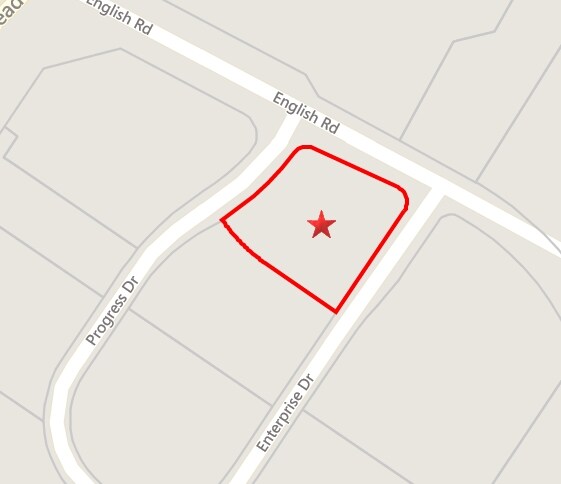
21 Progress Dr
Restaurantdrivein
0.97 AC, 5 WINSTEAD PK SPLIT OUT OF 384113121180 AC 5 WINSTEAD PK SE 2
B5CU
Nash
B and X Area of moderate flood hazard, usually the area between the limits of the 100-year and 500-year floods.
North Carolina
2025
1.10 AC
2025
Other Market Areas
010505
Rocky Mount, NC
3,469 SF
3841-13-22-2637
NEARBY LISTINGS FOR SALE OR LEASE
DEMOGRAPHICS near 21 Progress Dr
1 mile
3 mile
5 mile
2025 Total Population
4,019
27,959
59,428
2030 Population
4,143
28,757
61,643
Pop Growth 2025-2030
+ 3.09%
+ 2.85%
+ 3.73%
Average Age
41
42
41
2025 Total Households
1,876
12,275
25,288
HH Growth 2025-2030
+ 2.93%
+ 2.92%
+ 3.82%
Median Household Inc
$56,109
$67,519
$58,138
Avg Household Size
2.10
2.20
2.30
2025 Avg HH Vehicles
2.00
2.00
2.00
Median Home Value
$212,896
$217,497
$195,683
Median Year Built
1995
1985
1981
Nearby Places
Map Layers
Map Styles
 Street
 Aerial
Layers
 Traffic
 Biking
Places
Listings with unknown addresses are not visible on the map
- Restaurants
- Banks
- Shops
- Fitness
- Groceries
PUBLIC TRANSPORTATION
COMMUTER RAIL
Rocky Mount (Carolinian - Amtrak, Palmetto - Amtrak, Silver Meteor - Amtrak, Silver Star - Amtrak)
Drive
Walk
Distance
Rocky Mount (Carolinian - Amtrak, Palmetto - Amtrak, Silver Meteor - Amtrak, Silver Star - Amtrak)
9 min
5.7 mi
Freight Ports
Virginia Port Authority - Portsmouth
Drive
Walk
Distance
Virginia Port Authority - Portsmouth
158 min
134.1 mi
SALE & LEASE HISTORY
LISTING DATE
SALE/LEASE

Sep 24, 2016
For Sale
Nearby Properties
Address
Land Use
TOTAL SIZE
Lot Size
Zoning
Address
Land Use
TOTAL SIZE
Lot Size
Zoning
133,154 SF
70.45 AC
MA
Address
Land Use
TOTAL SIZE
Lot Size
Zoning
129,595 SF
11.35 AC
B2CU
Address
Land Use
TOTAL SIZE
Lot Size
Zoning
130,639 SF
60.52 AC
A1M
Address
Land Use
TOTAL SIZE
Lot Size
Zoning
104,995 SF
16.01 AC
Address
Land Use
TOTAL SIZE
Lot Size
Zoning
78,052 SF
122.10 AC
I2
Address
Land Use
TOTAL SIZE
Lot Size
Zoning
79,027 SF
33.37 AC
R10
Address
Land Use
TOTAL SIZE
Lot Size
Zoning
98,831 SF
5.40 AC
I
Address
Land Use
TOTAL SIZE
Lot Size
Zoning
29,504 SF
18.61 AC
Address
Land Use
TOTAL SIZE
Lot Size
Zoning
6,976 SF
15.97 AC
R6
Address
Land Use
TOTAL SIZE
Lot Size
Zoning
65,826 SF
16.77 AC
Address
Land Use
TOTAL SIZE
Lot Size
Zoning
204,903 SF
23.07 AC
Address
Land Use
TOTAL SIZE
Lot Size
Zoning
85,766 SF
4.61 AC
B5
Address
Land Use
TOTAL SIZE
Lot Size
Zoning
98,065 SF
6.14 AC
I
Address
Land Use
TOTAL SIZE
Lot Size
Zoning
73,338 SF
2.81 AC
B5CU
Address
Land Use
TOTAL SIZE
Lot Size
Zoning
16,110 SF
17.49 AC
MA
Address
Land Use
TOTAL SIZE
Lot Size
Zoning
8,822 SF
9.70 AC
R6
Address
Land Use
TOTAL SIZE
Lot Size
Zoning
8,020 SF
13.81 AC
R6
Address
Land Use
TOTAL SIZE
Lot Size
Zoning
59,236 SF
2.18 AC
B5M
Address
Land Use
TOTAL SIZE
Lot Size
Zoning
51,543 SF
9.61 AC
I
Address
Land Use
TOTAL SIZE
Lot Size
Zoning
7,952 SF
8.59 AC
R6
Address
Land Use
TOTAL SIZE
Lot Size
Zoning
6,253 SF
16.22 AC
A1
Address
Land Use
TOTAL SIZE
Lot Size
Zoning
135,400 SF
21.45 AC
B2
Address
Land Use
TOTAL SIZE
Lot Size
Zoning
25,936 SF
22.35 AC
R15
Address
Land Use
TOTAL SIZE
Lot Size
Zoning
62,024 SF
5.39 AC
B5
Address
Land Use
TOTAL SIZE
Lot Size
Zoning
7,022 SF
14.89 AC
A1
Address
Land Use
TOTAL SIZE
Lot Size
Zoning
47,410 SF
2.58 AC
B5CU
Address
Land Use
TOTAL SIZE
Lot Size
Zoning
129,264 SF
31.28 AC
B3
Address
Land Use
TOTAL SIZE
Lot Size
Zoning
253,009 SF
52.80 AC
B3
Address
Land Use
TOTAL SIZE
Lot Size
Zoning
63,276 SF
3.07 AC
I
Address
Land Use
TOTAL SIZE
Lot Size
Zoning
61,944 SF
2.51 AC
B5
The World's #1 Commercial Real Estate Marketplace
Connect with us
© 2026 CoStar Group
The information above has been obtained from sources believed reliable. While we do not doubt its accuracy we have not verified it and make no guarantee, warranty or representation about it. It is your responsibility to independently confirm its accuracy and completeness. Any projections, opinions, assumptions, or estimates used are for example only and do not represent the current or future performance of the property. The value of this transaction to you depends on tax and other factors which should be evaluated by your tax, financial, and legal advisors. You and your advisors should conduct a careful, independent investigation of the property to determine to your satisfaction the suitability of the property for your needs.