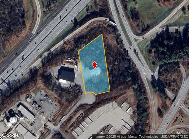
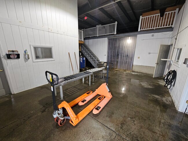
Property Record
21 Ranger Dr, Kittery, ME 03904
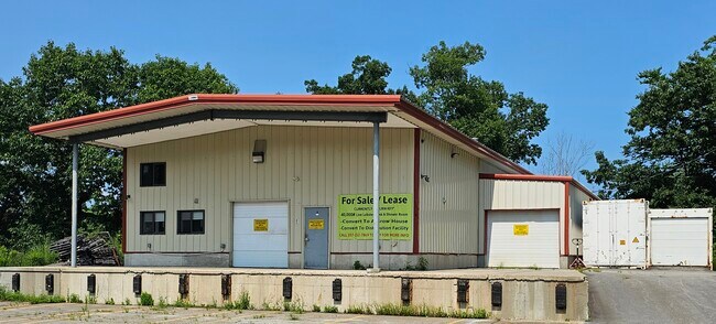
This Property Is For Sale
NEARBY LISTINGS FOR SALE OR LEASE
Property Detail
21 Ranger Dr
KITT-000013-000000-000005-000010
York
Commercialbuilding
Maine
X
5-10
23031C0726G
2.47 AC
2024
York County
2024
Portland/South Portland
038002
Portland-South Portland, ME
3,800 SF
DEMOGRAPHICS near 21 Ranger Dr
1 Mile
3 Mile
5 Mile
2024 Total Population
2,768
27,899
40,881
2029 Population
2,915
29,275
42,769
Pop Growth 2024-2029
+ 5.31%
+ 4.93%
+ 4.62%
Average Age
47
44
45
2024 Total Households
1,328
13,056
18,370
HH Growth 2024-2029
+ 5.20%
+ 4.83%
+ 4.52%
Median Household Inc
$61,205
$91,259
$98,460
Avg Household Size
2.00
2.10
2.10
2024 Avg HH Vehicles
2.00
2.00
2.00
Median Home Value
$414,881
$516,635
$511,890
Median Year Built
1983
1959
1964
Nearby Places
- Restaurants
- Banks
- Shops
- Fitness
- Groceries
PUBLIC TRANSPORTATION
AIRPORT
Portsmouth International at Pease
DRIVE
WALK
Distance
Portsmouth International at Pease
13 min
5.5 mi
Freight Ports
Portland, ME
DRIVE
WALK
Distance
Portland, ME
58 min
49.0 mi
Nearby Properties
Address
Land Use
TOTAL SIZE
Lot Size
Zoning
Address
Land Use
TOTAL SIZE
Lot Size
Zoning
58.25 AC
COMM
Address
Land Use
TOTAL SIZE
Lot Size
Zoning
6.20 AC
G1
Address
Land Use
TOTAL SIZE
Lot Size
Zoning
152,028 SF
CD5
Address
Land Use
TOTAL SIZE
Lot Size
Zoning
144,226 SF
5.72 AC
M
Address
Land Use
TOTAL SIZE
Lot Size
Zoning
1,575 SF
52.95 AC
COMM
Address
Land Use
TOTAL SIZE
Lot Size
Zoning
Address
Land Use
TOTAL SIZE
Lot Size
Zoning
22.33 AC
MU-N
Address
Land Use
TOTAL SIZE
Lot Size
Zoning
1,288 AC
GBW
Address
Land Use
TOTAL SIZE
Lot Size
Zoning
102,617 SF
1.27 AC
CD5
Address
Land Use
TOTAL SIZE
Lot Size
Zoning
57,711 SF
1.44 AC
CD4
Address
Land Use
TOTAL SIZE
Lot Size
Zoning
136,711 SF
1.85 AC
CD5
Address
Land Use
TOTAL SIZE
Lot Size
Zoning
19.26 AC
G1
Address
Land Use
TOTAL SIZE
Lot Size
Zoning
11.30 AC
G1
Address
Land Use
TOTAL SIZE
Lot Size
Zoning
4.73 AC
CD4-W
Address
Land Use
TOTAL SIZE
Lot Size
Zoning
86,293 SF
0.64 AC
CD5
Address
Land Use
TOTAL SIZE
Lot Size
Zoning
15.94 AC
G1
Address
Land Use
TOTAL SIZE
Lot Size
Zoning
48.95 AC
WIND
Address
Land Use
TOTAL SIZE
Lot Size
Zoning
3.78 AC
COMM
Address
Land Use
TOTAL SIZE
Lot Size
Zoning
18.49 AC
GRB
Address
Land Use
TOTAL SIZE
Lot Size
Zoning
23.29 AC
G1
Address
Land Use
TOTAL SIZE
Lot Size
Zoning
77,523 SF
CD5
Address
Land Use
TOTAL SIZE
Lot Size
Zoning
69,457 SF
0.98 AC
CD5
Address
Land Use
TOTAL SIZE
Lot Size
Zoning
204,800 SF
ABC
Address
Land Use
TOTAL SIZE
Lot Size
Zoning
3.97 AC
SD
Address
Land Use
TOTAL SIZE
Lot Size
Zoning
58,070 SF
0.53 AC
CD4
Address
Land Use
TOTAL SIZE
Lot Size
Zoning
84,273 SF
13.61 AC
C-1
Address
Land Use
TOTAL SIZE
Lot Size
Zoning
9,060 SF
7.02 AC
IND
Address
Land Use
TOTAL SIZE
Lot Size
Zoning
61,496 SF
17.59 AC
M
Address
Land Use
TOTAL SIZE
Lot Size
Zoning
70,555 SF
9.81 AC
ABC
Address
Land Use
TOTAL SIZE
Lot Size
Zoning
39,780 SF
8.82 AC
OR
The World's #1 Commercial Real Estate Marketplace
Connect with us
© 2025 CoStar Group
The information above has been obtained from sources believed reliable. While we do not doubt its accuracy we have not verified it and make no guarantee, warranty or representation about it. It is your responsibility to independently confirm its accuracy and completeness. Any projections, opinions, assumptions, or estimates used are for example only and do not represent the current or future performance of the property. The value of this transaction to you depends on tax and other factors which should be evaluated by your tax, financial, and legal advisors. You and your advisors should conduct a careful, independent investigation of the property to determine to your satisfaction the suitability of the property for your needs.